Category: Roraima

  • 10 Useful Tips for Trekking in Mount Roraima

    10 Useful Tips for Trekking in Mount Roraima

    Porters, permits, gear, paperwork, and weather for the 2,810-meter tepui on the Venezuelan border: the decisions that shape a Mount Roraima trekking expedition

    Mount Roraima stands 2,810 meters high where Venezuela, Brazil, and Guyana meet. Its 33–50 km² sandstone summit plateau formed 1.8 billion years ago, leaving behind a tepui with sheer 400–1,000-meter walls after upper layers eroded 180 million years ago.

    That unique geology drives the logistics. Venezuela holds 85% of it (Guyana has 10%, Brazil 5%), and all commercial treks depart from the Pemón village of Paraitepuy in Venezuela. The Brazilian side falls within Monte Roraima National Park and Raposa Serra do Sol Indigenous Territory, requiring technical wall climbing and prior ICMBio approval. Consequently, Mount Roraima trekking demands border crossings, permits, and guides before setting foot on the trail.

    PlanetaEXO, an ecotourism platform specializing in Mount Roraima tours, has put together 10 tips on porters, permits, gear, weather, and paperwork, each one with the figure behind it. Check it out below!

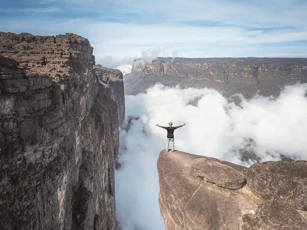
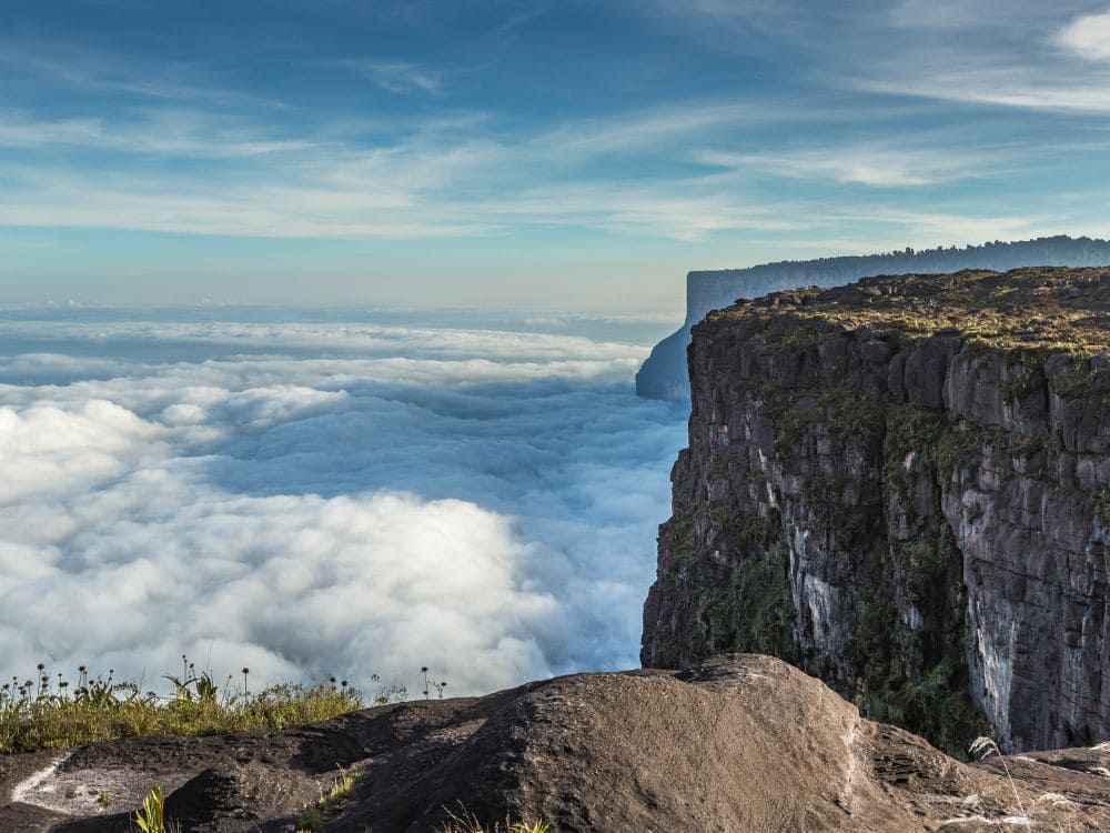
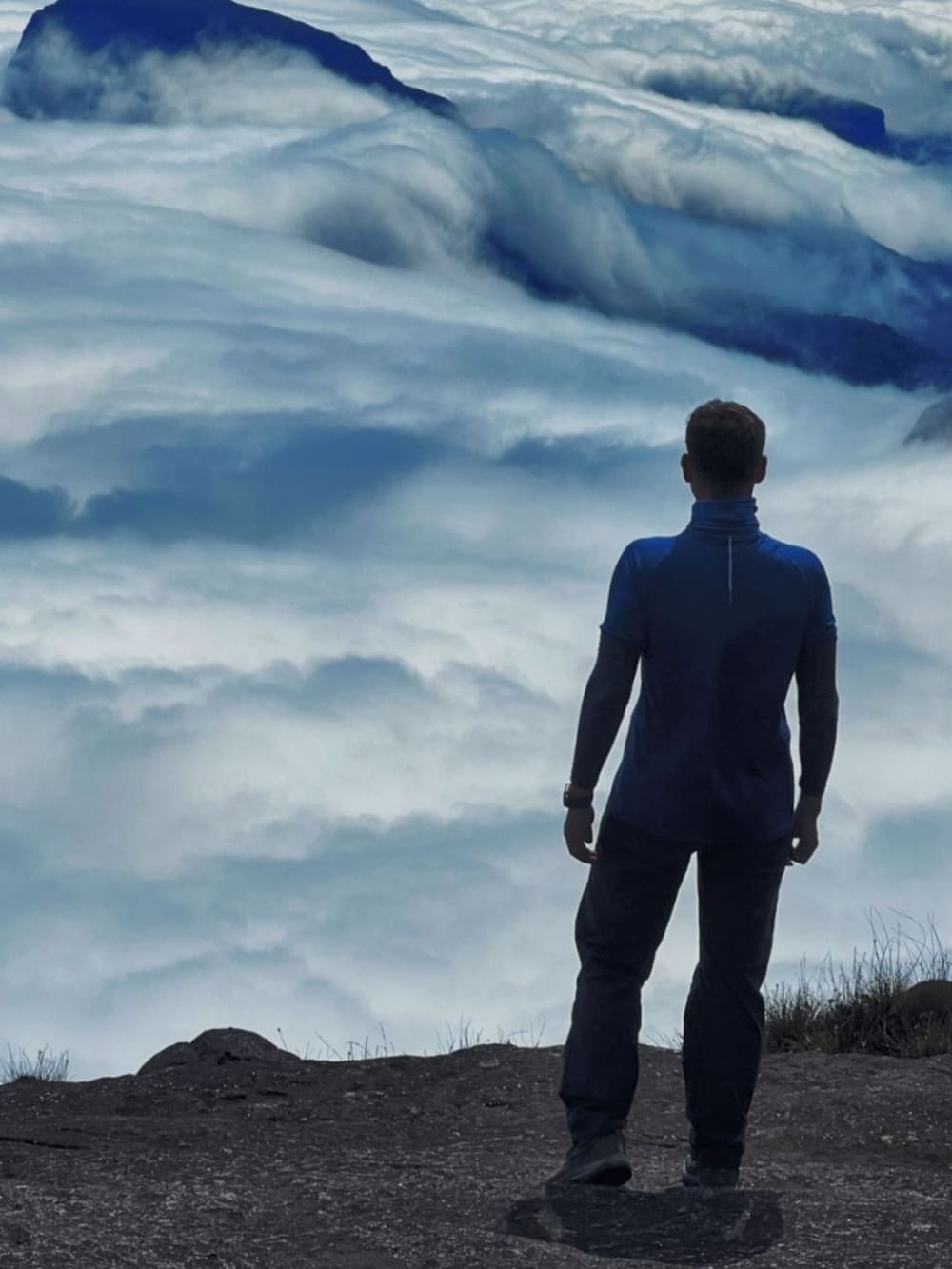
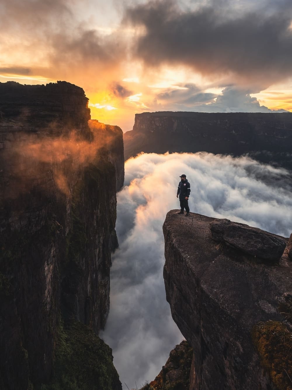
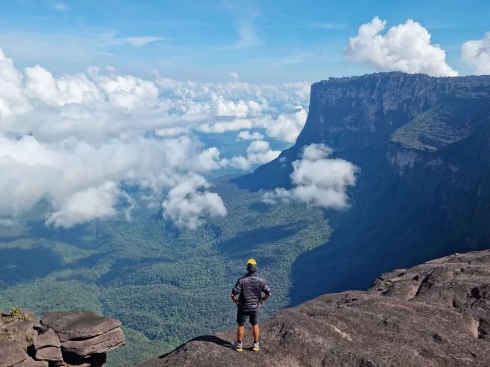
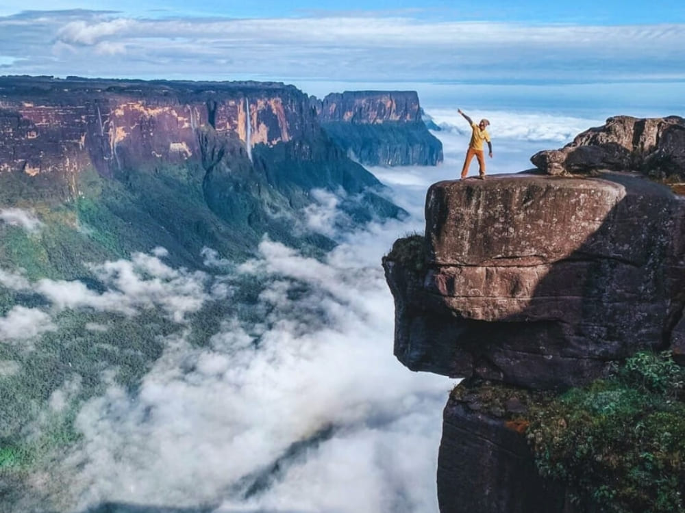
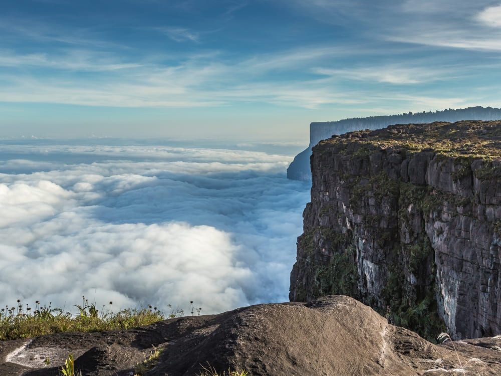
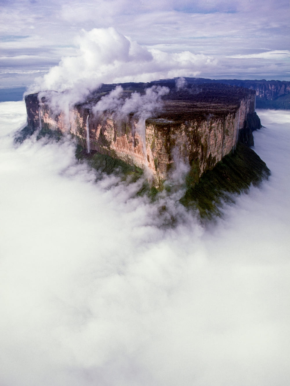
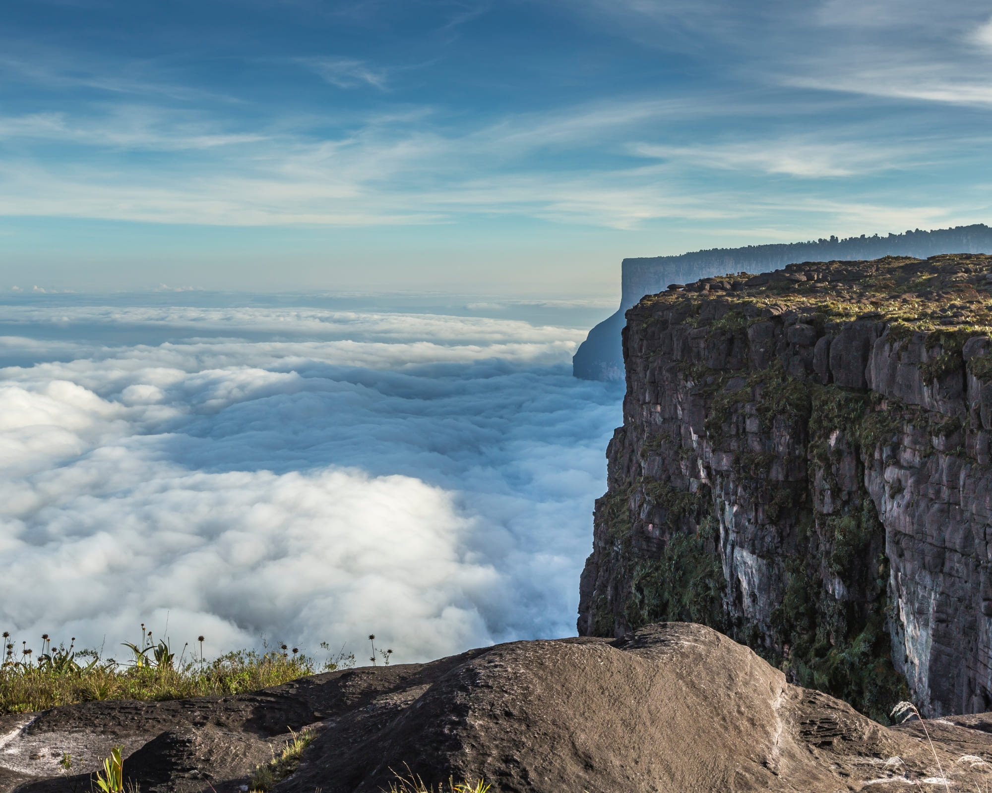
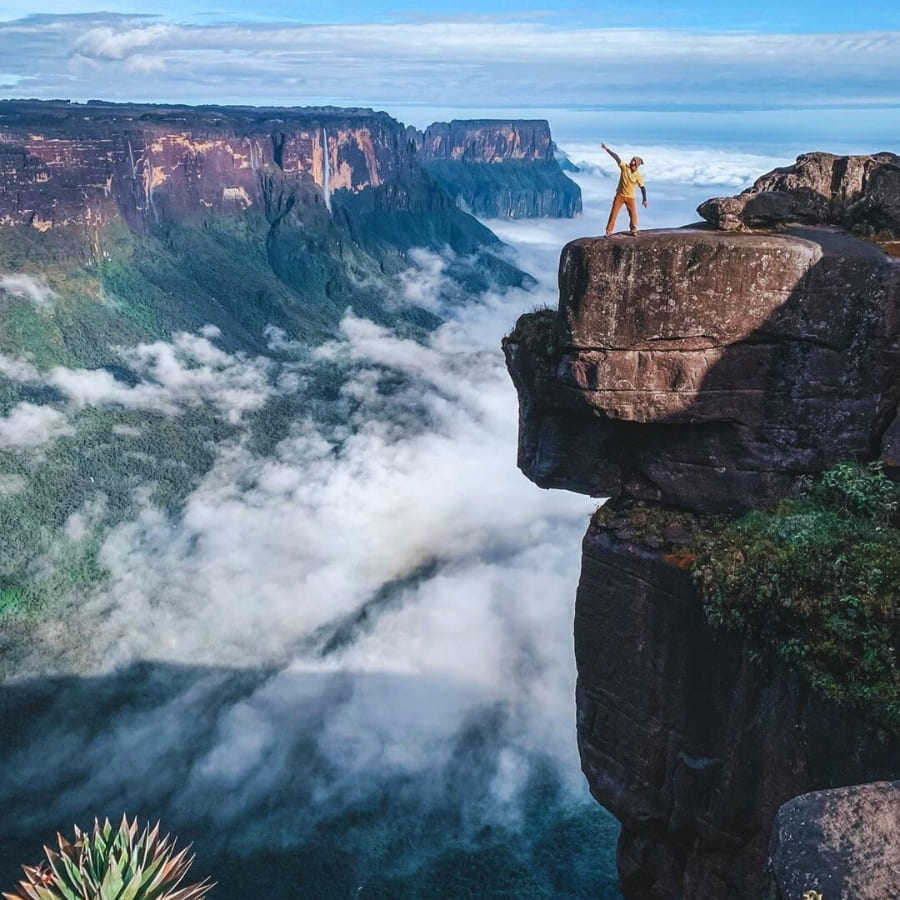
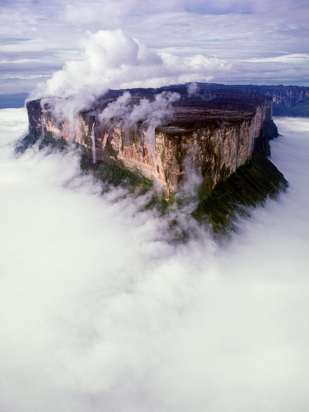
    Mount Roraima trekking: the edge of the summit plateau above a sea of clouds, with the tepui's sheer cliff wall on the right
    Photo: mariusz_prusaczyk

    1. Hire porters from the Pemón community

    Personal porters are hired at Paraitepuy before the trail starts. On the 10-day itinerary, you cover approximately 90 kilometers overall, with daily stages ranging from 6 to 15 kilometers on the plateau, where most tour companies limit individual bags to 15 kilos.

    Local porters belong to the Pemón communities whose land the trail traverses. By hiring them, you directly support the village that manages access to the area, which is community-based tourism all about.

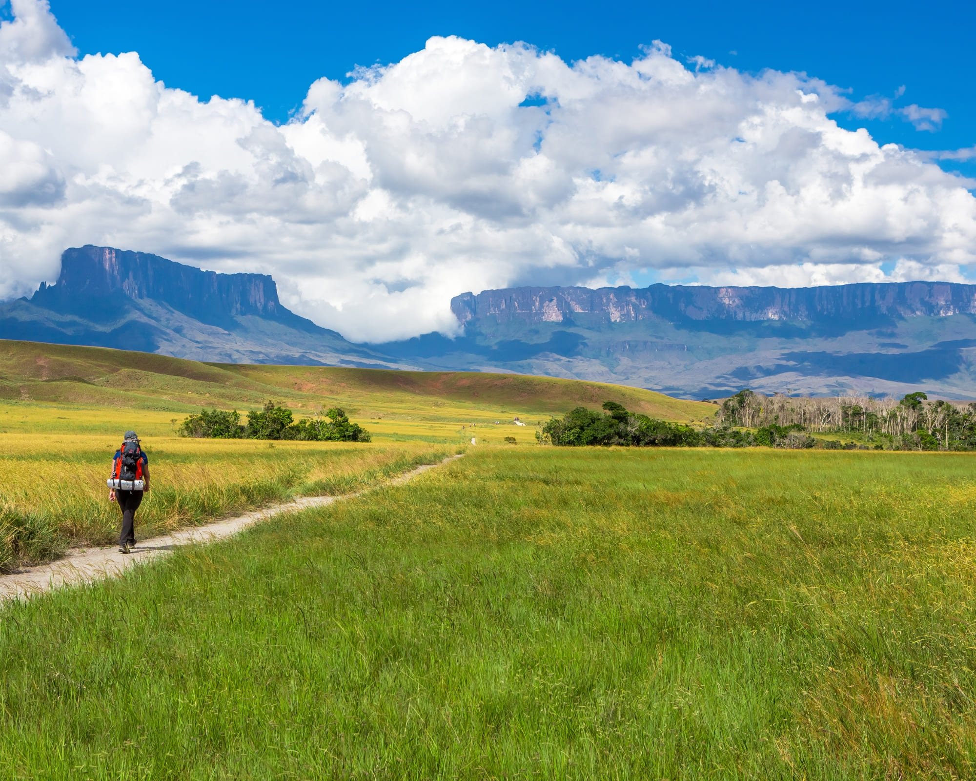
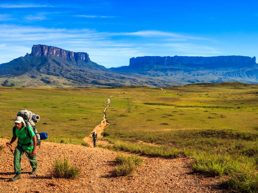
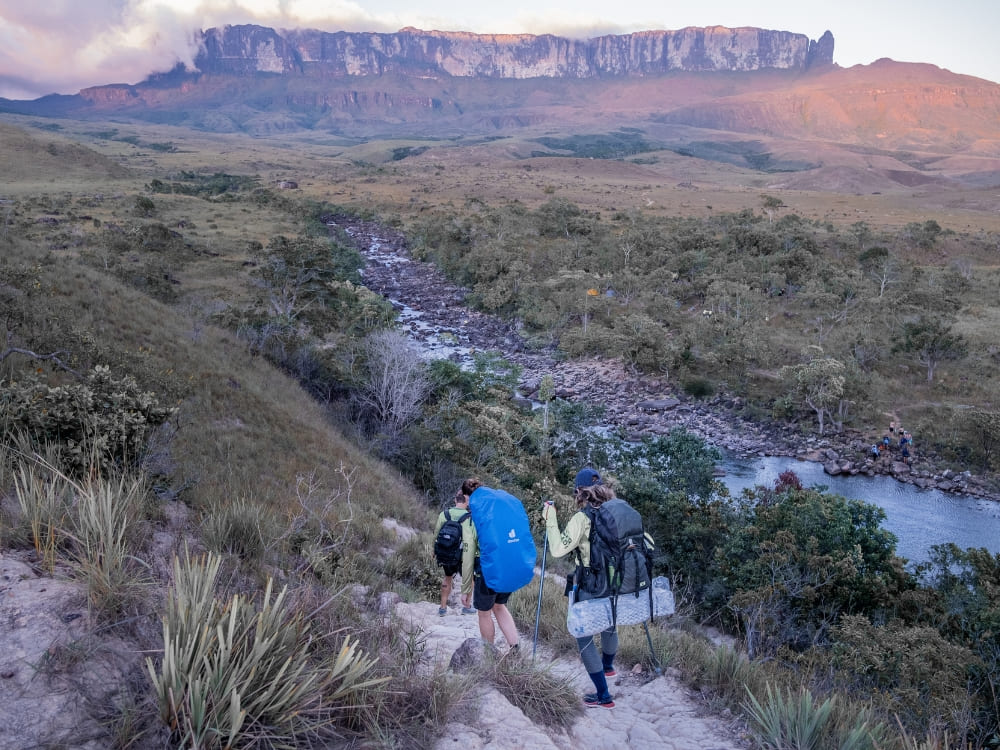
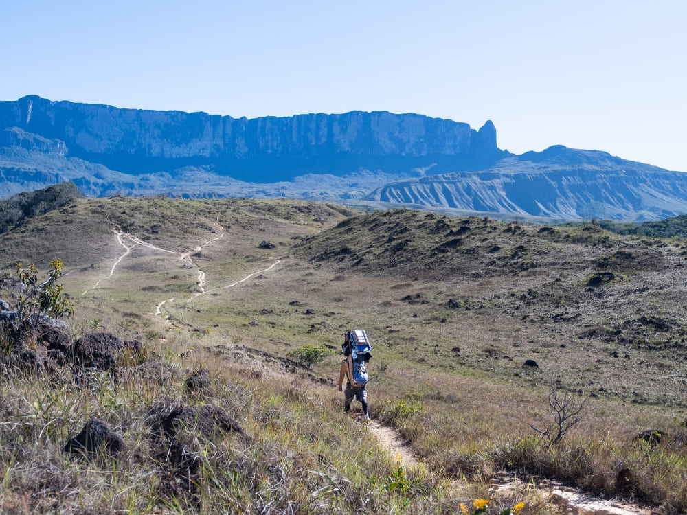
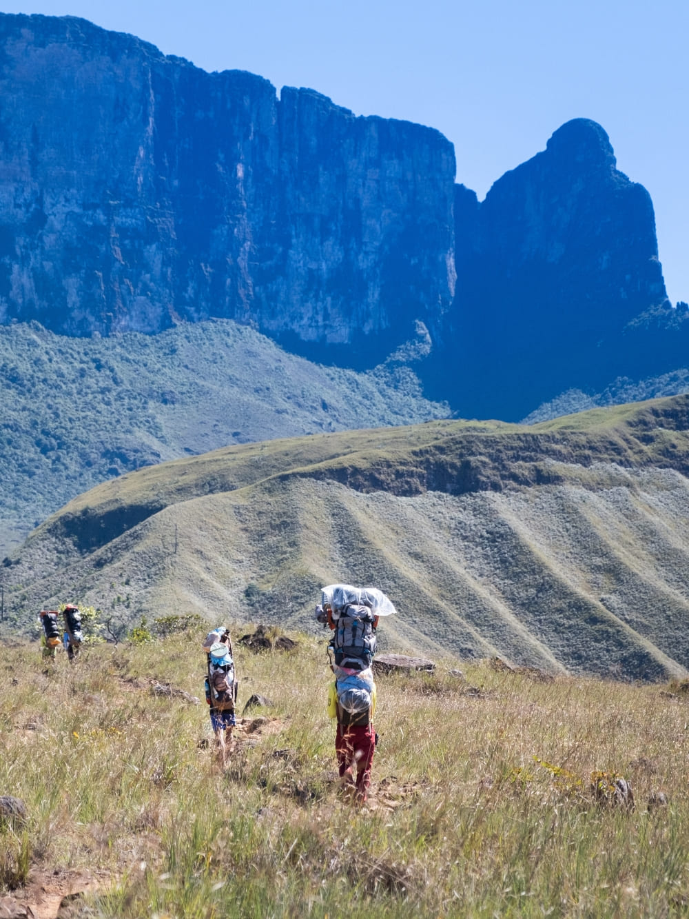
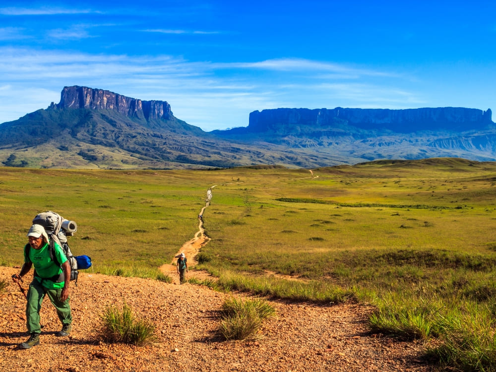
    A Pemón porter carrying a loaded pack on the savanna trail to Mount Roraima, with the Kukenán and Roraima tepuis ahead

    2. Book the Mount Roraima trekking with an operator that handles the border

    The practical route runs through Brazil. From Boa Vista it is 220 km (about 3 hours) on the BR-174 to Pacaraima, the only road crossing between the two countries, then across to Santa Elena de Uairén, in Venezuela. The trek starts at Paraitepuy, which is reached by traveling an additional 100 km by 4×4 across the Gran Sabana.

    Venezuela requires a yellow fever certificate from anyone arriving from Brazil or transiting a Brazilian airport for more than 12 hours, while visa rules differ by nationality.

    British, Canadian, and Australian passports are generally visa-free for stays under 90 days, while US citizens apply for an e-visa and pay a USD 180 fee, though the US State Department keeps a “Level 3: Reconsider Travel” advisory for Venezuelan territory.

    Mount Roraima trekking specialists not only guide travelers through border formalities and other potential bureaucratic requirements but also handle all transfer logistics to ensure maximum comfort, peace of mind, and safety.

    👉 Read more:

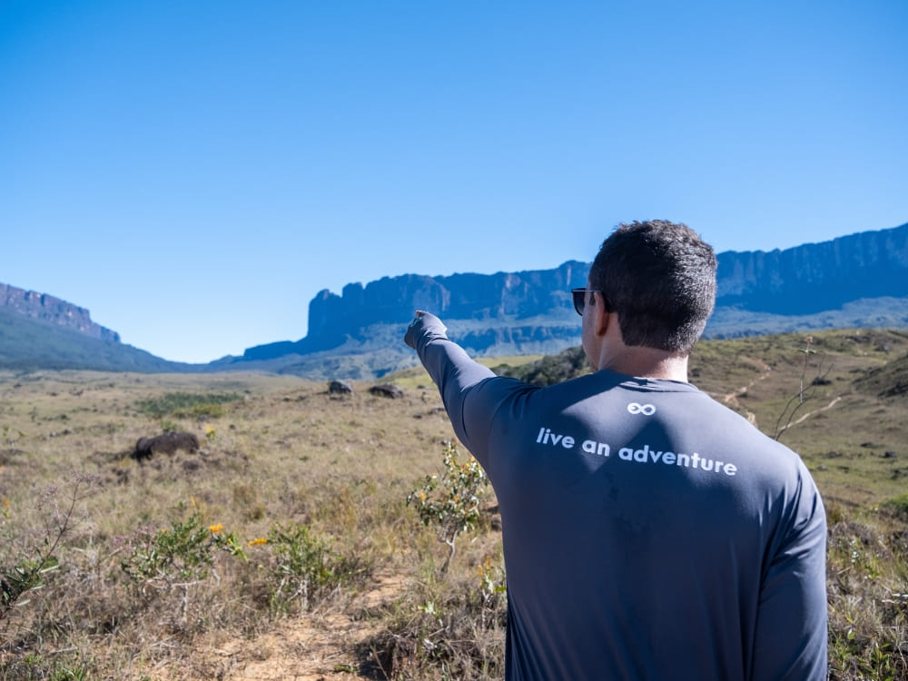
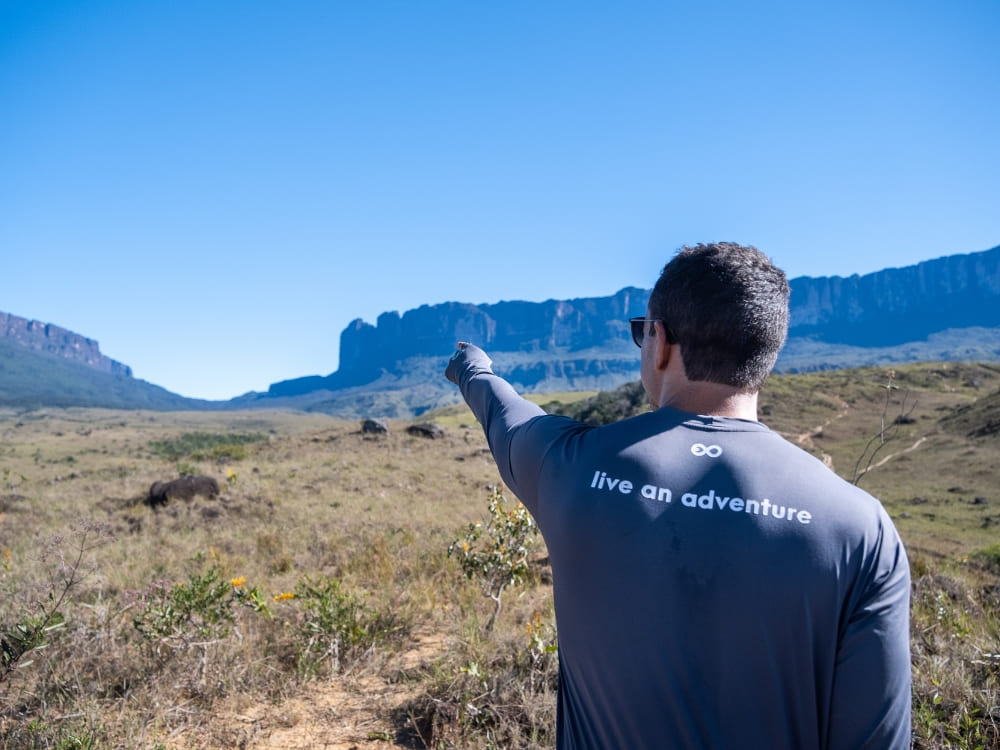
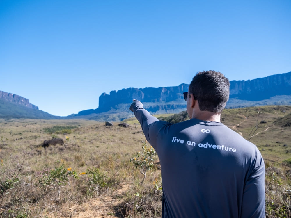
    A PlanetaEXO guide pointing at the Kukenán tepui from the savanna on the way to Mount Roraima
    Photo: Lucas Gobatti

    3. Pack for rain that arrives from every direction

    Mount Roraima receives more than 1,500 millimeters of rain a year. The weather is made on the plateau rather than in the valley, so the forecast for Santa Elena tells you very little. December to April is the driest window, though departures run year-round, and no month here is dry. Even in the best season, plan for sun in the morning, cloud by midday, and rain at night.

    If you’re researching what to expect during guided hikes in Mount Roraima, you might have stumbled on something called “reverse rain,” which is when strong upward wind gusts (roughly 75 km/h) catch falling water or rain, blowing it back into the sky before it hits the ground.

    Bring a waterproof shell and a cover/dry bags for your pack, sleeping bag, and electronics, when wild camping, protecting your gear is crucial. Additionally, bring spare socks and a microfiber towel.

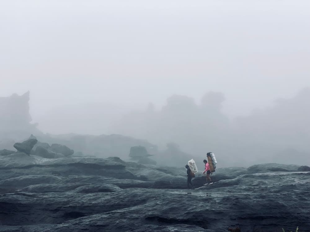
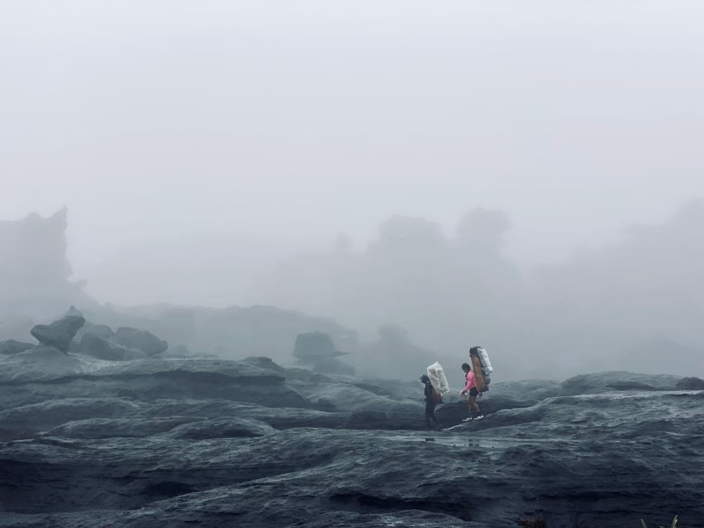
    Two trekkers crossing wet rock on the Mount Roraima plateau in thick fog and rain

    4. Train for La Rampa, not for the distance

    The Mount Roraima trekking route can be divided into distinct stages:

    • Paraitepuy to Kukenán River camp: covers 15 km in 4 to 5 hours.
    • Kukenán River to Base Camp: spans 8 km and 750 meters of climb.
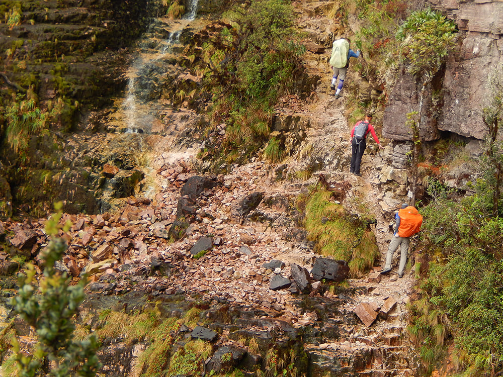
    • Ascent via La Rampa: tackles the wall along a natural ledge, the sole non-technical path up to the summit plateau, taking 4.5 km in 4 to 5 hours.
    • Top Plateau Exploration: daily distances range from 6 to 15 km.

    So the training that matters for hiking Mount Roraima is not distance but repeated climbing with weight on wet rock. Start hill walking with a loaded pack two months out, add cycling or running for the aerobic base, and work on legs and ankles. River crossings and slick boulder sections do more damage to unprepared ankles than the elevation does to lungs.

    Climbing Mount Roraima without technical skills is possible, since there are no ropes, harnesses, or scrambling grade on the standard line. With preparation, anyone in reasonably hiking condition can finish it.

    👉 Read more: How hard is it to trek up Mount Roraima?

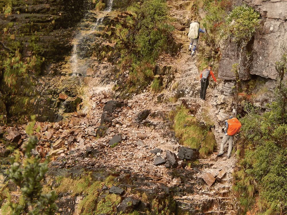
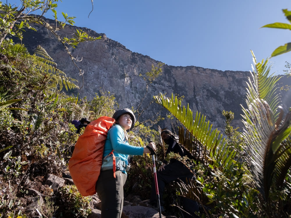
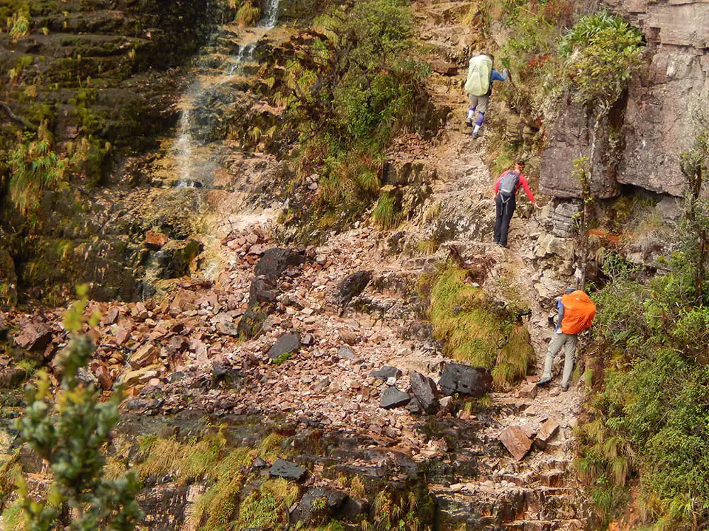
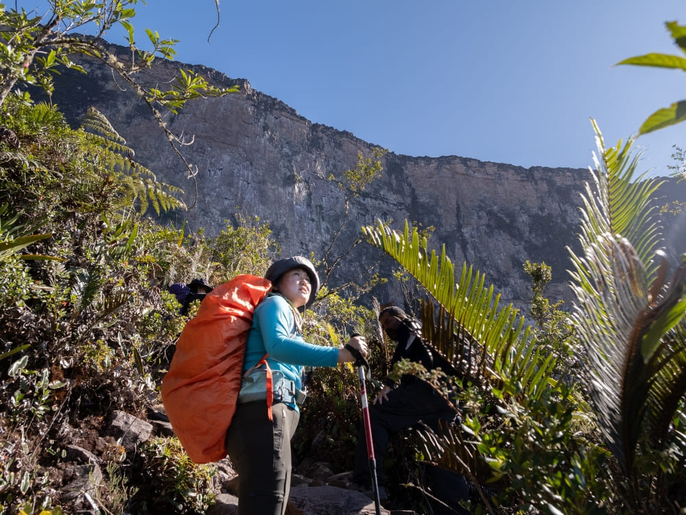
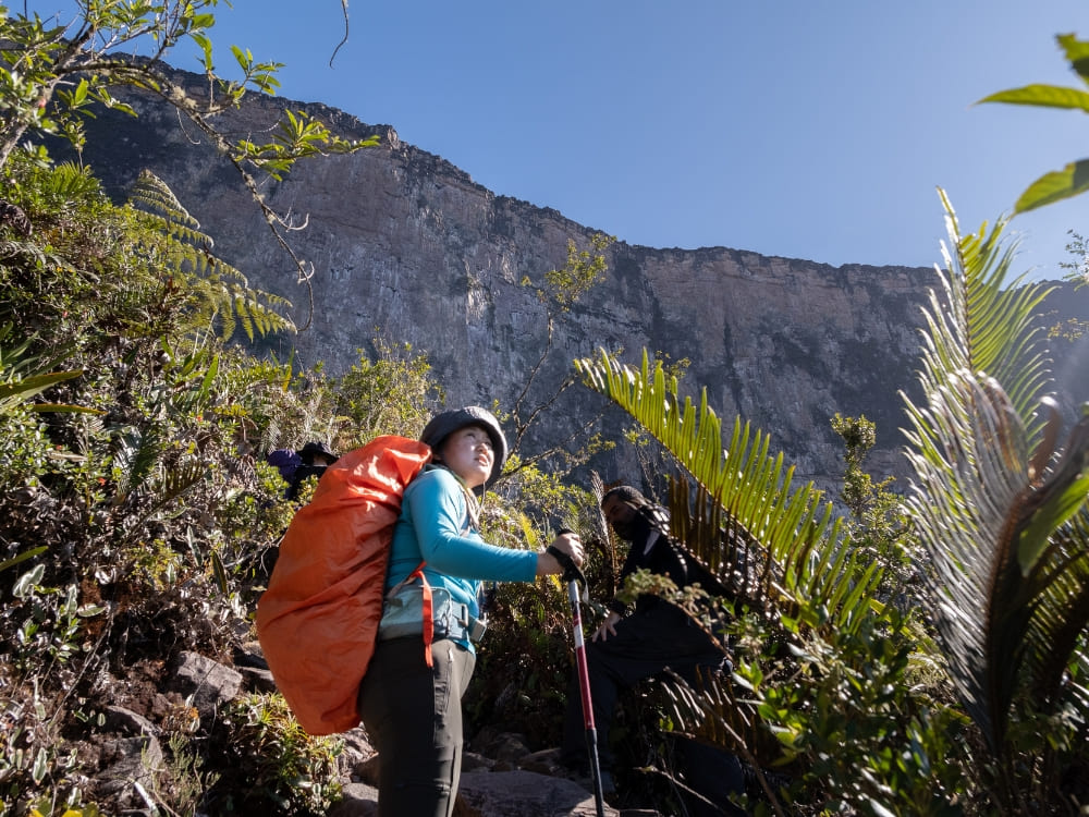
    A trekker with a rain-covered pack climbing La Rampa, the natural ledge up Mount Roraima's cliff wall
    Photo: Lucas Gobatti

    5. Learn what lives up there before you walk on it

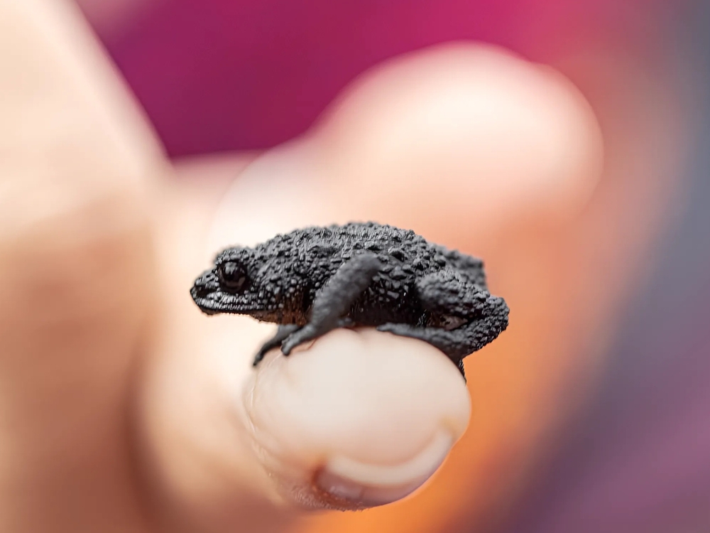
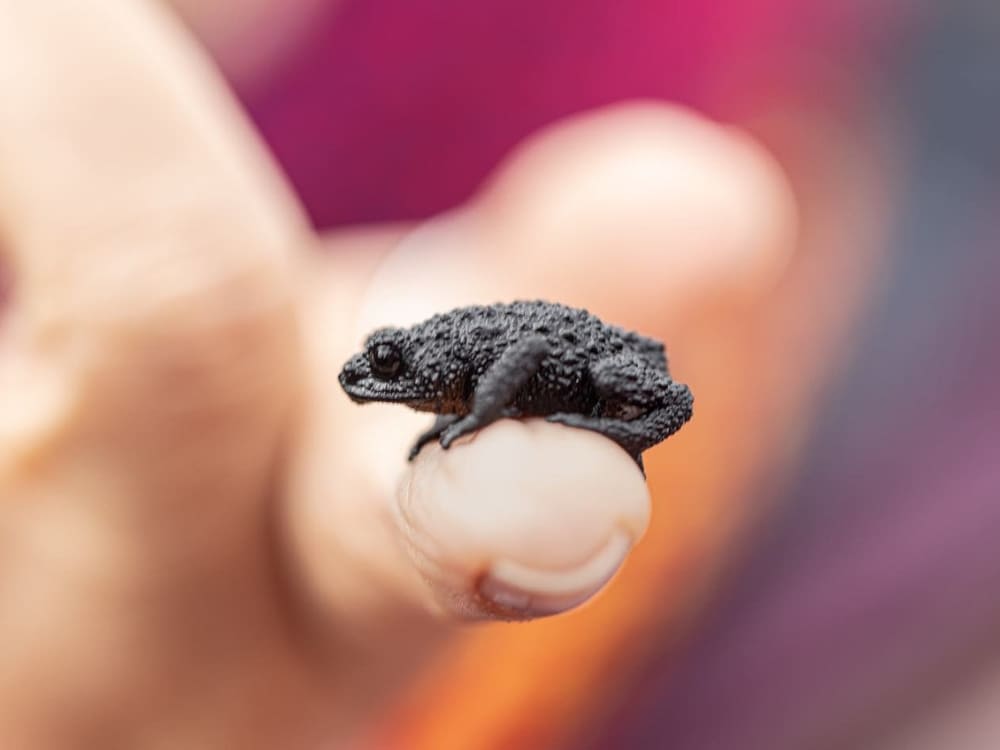
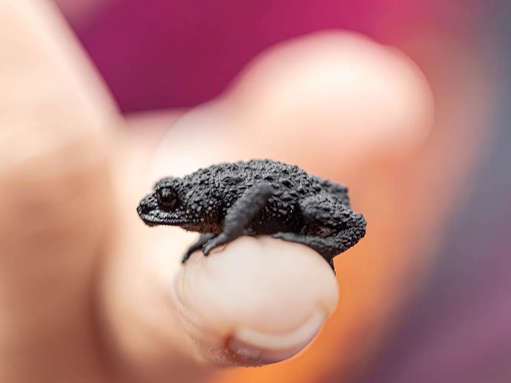
    Found exclusively at elevations between 2,300 and 2,800 meters on this summit and neighboring Wei-Assipu-tepui, the tiny Roraima bush toad (Oreophrynella quelchii) is no larger than a thumbnail, spotting one requires an experienced guide who knows precisely where to search.

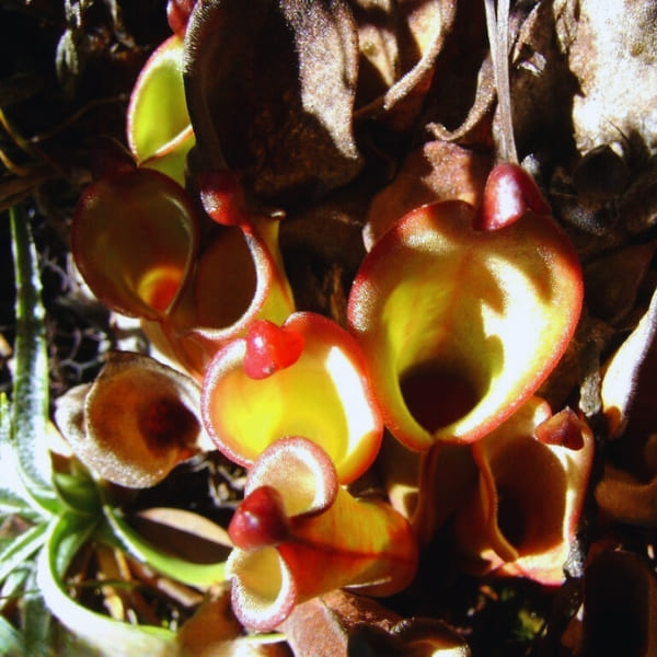
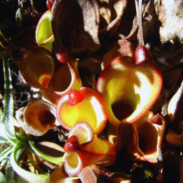
    First identified on the slopes of Roraima by Robert and Richard Schomburgk in October and November 1839, the pitcher plant Heliamphora nutans was the earliest of its genus ever recorded. Beyond Roraima, this species persists only on Kukenán, Yuruaní, Maringma, and Wei Assipu, remaining entirely exclusive to this specific group of tepuis.

    Tepui summits feature unique ecosystems, with WWF reporting that about one-third of their plant life is endemic. Though isolated from the lowlands for 70 to 90 million years, a 2012 study on tree frogs across separate tepuis traced a common ancestor to 5.3 million years ago, proving species cross these walls. To protect these habitats, always walk on bare rock and avoid native vegetation.

    👉 Read more: 10 Facts About Mount Roraima

    The tiny Roraima bush toad (Oreophrynella quelchii) balanced on a fingertip on the summit plateau
    Photo: @cafred33

    6. Bring gear rated for 0°C

    You start the week at around 25°C in the savanna and sleep it out at 5°C, with summit days near 10°C and nights that fall close to 0°C whenever it rains. That is a 25-degree swing inside one bag, at a latitude of 5 degrees north, which is why so many people arrive underdressed for the tropics.

    Make sure your sleeping bag is rated for 0°C, with an insulating mat under it. Add trekking poles for the descent, a headlamp with spare batteries, and boots already broken in. Nothing about Mount Roraima camping forgives new boots on a 15-kilometer day.

    Trekkers spend nights in tents at designated campsites across the plateau. Many sleep beneath natural rock overhangs, which offer protection against driving wind and rain, though they do not insulate against the chilly dampness radiating from the stone floor.

    Remember to carry a bottle and a purifier, as the summit water runs clear from the plateau pools and there is nowhere to buy anything for several days.

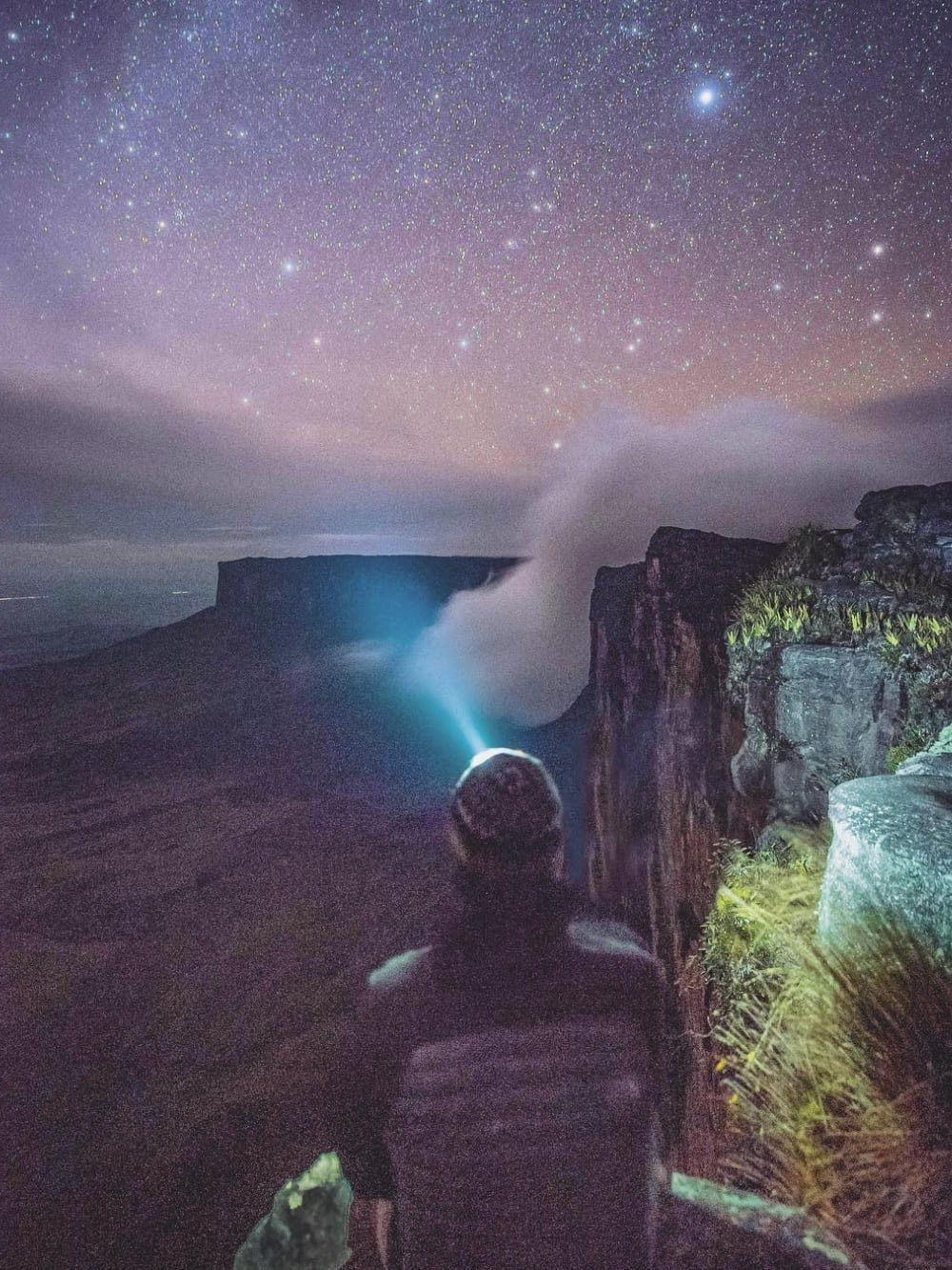
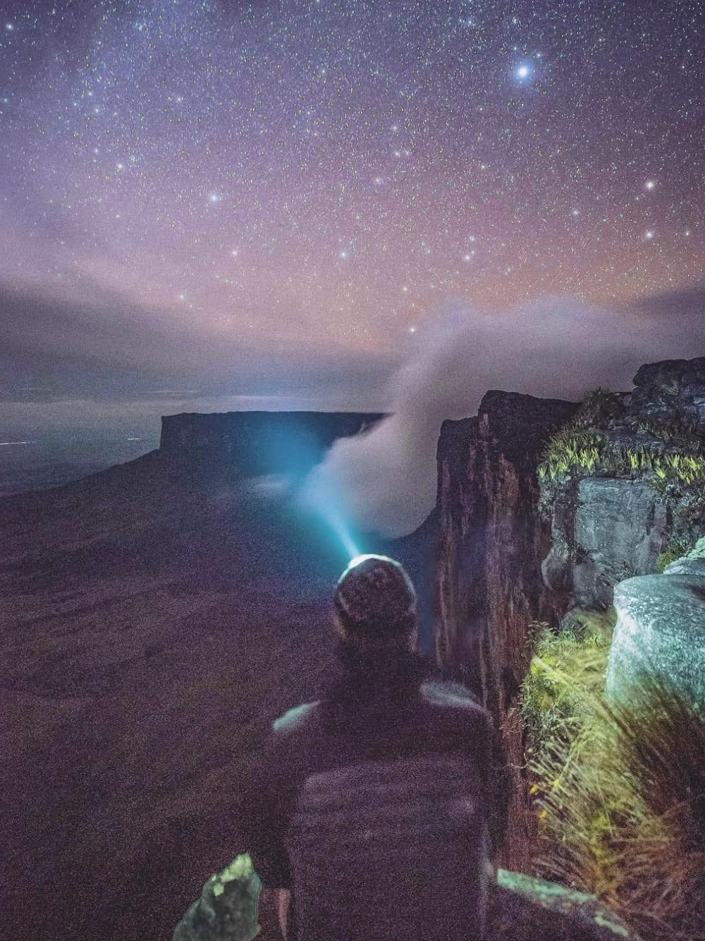
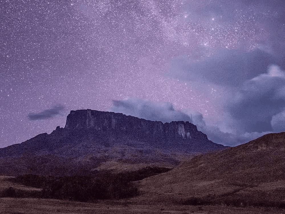
    A trekker's headlamp beam under a starry sky at the edge of Mount Roraima's plateau at night
    Photo: @overlandtheamericas

    7. Split your luggage into waterproof compartments

    Pack all your belongings into waterproof dry bags, ensuring essential items like sunscreen, snacks, and a camera stay easily accessible in an exterior pocket. Distribute weight effectively by positioning heavy gear against your back to rest the load on your hips instead of your shoulders.

    Next, lighten your load. Unnecessary weight becomes a heavy burden on La Rampa, where travelers most often regret bringing unworn clothing. Prioritize versatile, repeatable layers over multiple outfits, especially since camp conditions offer no way to dry damp garments.

    Documents and cash travel separately, in their own dry bag. You need a passport valid for at least six months, the yellow fever certificate, and cash.

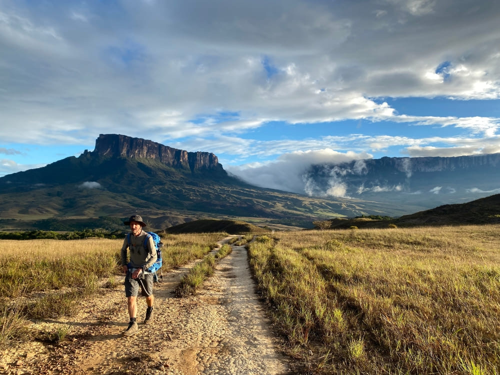
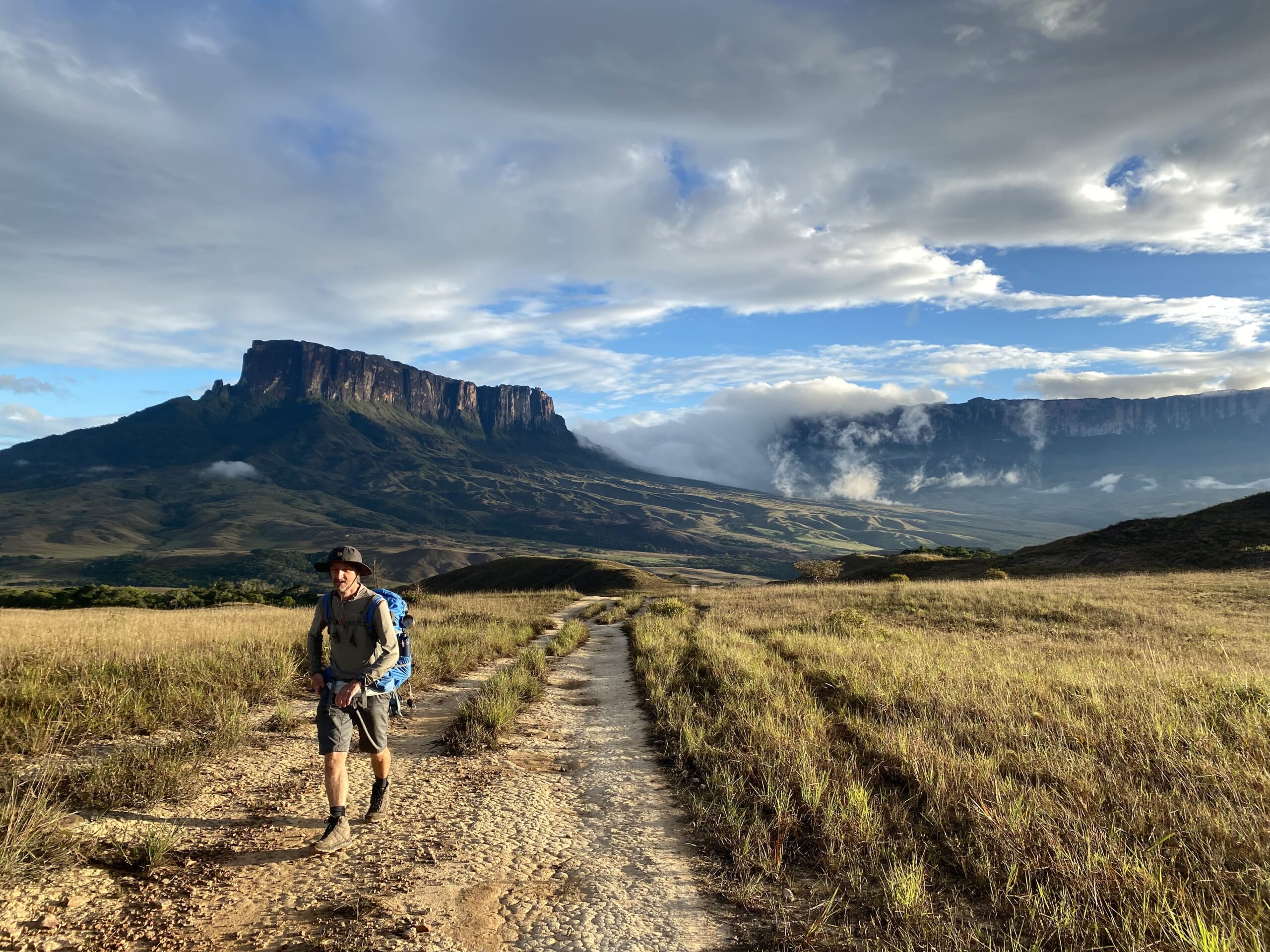
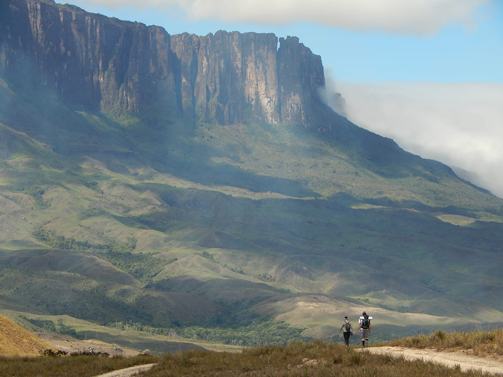
    A hiker on the trail across the Gran Sabana with the Kukenán and Roraima tepuis rising behind

    8. Expect no signal, and decide now what you want to bring home

    If you go trekking in Mount Roraima, be aware that there’s no internet on the tepui. Between Paraitepuy and the descent, travelers are offline for several days. The recommendation is to tell people at home you won’t be reachable for a while.

    Being disconnected encourages intentional recording over routine updates. Key landmarks across the plateau include the Valley of Crystals, Lake Gladys, La Ventana lookout, the Triple Point border marker, El Foso, and Maverick Rock (the summit’s peak at 2,810 meters). Because low temperatures and moisture drain battery life quickly, store power banks in dry bags and keep spare batteries inside your sleeping bag overnight.

    A written journal survives conditions that kill a phone, and it catches what photographs miss. Think of your trek as part of a global community of explorers. Every image, note, and exchange with fellow hikers is part of the story you’ll tell once back home.

    👉 Read more: How to Get to Mount Roraima?

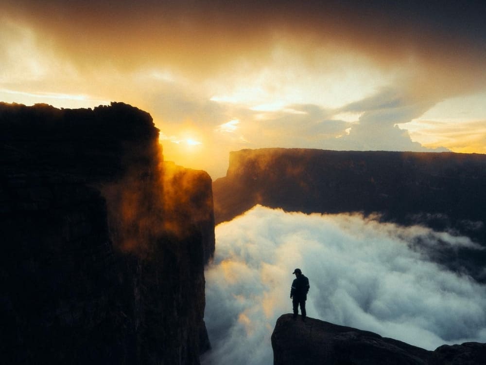
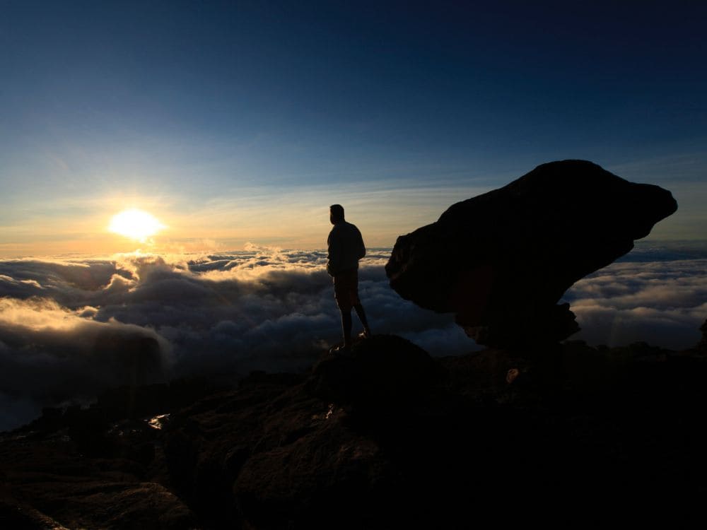
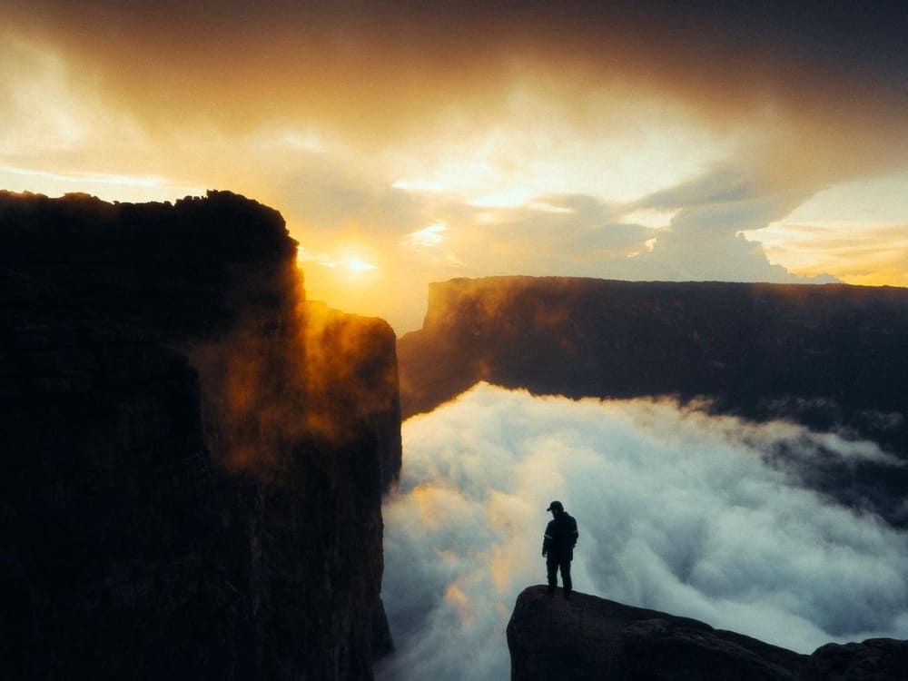
    A trekker silhouetted at the cliff edge of Mount Roraima at sunset, above a sea of clouds
    Photo: @watchluke

    9. Research local history and culture

    “Tepui” means house of the gods in Pemón. The name “Roraima” itself comes from roroi, blue-green, and ma, great. Pemón cosmology sees this tabletop as the stump of a mythic tree that held all world fruit until Makunaima felled it, inspiring PlanetaEXO’s 10-day Makunaima Expedition.

    Trekkers cross Pemón territory in Venezuela, accompanied by Pemón guides and porters. Meanwhile, the Ingarikó reside on the Brazilian side, within Monte Roraima National Park and the Raposa Serra do Sol Indigenous Territory, sharing the region with the Macuxi, Wapichana, Patamona, and Taurepang peoples.

    That side is not part of the tourist route. The park was created on June 28, 1989, covers 116,747 hectares, and has been under a shared arrangement between ICMBio (Chico Mendes Institute for Biodiversity Conservation), FUNAI (National Indigenous Peoples Foundation), and the Ingarikó since 2005.

    Everard im Thurn and Harry Perkins completed the first recorded ascent on December 18, 1884, guided by locals who likely reached the summit long before. Delving into this rich history transforms your perspective on the plateau and deepens the conversations you share along the trail.

    👉 Read more: What’s on top of Mount Roraima?

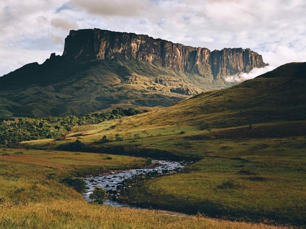
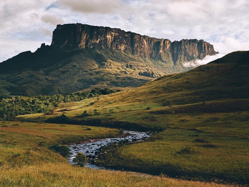
    The Kukenán tepui wall above the green savanna, with a stream running through the foreground
    Photo: @alecio_Cezar

    10. Build slack into the plan

    Three things move on this route regardless of planning: the weather, the border, and the pace of the slowest person in the group.

    Trip length determines how much of the plateau you explore. The 8-day route includes three nights on top to visit the Jacuzzis, La Ventana, and Maverick Rock. The 10-day route adds two nights, Triple Point, Lake Gladys, and an Indigenous community stay. The 12-day option extends this itinerary even further. Daily difficulty is identical; only your time spent above 2,700 meters varies.

    Even with thorough preparation, conditions on the mountain can change quickly. Campsites may become soaked, unexpected cloud cover can temporarily obstruct views, or earlier groups might secure the best shelters. Accounting for flexibility in your schedule transforms these potential setbacks into memorable experiences.

    👉 Explore the adventure: Mount Roraima Expedition: 12-Day Trek from Boa Vista

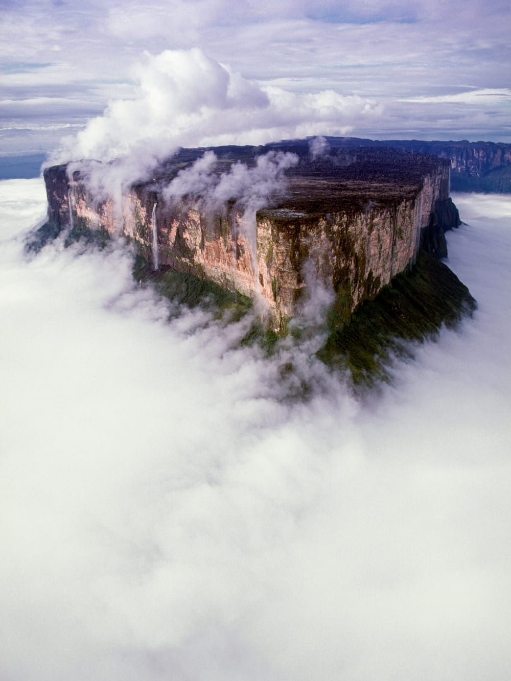
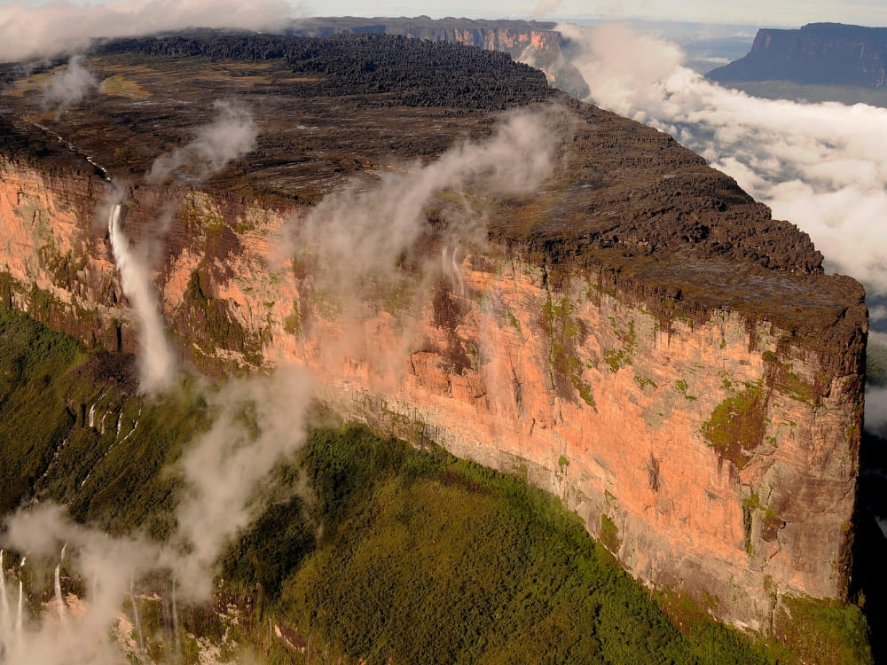
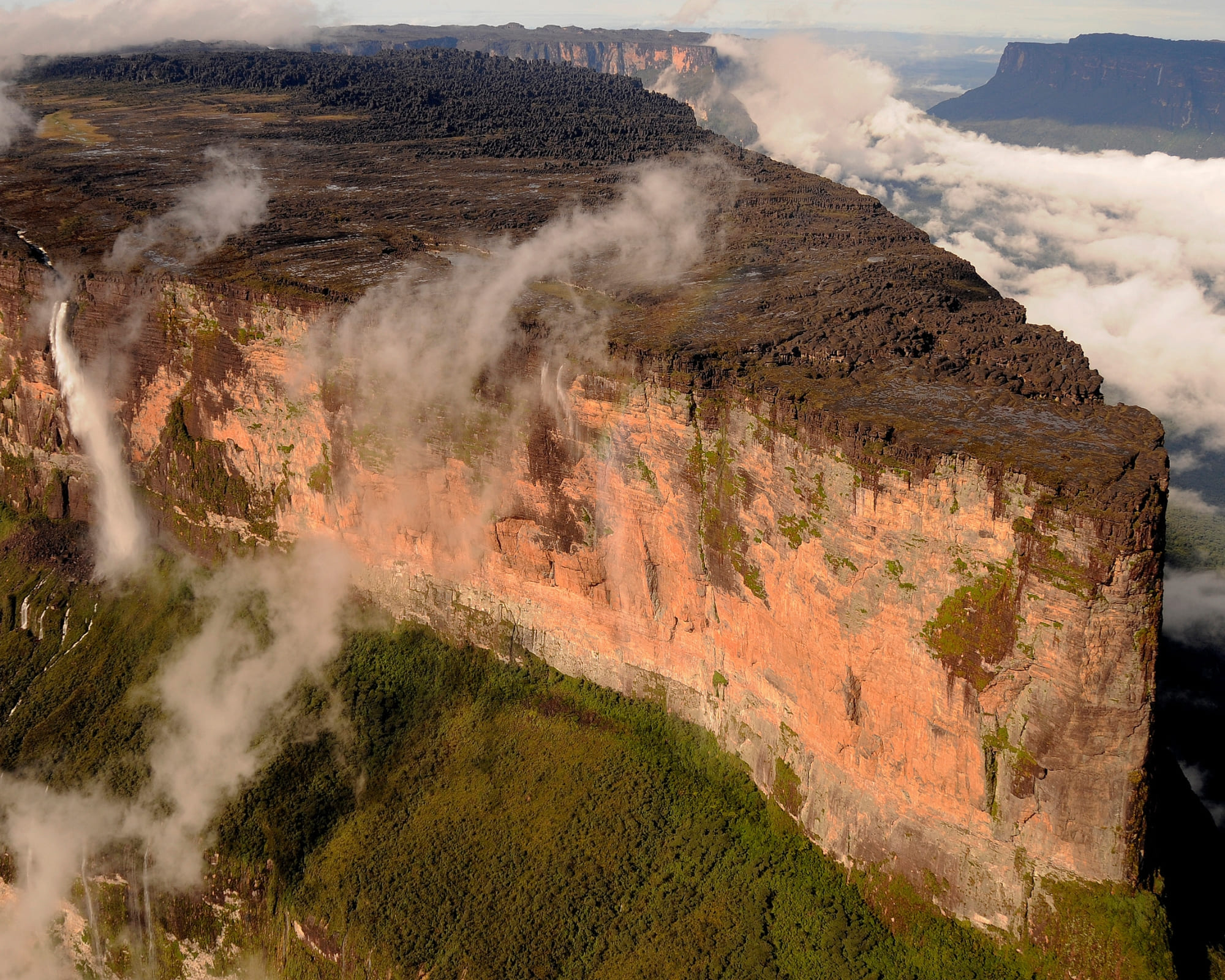
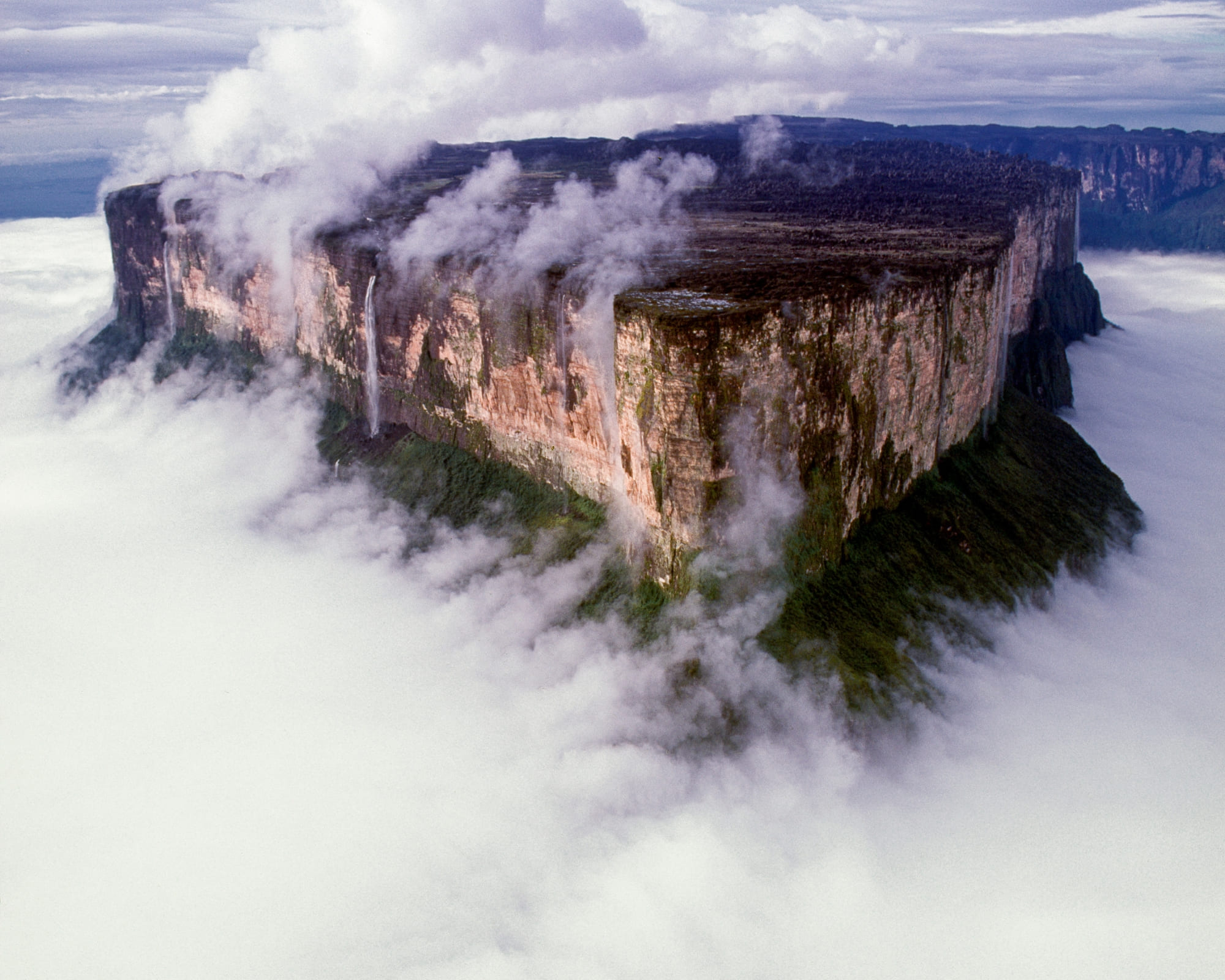
    Mount Roraima's summit plateau seen from the air, ringed by cloud with waterfalls falling off its walls

    Ready for Mount Roraima Trekking? Plan your expedition with PlanetaEXO

    Now that you know the best tips for a smooth trek in Mount Roraima, it's time to think about your travel plans.

    PlanetaEXO is an ecotourism platform specializing in hiking and trekking tours in Brazil. We run this route from Boa Vista with Pemón guides and partners who handle the crossing, the permits, and the camps, so all you have to do is enjoy the crossing. Contact us now!

  • Mount Roraima's flat-topped tepui rising above the green Gran Sabana savanna in Venezuela

    Is it Safe to Travel to Mount Roraima in Venezuela?

    Learn everything you should know for a safe trip to Venezuela and a smooth trek across Mount Roraima

    Mount Roraima is the best known of the tepuis, the flat-topped table mountains that rise from the savannah where Brazil, Venezuela, and Guyana meet. Its sandstone plateau has stood for close to 2 billion years, and its summit reaches 2,810 meters (9,219 feet), making it Brazil’s 8th highest peak. About 85% of it sits inside Venezuela, which is behind most of the questions travelers have before they book.

    So, is Mount Roraima dangerous? Not in the way the rumors suggest. The real dangers are the cold, the high plateau, rugged terrain, remoteness, and the Venezuelan border—not crime or wild animals. As long as you do it the right way, your travel experience has no reason to be a problem.

    PlanetaEXO guide pointing toward Mount Roraima across the Gran Sabana on a trip to Venezuela
    Photo: Lucas Gobatti

    PlanetaEXO, an ecotourism platform specializing in Mount Roraima tours, has put together this guide to help ease your worries. Check it out below!

    Approach from Boa Vista, on the Brazilian side

    The plateau can technically be reached through Venezuela, flying into Caracas and traveling overland, but almost nobody does.

    Brazil’s Roraima route is simpler, better serviced, and far less exposed. Boa Vista is a calm regional capital with daily flights and proper infrastructure, and the drive north on the BR-174 is straightforward.

    But is it safe to travel to Venezuela at all? This is the reassuring part. Since the Brazil–Venezuela border reopened in 2022, a dedicated tourist corridor lets groups with the correct permits reach the trailhead without passing through the parts that advisories warn about.

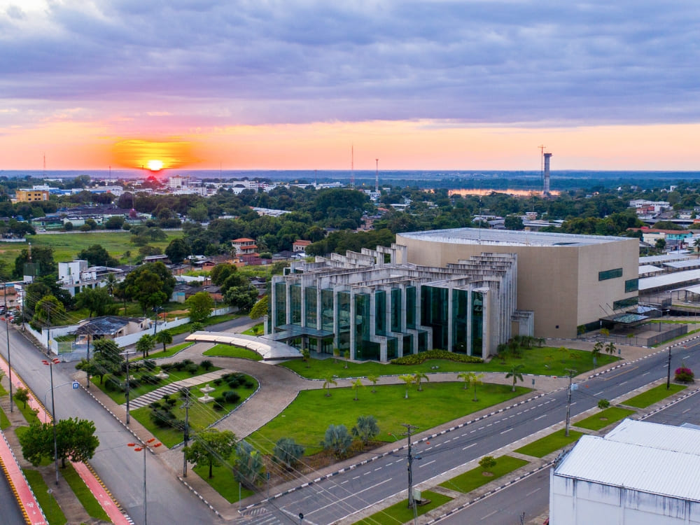
    Aerial view of Boa Vista, the Brazilian gateway city to Mount Roraima, at sunset
    Photo: Andreza Mariot

    👉 Read more: How to get to Mount Roraima?

    Respect the rules on both sides of the border for a smooth Roraima trip

    Since the Mount Roraima trek crosses into Venezuela, you deal with two sets of border rules. A valid passport is required for every nationality, Brazilians included, valid for at least six months beyond your entry date.

    Visa requirements vary: EU, UK, and most Latin American citizens enter Venezuela visa-free for tourism, while others, including U.S. and Canadian citizens, need a visa arranged in advance for Venezuela’s Roraima crossing.

    To have a safe trip to Venezuela, you should be aware of some restrictions. The U.S. Department of State rates the country “Level 3: Reconsider Travel” (its June 2026 update, eased from “Level 4: Do Not Travel”) and keeps a stricter warning on specific regions such as the Colombia border and Amazonas state, not the Gran Sabana corridor used to reach Roraima.

    This is where the tourist corridor matters. Since 2022, a dedicated, permit-controlled corridor connects the Brazilian border to Paraitepuy, so travelers move through a monitored route rather than the open country. Your time in Venezuela is short, guided from start to finish, and spent in the peaceful Gran Sabana, well away from the flagged areas.

    If you’re wondering if it’s safe to go to Venezuela for the Mount Roraima hike, the answer is yes, as long as you properly plan your trip: stay on the tourist corridor and check your own government’s current travel advisory before you book, as the situation can change.

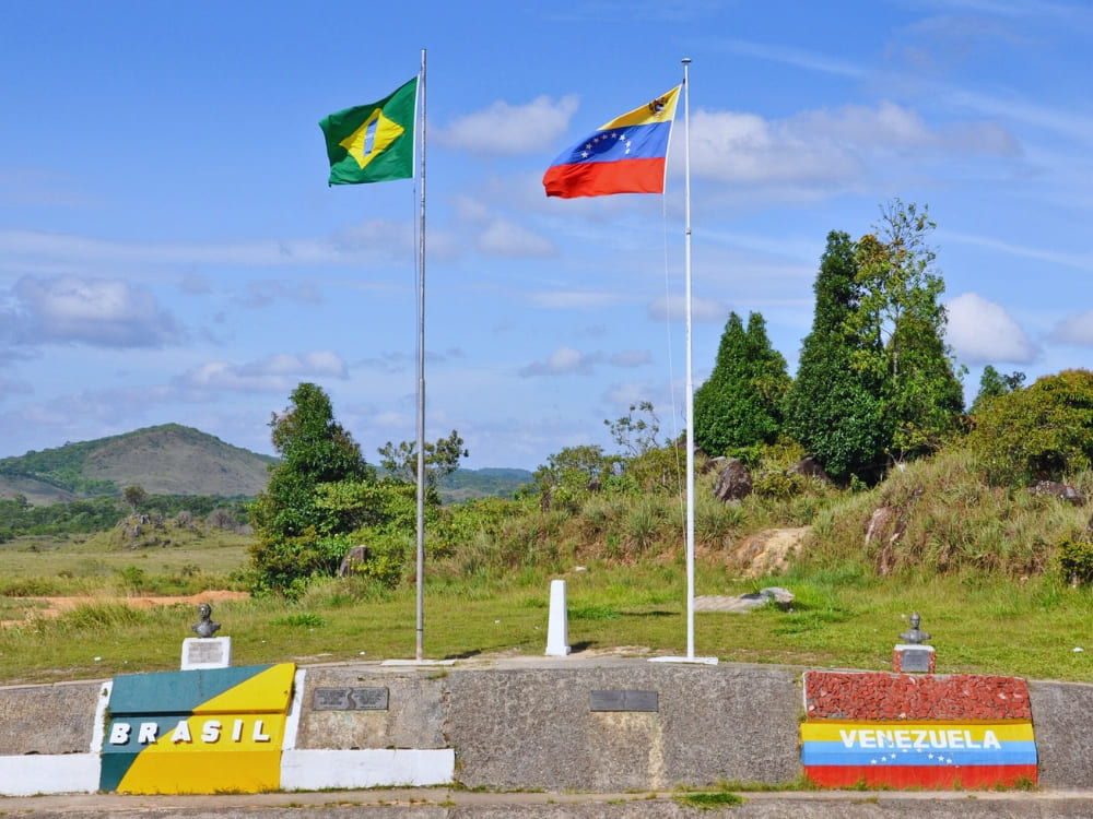
    The Brazil–Venezuela border marker with both national flags, on the crossing used to reach Mount Roraima
    Photo: Paolo Stefano

    👉 Read more: Do I need a Visa to visit Mount Roraima in Venezuela?

    Trek with experienced, qualified guides and a reputable operator

    Choosing a qualified guide and a trusted tour operator is your single most critical safety choice—and for Mount Roraima, it is mandatory.

    National park rules require every group to trek with certified local guides, and independent trekking is not allowed. The guides are Indigenous Pemón from the Paraitepuy community, who handle the route, the camps, and the cooking.

    A reputable operator does more than lead the trail: it arranges the border formalities, the transfers, the meals, and the shared gear so the logistics that trip up solo travelers are taken care of.

    Venezuela’s park authority, Inparques, also caps groups at 8 trekkers in peak periods and 16 in regular season, always with at least two guides. That support structure is precisely what differentiates standard options from top-tier Roraima tours.

    Trekkers with backpacks approaching Mount Roraima on the trek across the Gran Sabana
    Photo: Lucas Gobatti

    👉 Explore the adventure: Mount Roraima Trek: 8-Day Expedition to the Lost World

    Follow your guide and keep the group together

    The dangers of Mount Roraima become much less significant when you follow your guide’s lead. They read the weather, judge the river crossings, set the pace on La Rampa, and decide when the plan needs to change—which changes often on the plateau, as the mist can close in within minutes and rock turns slick the moment it rains.

    Stay with the group, tell your guide early if you feel unwell or are struggling with the cold or the altitude, and don’t wander off the marked route on the plateau, where sinkholes and drop-offs hide in the fog.

    Don’t see good communication as a formality but as a way to keep such a remote trek safe.

    Hikers crossing Mount Roraima's misty summit plateau among dark rock formations
    Photo: Lucas Gobatti

    Pack the right gear, clothing and medication

    The dangers of Mount Roraima are more about the cold, wet weather than anything else. To make sure you won’t have any health issues during the trek and go back home sick, your packing list is safety equipment.

    Temperatures on the plateau can plummet to around 5°C overnight and hover near 0°C during rainfall. Combined with frequent exposure to heavy mist and rushing waterfalls, keeping warm and dry becomes a crucial defense to avoid hypothermia rather than a mere matter of personal comfort.

    Here are the essentials:

    • Well-worn, waterproof trekking boots (new boots cause blisters) and trekking poles for the steep descent.
    • A high-quality rain jacket, pack cover, and dry bags to keep everything inside your backpack dry.
    • Thermal base layers, a warm jacket, gloves, and one set of dry clothes kept only for sleeping.
    • A sleeping bag rated to 0°C, a headlamp with spare batteries, and a 1-liter bottle with water purification tablets.
    • A personal first-aid kit and any personal medication, plus sunscreen and a wide-brimmed hat for the exposed savannah.

    Keep your international yellow fever vaccination certificate stored right alongside your passport. It’s also essential to carry cash in Brazilian Reais to cover expenses where cards aren’t accepted, as ATMs are extremely hard to find near the border.

    Hiker on Mount Roraima's rocky summit plateau in the mist during the Roraima trek
    Photo: Lucas Gobatti

    👉 Read more: 10 Travel Tips for Mount Roraima to make the most of your trip

    Take out adventure travel insurance

    Some might consider Mount Roraima dangerous in the sense that, in a remote location such as this, serious injuries can mean a slow, weather-dependent evacuation.

    Accidents are avoided when hikers follow the guide’s instructions, use the right equipment, and recognize their limits, but unforeseen events can still occur. That’s why travel insurance that covers remote, high-altitude trekking is mandatory.

    Make sure your policy explicitly covers trekking to around 2,800 m, medical evacuation, and repatriation, because standard vacation insurance often excludes exactly this kind of trip.

    If you’re not sure where to find coverage for everything you need, reliable operators can point you in the direct direction—another reason to book your Mount Roraima trek with specialists!

    Know your limits and do your homework

    The last piece of safety is honest self-assessment. The Mount Roraima trek is graded as challenging, including roughly 86 km on foot, a steep 4.5 km ascent, multiple nights in a tent, and days that run up to 8 hours. You don’t need to be an athlete, but you should be able to walk several kilometers with a loaded pack on consecutive days.

    A couple of months of hiking, cardio, and leg training beforehand make the difference between suffering and enjoying it, so research the mountain, the route, and the season before you commit.

    Trekkers climbing the steep rocky ascent of La Rampa on the Mount Roraima hike
    Photo: Lucas Gobatti

    👉 Read more:

    Safely trekking Mount Roraima with PlanetaEXO

    Mount Roraima is dangerous only if you go unprepared or alone. For a smooth trek, do it the right way: pack your gear, follow border protocols, get travel insurance, and hire local guides. If you just want to enjoy the trail and not worry about anything else, an experienced operator can take care of all that!

    PlanetaEXO is an ecotourism platform that runs Mount Roraima tours with experienced Indigenous Pemón guides and trusted local partners, handling everything from the border crossing to the summit camps. Our team takes care of the logistics, the permits, and the safety of your trip to Venezuela. Contact us now!

  • How to visit Mount Roraima – Travel Guide

    How to visit Mount Roraima – Travel Guide

    Learn everything you should know to travel to Mount Roraima, including how to get there, the best time to visit, main attractions, and more!

    Standing tall at an impressive altitude of 2,810 meters (9,219 feet), Mount Roraima is the 8th highest peak in Brazil and one of the tallest on the planet.

    Known for its wild beauty, ancient geological formations, and spirituality, it attracts thousands of tourists from all over the world. According to Brazil’s Ministry of Tourism, the state of Roraima welcomed over 16,000 foreign travelers in 2024—a good chunk had the mountain as their destination.

    Curious to learn more? PlanetaEXO, an ecotourism platform specializing in Mount Roraima tours, has put together a comprehensible travel guide with all the essential information for a fantastic trip. Check it out below!

    Table of contents

    1. About Mount Roraima
    2. Is Mount Roraima the Oldest Place on Earth?
    3. Where is Mount Roraima Located?
    4. How to Get to Mount Roraima?
    5. When is the Best Time to Visit Mount Roraima?
    6. Main Attractions: What’s on Top of Mount Roraima
    7. Can You Visit Mount Roraima?
    8. Is it Safe to Visit Mount Roraima?
    9. What to Pack for a Mount Roraima Hike?
    10. How Hard is it to Trek Up Mount Roraima?
    11. How Many Days Should You Stay in Mount Roraima?
    12. Mount Roraima Tours
    Sunset over the cliff edge of Mount Roraima's summit, above a sea of clouds
    @watchluke

    About Mount Roraima

    Mount Roraima is a tepui, a table-shaped geological formation typical of the northern region of South America. Offering breathtaking views of plateaus, cliffs, and unique natural landscapes, it was first climbed in 1884 by British explorer Sir Everard im Thurn.

    The discovery of a remote and mysterious place inspired one of the most famous literary works of all time. The Lost World, written in 1912 by Sir Arthur Conan Doyle, was entirely inspired by Roraima. In the story, a group of scholars sets off from London to explore an isolated plateau where dinosaurs and other prehistoric creatures survived extinction. The book, in turn, inspired Jurassic Park.

    Outside of fictional books and films, the mythology of Mount Roraima is well-known. The main one is the legend of Makunaíma, an indigenous hero who was born from a lake fertilized by the sun and the moon. Clever, strong, and just, he is the protector of the Tree of All Fruits, a magical tree that provides all foods. The origin of the story is attributed to the Macuxi indigenous group.

    This legend served as inspiration for the eponymous work by Brazilian author Mário de Andrade—he also based his work on the accounts of the German explorer Theodor Koch-Grünberg. In the 1928 book, Macunaíma is an antihero who goes to São Paulo to retrieve a valuable artifact.

    For the indigenous people of the region (Macuxi, Pemón, Taurepang, Arekuna, and Kamarakoto, etc.), Mount Roraima is a sacred place. It is believed that the so-called Land of Makunaíma has a powerful connection between man and nature, balancing respect, ancestry, and mystical aspects.

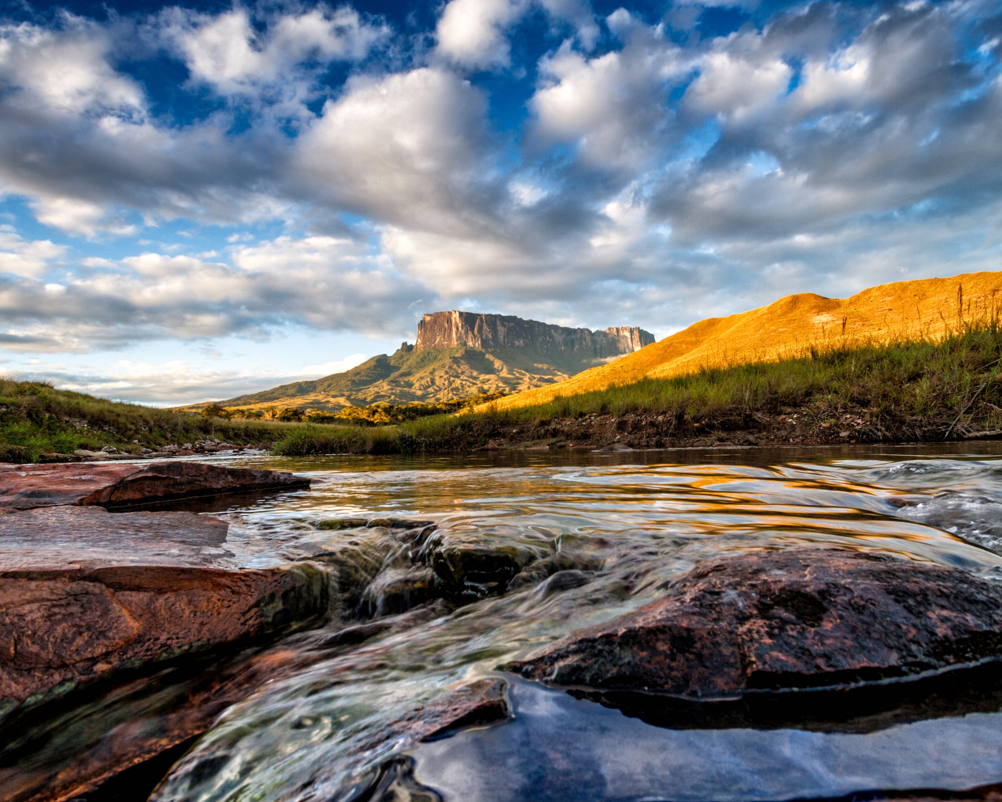
    The Kukenán tepui next to Mount Roraima reflected in a river at golden hour
    .


    Is Mount Roraima the Oldest Place on Earth?

    The geological composition of Mount Roraima is predominantly formed by Precambrian rocks dating back approximately 2 billion years, providing a window into the planet’s distant past.

    Over millions of years, the mountain has resisted relentless erosion, shaping its unique landscape and revealing its flat plateau that extends for about 31 km².

    In addition, tectonic activity has also sculpted Roraima—a crucial factor for its title as the oldest place on Earth, as it is part of the ancient Pakaraima mountain range, formed over billions of years by the movement of the tectonic plates.

    Where is Mount Roraima Located?

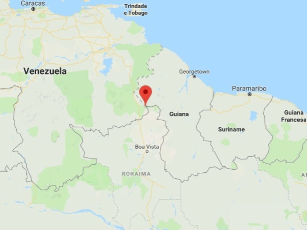
    Mount Roraima is located on the triple border of Venezuela, Brazil, and Guyana, in South America. The largest share is situated within Venezuelan borders (85%), while the Brazilian and Guyanan sides represent 5% and 10%, respectively.

    In Brazil, the area is overseen by the state of Roraima, more specifically in the city of Uiramutã. See the map of Mount Roraima below:

    How to Get to Mount Roraima?

    The most convenient access to Mount Roraima is via Boa Vista, the capital of the state of Roraima, Brazil. Boa Vista Airport (BVB) receives daily flights from Brasília, Manaus, and São Paulo.

    From there, travelers head north on the BR-174 highway, crossing into Venezuela and arriving in Santa Elena de Uairén, in Gran Sabana, Bolívar, the main hub for expeditions (20 km away from Brazil). This town provides accommodations and a pause before the trek begins.

    While Santa Elena has a small airport, flights are rare and less reliable, making the road journey from Boa Vista the preferred option. From the city, the route continues toward the Community of Paraitepuy, the official gateway to the trails.

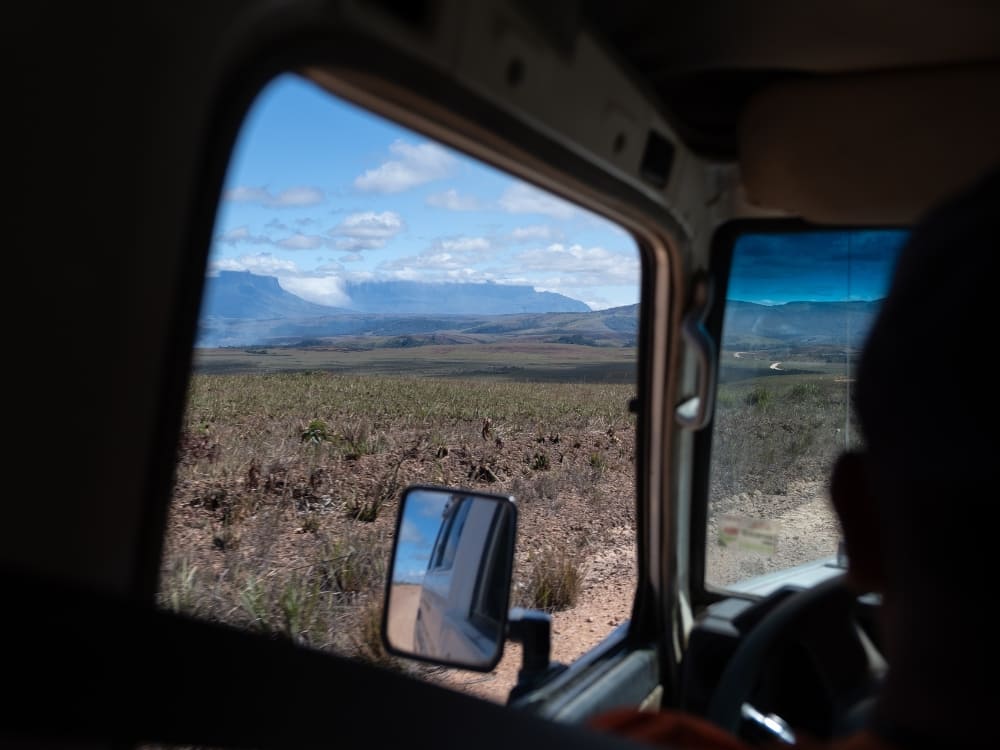
    The drive across the Gran Sabana reveals breathtaking landscapes, where travelers often catch their first glimpse of the tepui.

    A 4x4 jeep transfer crossing the Gran Sabana with Mount Roraima in the distance
    Photo: Lucas Gobatti

    👉 Read more: How to get to Mount Roraima?

    When is the Best Time to Visit Mount Roraima?

    The weather on Mount Roraima is highly unpredictable and follows the tropical climate of Venezuela. Rain, fog, and sudden temperature changes can happen at any time, so being prepared for all conditions is essential throughout the year.

    From October to March (dry season), the trek is generally easier, with less rain and clearer trails. Views from the top of Mount Roraima are more frequent, and temperatures range from 20–25°C (68–77°F) at the base to 10–15°C (50–59°F) at the summit during the day, dropping to 5°C (41°F) or even 0°C (32°F) at night.

    From April to September (rainy season), the trails become muddier and more challenging, but waterfalls are fuller, and some appear only during this period.

    Year-round, trekkers should expect cold nights, frequent winds, afternoon showers, and mist at the summit—elements that make every expedition unique.


    A hiker on a misty cliff at the summit of Mount Roraima, in black and white
    Photo: Lucas Gobatti

    Main Attractions: What’s on Top of Mount Roraima

    Crystal Valley

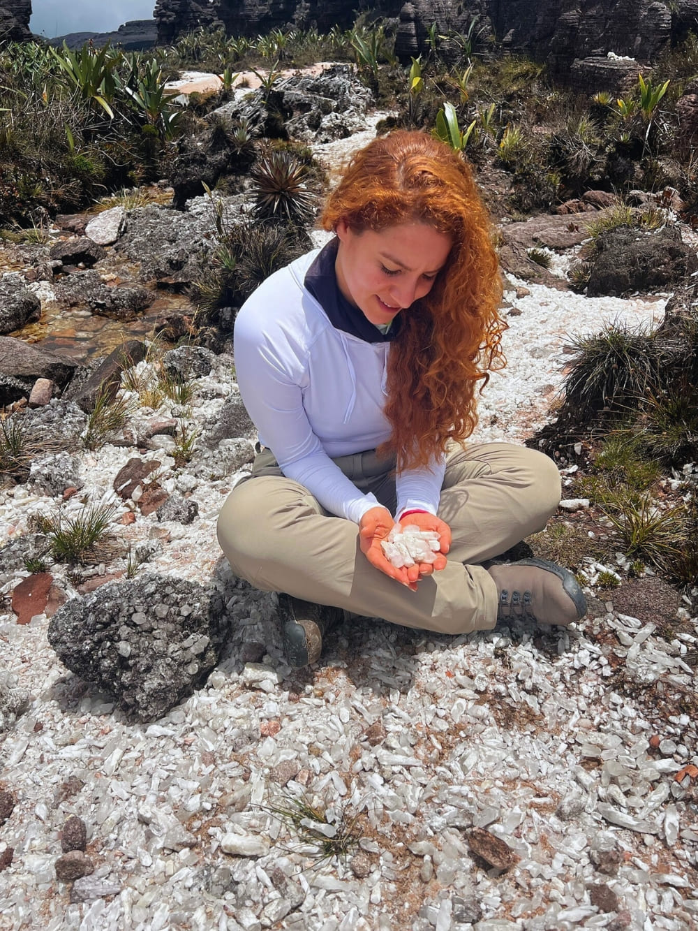
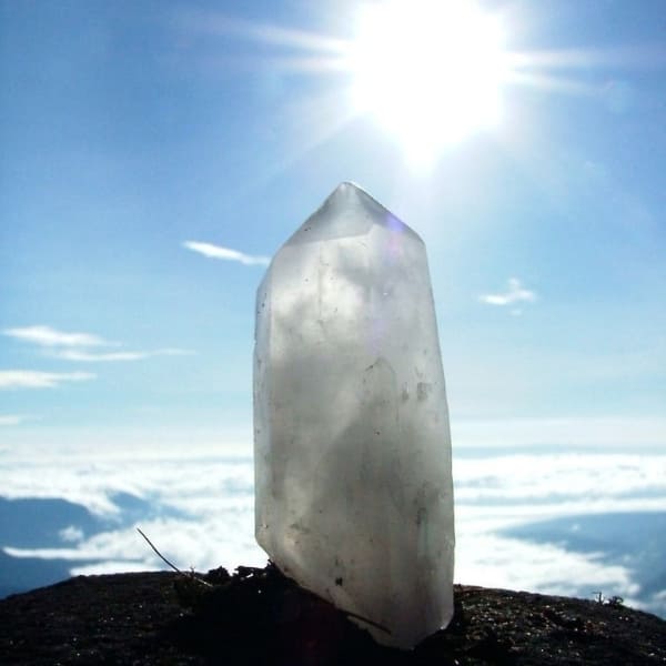
    Crystal Valley is a shallow depression on the Roraima plateau covered in millions of quartz crystals scattered across the dark sandstone like broken glass. The crystals were formed roughly 1.8 billion years ago, when the tepui was still part of an ancient seabed, making them among the oldest exposed minerals on Earth.

    Removing crystals is strictly forbidden by Venezuelan park authorities, and local Pemón guides treat the valley as sacred ground. The Pemón believe the crystals are fragments of stars that fell when Makunaima, the creator god, cut down the original tree of life.


    Lake Gladys

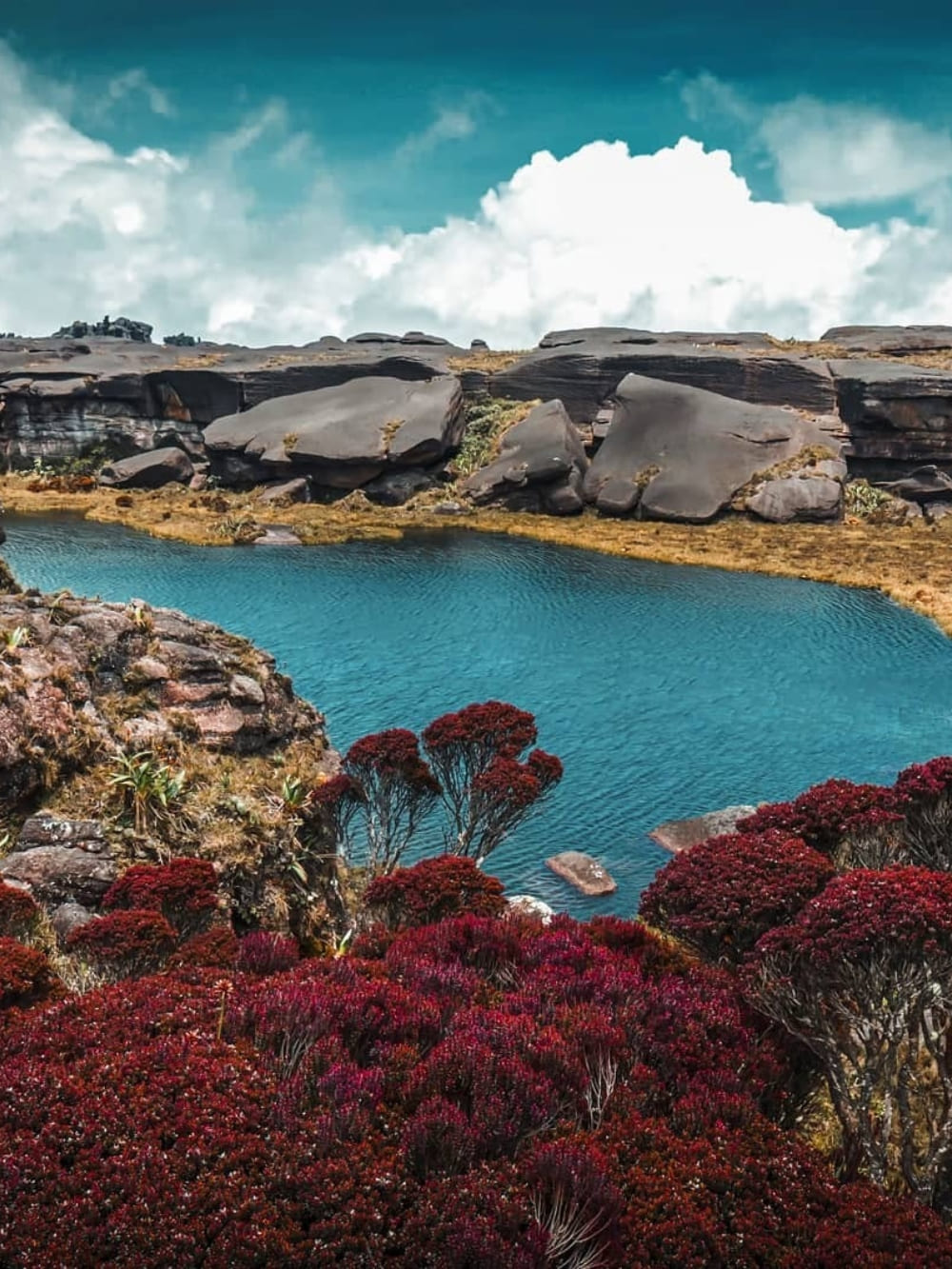
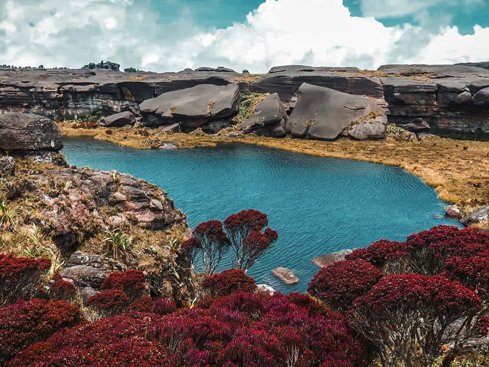
    Gladys is a small, dark pool on top of the plateau, named by British botanist Everard Im Thurn after the heroine of Arthur Conan Doyle’s The Lost World. The water sits in a natural sandstone basin and reflects the surrounding rock formations like a black mirror.

    The lake is one of the few permanent water sources on the summit, fed by the constant mist and over 4,000 mm of annual rainfall that hits the area. Endemic species like the tiny black Oreophrynella frog, found nowhere else on the planet, live in the moss around its edges.

    A dark natural pool on the summit plateau of Mount Roraima
    Photo: Luiz Gustavo Rebello

    👉 Read more: 10 Facts About Mount Roraima

    El Foso

    A circular natural well carved into the sandstone, roughly 20 meters deep, filled with rainwater so dark it looks like ink. El Foso’s walls drop almost vertically, polished smooth by millennia of erosion, and the surface stays still even on windy days because the pit sits below the level of the plateau wind.

    For the Pemón, El Foso is one of the “eyes of the mountain”—points where the spirits of Mount Roraima watch the world below. Trekkers who reach it usually swim a few strokes in water that hovers around 8–12°C year-round, even when the air above is warmer.

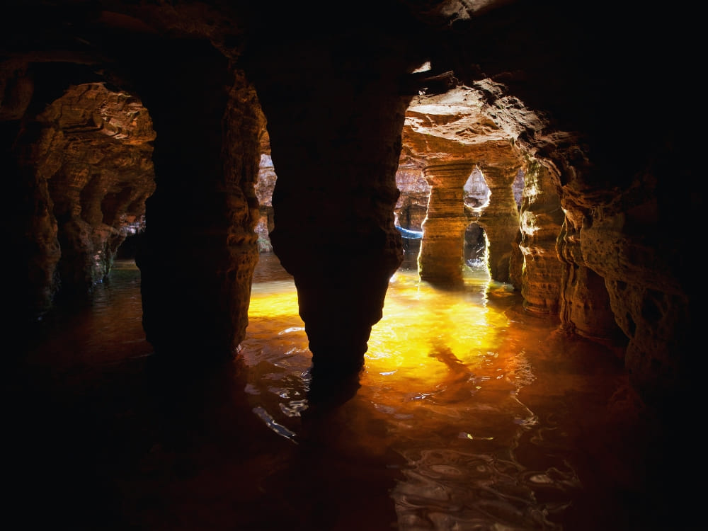
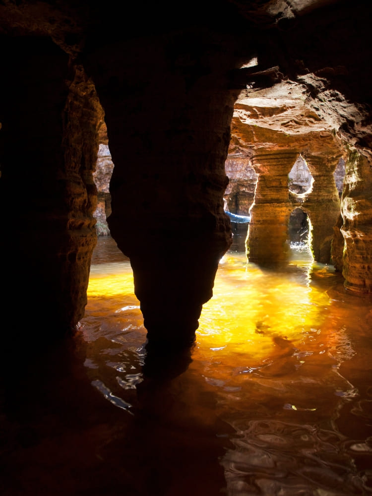
    A swimmer in the golden natural pool inside a cave at Mount Roraima

    Maverick Rock

    The most photographed rock formation on the summit, Maverick is a massive isolated boulder shaped by wind and rain into a form that resembles a face in profile. It stands near the edge of the plateau, with a sheer 400-meter drop behind it.

    The rock is part of the Mato-Tepui sandstone formation, the same geological layer that makes up the entire Pacaraima chain. The Pemón legend tells that the silhouettes carved by wind on the plateau are the frozen faces of warriors who challenged Makunaima and were turned to stone.

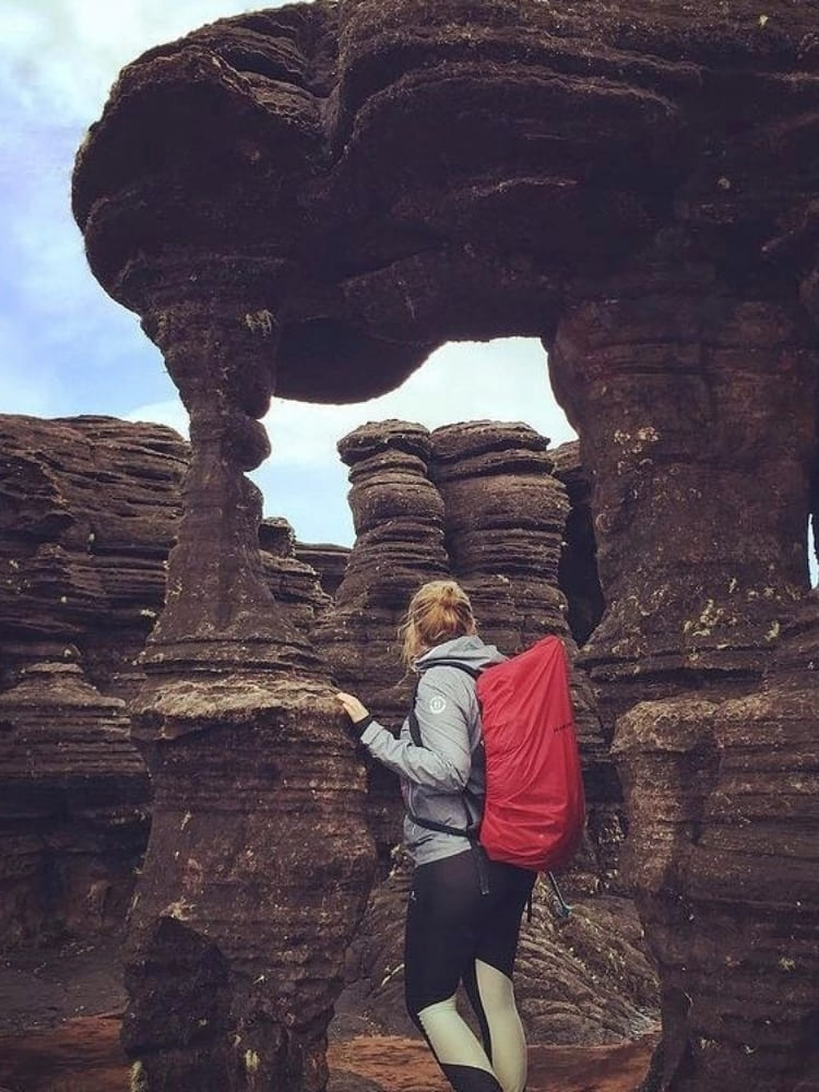
    Weathered rock formations across the summit landscape of Mount Roraima

    La Ventana

    La Ventana is a natural opening in the rock at the very edge of the plateau, framing a view of the savanna 1,000 meters below. On clear mornings you can see Kukenán-tepui to the west and, on rare days, all the way to the borders of Guyana.

    The window faces east, which makes it the most popular spot for sunrise on the trek. Mist rises from the savanna at dawn and pours through the opening, a phenomenon the Pemón call “the breath of the mountain.”

    A viewpoint on Mount Roraima looking out above the clouds
    @katharina_bongaertz

    👉 Read more: What’s on top of Mount Roraima?

    Jaccuzis

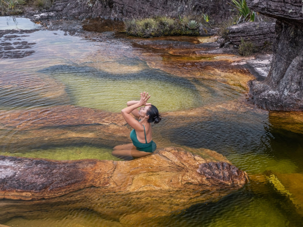
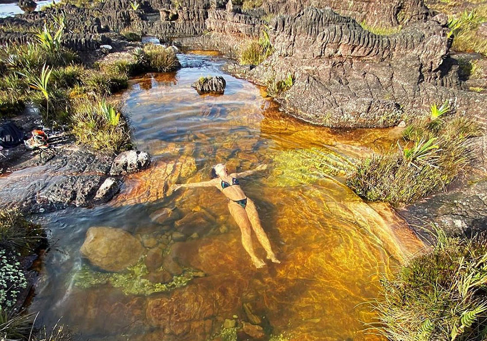
    The jacuzzis are a series of natural pools carved into the quartzite by streams running across the plateau—round, shallow basins of clear, freezing water surrounded by black rock. The largest are about 2 meters in diameter and 1 meter deep, fed by springs that emerge directly from the sandstone.

    Water temperature stays between 6 and 10°C all year, and the mineral content gives it a slight pink tone from the iron in the surrounding rock. Most groups stop here for a quick dip on the way to Triple Point (the spot where Venezuela, Brazil, and Guyana meet).

    A trekker swimming in a natural jacuzzi pool on Mount Roraima
    Photo: Lucas Gobatti

    Coati Camp

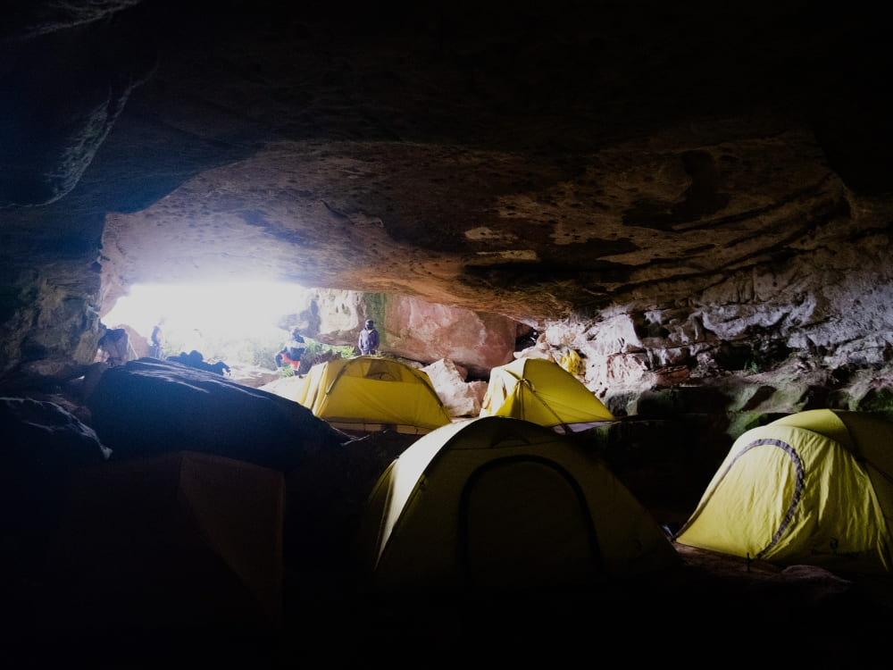
    Coati is a natural rock shelter (essentially a wide, shallow cave formed by overhanging sandstone) where trekkers sleep on the second or third night of the route, already on top of the plateau. A small stream of drinkable water runs nearby—a very welcome feature for campers.

    The roof of rock blocks most of the constant mist and rain that hits the summit, making it one of the few dry spots on Roraima and the reason every expedition uses it as a base.

    Tents set up in a rock shelter base camp on Mount Roraima
    Photo: Lucas Gobatti

    Can You Visit Mount Roraima?

    Yes, you absolutely can visit Mount Roraima, but it’s important to be aware that the location is remote, camping is the main form of accommodation, and some foreign travelers might need visas to enter Brazil and/or Venezuela.

    Canadian and United States citizens, for example, need a visa for both countries, while Chinese visas are only required in Venezuela. Upon arriving in Santa Elena de Uairén, Brazilians only need an ID.

    Find out if you need a visa on Sherpa and check the conditions of Brazil’s Ministry of Foreign Affairs and the official channels of the Venezuelan embassy in your country.

    A hiking trail across the Gran Sabana toward Kukenán tepui near Mount Roraima

    👉 Read more: Do I need a Visa to visit Mount Roraima in Venezuela?

    Is it Safe to Visit Mount Roraima?

    Yes, visiting Mount Roraima is considered safe, especially when starting the journey through Brazil. Boa Vista is a reliable gateway with daily flights from major cities, and the crossing into Venezuela via Santa Elena de Uairén is a well-established route frequently used by tourists.

    With organized tours, border procedures are straightforward, and the town itself has adapted to receive trekkers, offering accommodations, restaurants, and support for expeditions. Traveling with local operators ensures logistics run smoothly and gives you peace of mind from the moment you land in Brazil.

    The trek itself is also safe when done with experienced local guides who know the terrain. Hiking to the top of Mount Roraima requires physical preparation, but the trails are well-marked, and campsites are organized.

    With proper guidance and realistic expectations, visitors can enjoy this adventure securely and focus on the incredible landscapes along the way.

    What to Pack for a Mount Roraima Hike?

    Packing smart is key to a successful Mount Roraima expedition since you’ll be trekking for several days. Equip yourself with durable hiking boots, breathable yet protective clothing, and weather-resistant gear to tackle the mountain’s diverse climates.

    Essentials include a robust backpack, a comfortable sleeping bag rated for 0°C (32°F), reliable trekking poles, and an efficient headlamp. Prioritize hydration with reusable water bottles, and ensure safety with a portable water purifier.

    Round off your gear with energy-boosting snacks, protective sunscreen, sunglasses, and a hat to shield you from the elements.

    A hiker at a viewpoint over the tepui cliffs of Mount Roraima

    👉 Read more: 10 Travel Tips for Mount Roraima to Make the Most of Your Trip

    How Hard is it to Trek Up Mount Roraima?

    Trekking Mount Roraima is a challenging hike that demands endurance and preparation. Some sections, like steep ascents and slippery rocky passages, require extra caution and physical strength.

    The trek covers up to 100 km in several days, with long walks, river crossings, and rugged trails. Nights at high altitude bring cold temperatures and less-than-ideal camping conditions.

    Still, with good fitness, proper gear, and the support of experienced local guides, the adventure is absolutely achievable and deeply rewarding!

    A trekker climbing the rocky steps on the ascent of Mount Roraima
    Photo: Lucas Gobatti

    How Many Days Should You Stay in Mount Roraima?

    The hike to Mount Roraima lasts at least 6 days. The first thing to have in mind is that the climb to the summit involves 3 days of trekking through dense jungle and challenging trails, followed by 2 days of descending.

    Mount Roraima Tours

    PlanetaEXO offers amazing Mount Roraima trekking tours that include accommodation in Venezuela, shared camping gear, meals, and incredible guided tours through some of the tepuis’ most iconic sites.

    TOUR HIGHLIGHTS DURATION STARTING PRICE*
    Mount Roraima Trek 7 days of hiking; visits to the main attractions of Mount Roraima (Lake Gladys, Crystal Valley, Maverick, La Ventana, Jacuzzis, etc.); Coati Camp; immersion in local culture. 8 days US$ 1,390
    Mount Roraima Hike 8 days of hiking; visits to the main attractions of Mount Roraima (Lake Gladys, Crystal Valley, Maverick, La Ventana, Jacuzzis, etc.); Coati Camp; immersion in indigenous culture. 10 days US$ 1,570

    *Per person, based on double occupancy in group departures. Prices may vary depending on the season and availability. Exchange rate as of May 25, 2026; subject to change.

    A hiker pointing toward the Kukenán tepui view from Mount Roraima
    Photo: Lucas Gobatti

    👉 Read more: Is Mount Roraima Dangerous? Everything You Should Know For a Safe Trip to Venezuela

    Traveling to Mount Roraima with PlanetaEXO

    Discover the wonders of one of Earth’s most fascinating destinations with PlanetaEXO, an ecotourism platform specializing in Mount Roraima tours.

    From bookings to tailor-made itineraries, our team works with the best local operators to ensure safe, responsible, and unforgettable vacations. Contact us now!

  • Do I need a Visa to visit Mount Roraima in Venezuela?

    Do I need a Visa to visit Mount Roraima in Venezuela?

    Visa to visit Mount Roraima: essential Brazil and Venezuela entry requirements

    Mount Roraima, one of the world’s oldest geological formations, rises on the border of Brazil, Venezuela, and Guyana. Known for its vertical cliffs, mysterious ecosystems, and breathtaking scenery, it attracts adventurers worldwide. But before packing, a key question arises: Do I need a visa to visit Mount Roraima?

    Since 85% of the mountain lies in Venezuela, travelers always cross its border, even if starting in Brazil. That means both the Brazilian and Venezuelan visa rules may apply, depending on your nationality. Understanding this is crucial to avoiding unpleasant surprises at immigration.

    At PlanetaEXO, an ecotourism platform specializing in Mount Roraima tours, we know how essential visa planning is. Before we successfully helped adventures from all over the world to reach their trekking destination, many nearly gave up on their trip due to lack of information regarding immigration rules.

    But with the right preparation, the journey becomes seamless. Let’s dive into who needs a visa and how to check official sources for your case!

    Do I need a visa to visit Mount Roraima?
    Photo: Denis Minnetdinov

    Venezuela: countries that require a visa

    Most travelers from Europe and Latin America can enter Venezuela without a visa, but there are important exceptions. It is also essential to note that, for countries exempt from visas, the agreement applies for a period of 90 days as a tourist only, never covering activities such as work or stays longer than the specified period.

    If your country is not on the official exemption list, you must apply for a Tourist Visa (T) at a Venezuelan consulate before arrival.

    Examples of countries that require a Venezuela visa:

    • North America: United States, Canada.
    • Latin America: Honduras, El Salvador, Guatemala, Panamá, República Dominicana, Cuba, Haití, Guyana, Suriname, Chile, Peru.
    • Europe (non-EU and non-Schengen associates): Ukraine, Moldova, Kosovo, Albania, North Macedonia, Bosnia-Herzegovina, Montenegro, Serbia.
    • Asia: China, India, Pakistan, Bangladesh, Afghanistan, Vietnam, Philippines, Nepal, Syria, Lebanon, Saudi Arabia, Maldives, Sri Lanka.

    Remember that official information can be checked with the Ministry of Foreign Affairs of Venezuela (MPPRE) or your nearest consulate. In addition, there are trustworthy sites for consultation, like Sherpa.

    Top of Mount Roraima
    .

    Venezuela: Countries that do not require a visa

    According to the Consulate of Venezuela in France, citizens from the European Union and much of Latin America are exempt from visas for up to 90 days when entering Venezuela for tourism.

    Examples of visa-exempt countries for Venezuela:

    • Europe: Germany, Austria, Switzerland, France, Belgium, Luxembourg, the United Kingdom, Ireland, the Netherlands (including Aruba, Curaçao, Bonaire, Saba, Sint Maarten), Spain, Portugal, Italy, Greece, Poland, and other EU members.
    • Latin America: Argentina, Brazil, Mexico, Colombia, Uruguay, Paraguay, Ecuador, Bolivia, Costa Rica, Nicaragua.
    • Asia: Japan, South Korea, Malaysia.
    • Africa: South Africa is visa-exempt for up to 90 days.

    This means a traveler from France, the Netherlands, Germany, the United Kingdom, or Mexico can enter Venezuela for up to 90 days without a visa. The passport must be valid for at least 6 months beyond the date of entry.

    To double-check your case, see the official Venezuelan Consular Services in France or use consultation sites like Sherpa.

    Brazil: Countries that require a visa

    Most travelers from Europe and Latin America can also enter Brazil without a visa, but some nationalities must apply in advance.

    Countries that need a Brazil visa:

    • North America: United States, Canada.
    • Oceania: Australia.
    • Asia: India, China, Afghanistan, Pakistan, Bangladesh, Nepal, Sri Lanka, Vietnam, Philippines, Iran, Iraq, Syria, Lebanon.
    • Europe (outside EU/Schengen): Kosovo.
    • Africa: Most African countries require a visa, including Nigeria, Ethiopia, Kenya, Egypt, Morocco, Senegal, Ghana, Tanzania, and others.

    👉 Learn more: VISAS – Brazilian Ministry of Foreign Affairs

    Do I need a visa to visit Mount Roraima?
    @alecio_cezar

    Brazil: Countries that do not require a visa

    Citizens of the European Union, the United Kingdom, Japan, and Latin America can usually enter Brazil without a visa for short-term tourism (up to 90 days).

    Examples of visa-exempt countries for Brazil:

    • European Union: Germany, France, Italy, Spain, the Netherlands, Austria, Belgium, Greece, Portugal, Poland, Denmark, etc.
    • Schengen-associated states: Switzerland, Norway, Iceland, Liechtenstein.
    • English-speaking Europe: United Kingdom, Ireland.
    • Latin America: Argentina, Chile, Uruguay, Colombia, Peru, Paraguay, Bolivia, Mexico, Ecuador, Costa Rica, Panama.
    • Asia-Pacific: Japan, South Korea, New Zealand, Israel.
    • Africa: Botswana, Namibia, South Africa, and Mauritius are visa-exempt for short-term visits.

    👉 Read more: How to get to Mount Roraima

    Do I need a visa to visit Mount Roraima?
    Photo: Paolo Costa Baldi

    Important reminder: You always cross into Venezuela

    Even if you start in Brazil, the trek leads you to Santa Elena de Uairén and then to the Paraitepuy Indigenous Community, the official trailhead in Venezuela. That means you’ll cross the border and must comply with Venezuelan immigration rules.

    Therefore, although a lot of travelers often enter Brazil visa-free, they still need to check if Venezuela requires a visa for their passport. Missing this step could stop your journey before it even begins.

    👉 Read more: How hard it is to trek up Mount Roraima
    Can U.S. Citizens Travel to Venezuela? Safety, Visa, and rules

    In June 2026, the Ministry of Foreign Affairs of Venezuela (MPPRE) announced a digital application option, which allows U.S. citizens to apply online for a tourist visa (e-visa) to enter Venezuela. Under this procedure, applicants must pay a $180 fee per application directly through the Cancillería Digital portal. See more information in the U.S. Embassy in Caracas’ official channel.

    However, U.S. citizens may encounter the following issues regarding payment:

    • Payments are best made using Visa or Mastercard credit cards; debit cards and American Express are not recommended.
    • Many U.S. banks, adhering to U.S.-imposed sanctions policies, have implemented fraud filters for online payments processed by Venezuelan entities. Completing the online payment may require the customer to contact their bank to temporarily lift fraud restrictions related to Venezuela.
    • Another option is to charge for the service and process the payment using a Visa card not issued by a U.S. bank.

    Importantly, the U.S. Department of State advises against all travel to Venezuela because of political tensions, security concerns, and the lack of consular support. Travelers are urged to carefully review the official U.S. travel advisory for Venezuela before making any plans.

    Sunset Mount Roraima
    @diaz

    👉 Read more: Is Mount Roraima Dangerous? Everything You Should Know For a Safe Trip to Venezuela

    Traveling with PlanetaEXO

    PlanetaEXO is an ecotourism platform specializing in Mount Roraima tours. When you book your trip with us, you don’t just get a trekking package: you gain a partner that supports you at every step. More importantly, our expeditions are designed with sustainability in mind.

    In this way, your trip supports local communities, protects the environment, and brings you face-to-face with one of the world’s most unique ecosystems. If you’re ready to embark on this extraordinary experience, let’s start planning your journey. Contact us now!

    Please note: The information in this post was updated on June 27, 2026. Before booking your trip to Mount Roraima, check the official channels of the Venezuelan and Brazilian governments, as well as those of your own country.

  • What’s on top of Mount Roraima?

    What’s on top of Mount Roraima?

    Get to know more about the mysteries of the Tepui: wildlife, landscapes, and what is on the plateau at Mount Roraima 

    Mount Roraima has fascinated travelers, scientists, and storytellers for centuries. Rising over 2,800 meters above sea level, this tepui, a flat-topped mountain unique to the Guiana Shield, looks like something out of a fantasy novel. But the real question many adventurers ask is: What’s on top of Mount Roraima?

    At the top of Mount Roraima, you’ll find a surreal plateau unlike anywhere else on Earth: crystal valleys, natural pools, strange rock formations, and unique plants and animals that thrive only in this isolated environment. Far from being an empty summit, the plateau is alive with biodiversity and geological wonders.

    What's on top of Mount Roraima
    @diaz

    PlanetaEXO, together with trusted local partners, leads sustainable expeditions to this remote landscape. Beyond trekking to the Mount Roraima high point, the journey is about responsible travel: supporting Indigenous communities and protecting the fragile environment of the plateau.

    Without further ado, discover what’s on top of Mount Roraima and other questions about the tepui of this fascinating place:

    What to do on top of Mount Roraima?

    The summit is not just a barren rock: it’s a world full of surprises and experiences. From unique vegetation to surreal geological formations, every corner reveals something extraordinary. If you’re wondering what to do on top of Mount Roraima, here are the main activities and highlights that make the plateau so unforgettable:

    Explore the unique vegetation and endemic species

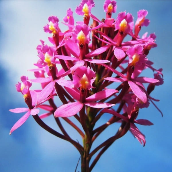
    Life at the summit has adapted to survive in extreme conditions. Carnivorous plants like Heliamphora nutans capture insects to compensate for nutrient-poor soil, while delicate orchids bloom between the rocks. 

    Look closer and you might spot endemics such as the tepui frog (Anomaloglossus roraima), the Roraima black frog (Oreophrynella quelchii), and the tree frog Stefania roraimae. These species exist nowhere else on Earth, making the plateau a natural treasure.

    👉 Check out 10 Tips for Mount Roraima before your trek

    Mount Roraima Frog
    @cafred33

    Climb maverick rock: the highest point 

    The most famous rock formation on the summit is Maverick Rock, which reaches 2,810 meters above sea level. Standing at this Mount Roraima high point gives trekkers sweeping views across Venezuela, Brazil, and Guyana. On clear days, it feels like the world stretches endlessly beneath your feet, while clouds swirl below the cliffs.

    What's on top of Mount Roraima
    @potter_2024

    Walk through the Valley of Crystals

    Perhaps the most surreal landscape on the plateau is the Valley of Crystals, where the ground sparkles with countless fragments of quartz. These glittering stones catch the sunlight, creating a dreamlike effect. Walking here feels like stepping into a natural cathedral made of glass.

    Valley of Crystals
    @brunaalanas

    Camp in the natural “hotels”

    Instead of traditional accommodations, trekkers stay in natural caves and rock formations known as “hotels.” These shelters protect hikers from wind and rain while preserving the rustic atmosphere of the tepui. Spending a night here is a one-of-a-kind experience, like living inside the mountain itself.

    Camping Mount Roraima
    Photo: Lucas Gobatti

    Swim in the natural pools and jacuzzis

    Water is everywhere on the plateau, creating enchanting natural pools and jacuzzis. After hours of hiking, a refreshing dip in these crystal-clear basins is pure bliss. Fed by constant rainfall, they reflect the sky and surrounding rocks, adding to the otherworldly beauty of the plateau.

    What's on top of Mount Roraima
    Photo: Lucas Gobatti

    Visit Lake Gladys

    Another remarkable stop is Lake Gladys, a mysterious lagoon nestled in a depression of the plateau. Surrounded by dark rocks and often shrouded in mist, it has an almost mystical atmosphere. Many travelers describe it as one of the most peaceful places at the top of Mount Roraima, where silence and still waters amplify the feeling of being in another world.

    What's on top of Mount Roraima
    @yaikeldorta

    Admire the view from La Ventana

    The viewpoint known as La Ventana opens up dramatic vistas of the Gran Sabana and neighboring Mount Kukenan. Between towering cliffs, you’ll see vast forests and waterfalls stretching into the horizon. It’s one of the most breathtaking panoramas at the top of Mount Roraima.

    What's on top of Mount Roraima
    @na7hann

    Visit El Foso: The pit

    Another unmissable feature is El Foso, a deep chasm with a natural pool at its base. Its dark waters and towering stone walls make it feel like a secret chamber carved by time. Many trekkers consider swimming here one of the most magical experiences of the journey.

    Stand at the Triple Point

    At one corner of the plateau lies the Triple Point, the exact spot where Brazil, Venezuela, and Guyana converge. Standing here, you are literally in three countries at once, a rare and fascinating highlight of the trek.

    👉 Join us on our 10-day hike and enjoy all these activities during your stay at the top of Mount Roraima

    Triple Point
    .

    Does anything live on the top of Mount Roraima?

    No, there are no permanent human settlements at the top of Mount Roraima. The plateau is too isolated and inhospitable for people to live there, with thin soil, frequent rain, and freezing nights. Trekkers only stay temporarily in campsites or natural rock shelters during expeditions.

    However, communities live and thrive around the mountain’s base. The Pemón (including groups like the Arekunas, Taurepanes, and Kamarakotos), as well as the Ingarikó, Patamona, Akawaio, and Wapishana, are deeply connected to the land. These Indigenous peoples guide expeditions, share cultural heritage, and help ensure that tourism respects both tradition and environment.

    👉 Want to learn even more fascinating details? Check out our article on 10 facts about Mount Roraima!

    Reach the top of Mount Roraima
    @overlandtheamericas

    Can you go to the top of Mount Roraima?

    Yes, you can! Reaching the top of Mount Roraima requires determination, but it’s not reserved for professional climbers. The ascent is a multi-day trek starting from Paraitepuy, an Indigenous community in Venezuela, with routes organized by experienced local guides.

    The trek usually takes 8 to 10 days, covering around 90 to 100 kilometers. You’ll pass rivers, rocky slopes, and steep sections like La Rampa, a natural corridor that leads hikers to the tepui of Mount Roraima. The journey is demanding but achievable for those with decent fitness and preparation.

    At the summit, the effort pays off with landscapes that seem straight out of another planet. Walking across the plateau, you’ll feel as if you’ve stepped into the pages of Arthur Conan Doyle’s The Lost World, which was inspired by this very mountain.

    👉 Thinking about the challenge? Read our full article on How hard it is to trek Mount Roraima

    How hard is it to trek up Mount Roraima
    Photo: Lucas Gobatti

    Has anyone been to the top of Mount Roraima?

    Not only has it been climbed, but thousands of travelers make the journey every year. The first documented ascent was in 1884 by the British explorer Sir Everard Thurn. However, long before Europeans arrived, Indigenous peoples such as the Pemón already knew the mountain intimately, weaving it into their myths and traditions.

    Today, Mount Roraima is a well-known trekking destination. Around 2,000 to 3,000 visitors make the journey each year, coming from all over the world to experience its alien landscapes, sleep under the stars, and discover the unique biodiversity of the tepui. Before planning your trek, don’t forget to check the visa requirements.

    👉 Curious about logistics and costs? Here’s our breakdown of How much it costs to climb Mount Roraima

    Sunset Mount Roraima
    Photo: Talez Aziz

    Can you fly to the top of Mount Roraima?

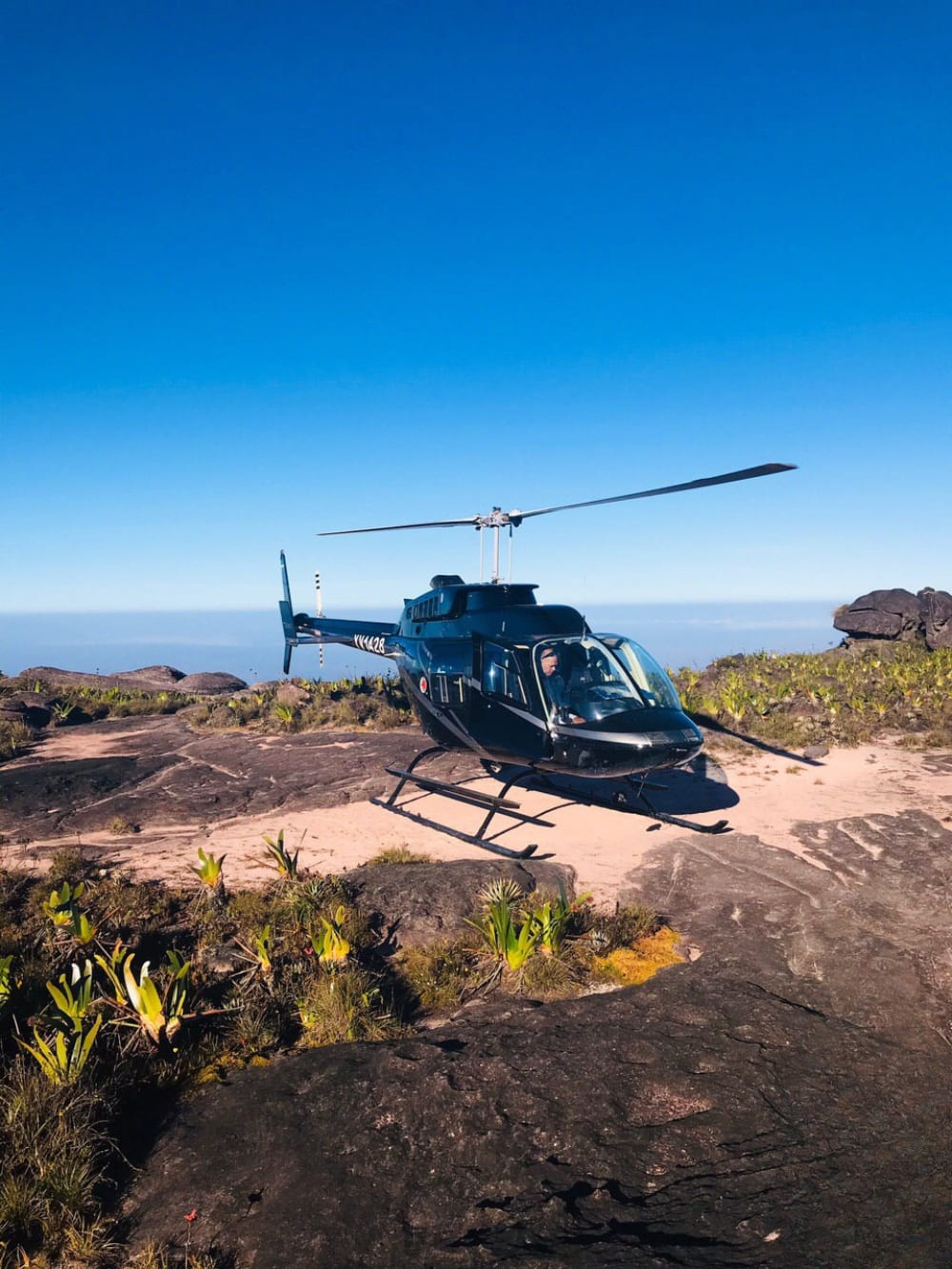
    This is a common question, and the answer is yes: helicopter landings are possible in certain areas of the summit. Some tours depart from Boa Vista, following the same route across the border to Paraitepuy before taking off toward the mountain. 

    Once on the plateau, visitors can explore highlights at the top of Mount Roraima. Flights depend on weather conditions and are operated under strict conservation rules to minimize environmental impact.

    For those who prefer not to land, aerial experiences are also available. Scenic flights provide breathtaking views of Canaima National Park, Angel Falls, Mount Kukenan, and the dramatic cliffs of Mount Roraima before circling above the plateau.

    👉 Prefer a more intense adventure? Explore our 8-day Mount Roraima trek for a rewarding experience

    Helicopter landing at Mount Roraima
    .

    Is Mount Roraima tepui above the clouds?

    Yes, it is. At 2,810 meters above sea level, the top of Mount Roraima frequently pierces the clouds. One moment, the summit may be hidden in thick fog, and the next, the sky clears to reveal panoramic views across Brazil, Guyana, and Venezuela.

    This high-altitude environment means dramatic weather shifts. Days can be surprisingly hot, with strong sun exposure that makes the thin air feel intense and requires constant hydration and sun protection. 

    Yet the atmosphere can change in minutes: clear skies give way to sudden rain showers and powerful winds sweeping across the plateau. Nights can be freezing, with temperatures dropping close to 0°C (32°F), even though you’re in the tropics.

    Even with all these challenges and unpredictable weather, seeing the world from above the clouds makes you feel both incredibly small and deeply connected to nature.

    Top of Mount Roraima
    Photo: Lucas Gobatti

    👉 Planning your trip? Don’t miss our blog post on How to get to Mount Roraima

    Traveling with PlanetaEXO

    Traveling with PlanetaEXO means more than reaching the summit: it’s about making your adventure count. By choosing our expeditions, you directly support Indigenous communities, help preserve the fragile ecosystem of the tepui, and ensure tourism leaves a positive footprint.

    We keep groups small and partner with trusted local guides, so your experience is authentic, safe, and respectful to the environment. That way, exploring the plateau and discovering what’s on top of Mount Roraima becomes both a personal achievement and a contribution to conservation.

    👉 Want to experience this adventure? Contact us here and let’s start planning your Mount Roraima trek!

  • How to Get to Mount Roraima?

    How to Get to Mount Roraima?

    Learn about logistics, the best routes, main access points, and what you need to plan before starting your Mount Roraima trekking adventure

    One of the most incredible tepuis in South America, Mount Roraima is located on the triple border of Venezuela, Brazil, and Guyana. At 2,810 meters (9,219 feet) above sea level, it’s one of the highest places on Earth.

    Its untouched natural beauty, thrilling hiking trails, and cultural and spiritual aspects attract countless adventurers every year, so knowing how to get to Mount Roraima is a crucial part of any travel planning.

    To help with the arrangements of your next trip, PlanetaEXO, an ecotourism platform specializing in Mount Roraima tours, has put together a detailed guide with all the information you need. Check it out below!

    How to get to Mount Roraima
    Photo: Lucas Gobatti

    How to Get to Mount Roraima?

    You can start your adventure to Mount Roraima from a few different locations, but the most popular and convenient gateway is Boa Vista, capital of the state of Roraima, in northern Brazil.

    Boa Vista’s close location to the Venezuelan border, specifically to the city of Santa Elena de Uiarén (Grand Sabana, Bolívar), makes it a natural hub for expeditions heading to the plateau.

    Boa Vista Roraima
    Photo: Andrezza Mariot

    From Boa Vista to Santa Elena de Uairén

    Boa Vista Airport (BVB) is categorized as internation, but in practice, it mainly receives domestic flights from Brazilian cities such as Brasília, Manaus, and São Paulo. Therefore, foreign travelers need to land in one of these locations before flying to Roraima.

    From Boa Vista, the most common route is to travel by car or transfer along the BR-174 highway. From there, it takes around 3 hours on the road to reach the border with Venezuela, followed by an extra 20 minutes to arrive in Santa Elena de Uairén.

    With a few ways to make the trip, this cross-border journey is a well-trodden path, particularly for Brazilian travelers joining organized expeditions.

    Private Transfer

    The most comfortable option, usually arranged by tour operators. A driver picks you up at your hotel or airport in Boa Vista and takes you directly to Santa Elena de Uiarén. This ensures flexibility with departure times and stops along the way.

    Operated by trustworthy local partners, shuttle services are included in all of PlanetaEXO’s tours.

    Shared Van

    More affordable, travelers join a small group for the ride. Vans depart regularly from Boa Vista and are commonly used by those joining expeditions. They may take slightly longer depending on stops and border procedures.

    Public Bus

    The cheapest but least convenient option. Buses connect Boa Vista to Santa Elena de Uiarén, but schedules are irregular, and the journey can be slower due to frequent stops. Not recommended for travelers with limited time or those who prefer more reliable logistics.

    How to get to Mount Roraima
    Photo: Lucas Gobatti

    The Beginning of the Journey

    Santa Elena de Uairén is a pivotal starting point for travelers, providing modest accommodations, restaurants, and last-minute supplies before the trek.

    From there, the adventure continues with a scenic drive to Paraitepuy, an indigenous community that serves as the gateway to the trails that lead to Mount Roraima. The drive itself offers stunning views of the Gran Sabana landscapes, passing the Tek and Kukenan rivers.

    Always counting on the expertise of local indigenous guides, trekkers usually stop at rustic campsites along the way. This is where the real journey to the top of Mount Roraima begins.

    Trek Mount Roraima
    Photo: Lucas Gobatti

    What’s the Best Access to Get to Mount Roraima: Brazil or Venezuela?

    When you plan a trip to Mount Roraima, one of the most common questions is whether to access it through Brazil or Venezuela. Both are possible, but they offer very different logistics.

    Entering via Brazil

    For most travelers, Brazil is the easiest and safest option. Boa Vista, in Roraima, is connected to major Brazilian cities with daily flights, making it relatively straightforward to plan an itinerary.

    The infrastructure on the Brazilian side is generally reliable, with services and support in Portuguese or English. Another advantage is that some nationalities (including Europeans and many Latin Americans) do not need a visa for short stays, making this a simpler route in terms of bureaucracy.

    After crossing into Venezuela, you’ll reach Santa Elena de Uairén, where most expeditions organize logistics before heading to Paraitepuy and, finally, to Mount Roraima.

    Traveling this way allows you to rely on Brazilian airports and services for your arrival and departure while only entering Venezuela for the actual trek.

    Top of Mount Roraima
    Photo: Lucas Gobatti

    Entering via Venezuela

    Santa Elena de Uairén does have a regional airport (SNV), but it handles little more than charter and air-taxi traffic. Scheduled service has always been thin and intermittent, a twice-weekly Conviasa link from Caracas via Puerto Ordaz and Canaima came and went, so you cannot plan a trip around it.

    Driving in from within Venezuela is a long haul: Caracas to Santa Elena covers about 1,250 km through Ciudad Guayana, which realistically means two days on the road.

    That is why, unless you are already in Venezuela, Boa Vista in Brazil remains the reliable way in to start your Mount Roraima trek.

    Sunset Mount Roraima
    @diaz

    👉 Read more: 10 Facts About Mount Roraima

    Visas and Travel Requirements

    Whether you choose to enter through Brazil or Venezuela, it is crucial to check visa requirements in advance.

    For those holding passports from the US, Canada, or Australia, Brazil mandates an e-Visa. This process is conducted entirely online without requiring a consulate visit, and airlines will verify your approved code prior to check-in. Citizens of Mercosur countries, Europe, Japan, and South Korea enter visa-free.

    Venezuela is where travelers tend to get caught out, because the rule depends on how they arrive. European travelers are exempt from the tourist visa only when they fly in. Crossing at the land border, which is exactly what the Boa Vista route involves, calls for a tourist visa arranged in advance. US citizens need one either way.

    However you enter, expect to show a passport valid for at least six months, onward travel, and proof of where you’re staying.

    Keep in mind: policies can change. During your travel planning, check if you need a visa on Brazil’s Ministry of Foreign Affairs website and/or the nearest Brazilian and Venezuelan embassies. You can also do a quick search on Sherpa, but remember to always verify the current conditions on the official channels of each country.

    How to get to Mount Roraima
    .

    👉 Read more: Do I need a Visa to visit Mount Roraima in Venezuela?

    Trekking in Mount Roraima with PlanetaEXO

    When you plan your trip to Mount Roraima, or any other destinations for hiking in Brazil, you need professionals who are familiar with the location and who can make the trek as smooth and fulfilling as possible.

    PlanetaEXO, an ecotourism platform specializing in Mount Roraima tours, works with expert local partners who are deeply connected with the indigenous community of the region, not only ensuring safety and the best logistics but also a culturally rich experience. Contact us now!

  • How hard is it to trek up Mount Roraima?

    How hard is it to trek up Mount Roraima?

    Hiking Mount Roraima involves diverse terrain and unpredictable weather, but with the right preparation, you can reach the top. Discover the challenges of climbing this iconic peak and how to make it achievable for all!

    You might be asking yourself: How hard is it to trek up Mount Roraima? While it’s a moderate challenge that requires physical preparation, it’s definitely achievable for anyone with the right mindset and training. It’s not just for professional climbers: many hikers, regardless of experience, can reach the top of Mount Roraima with proper planning and the right support.

    The trek is suitable for all ages, with children under 14 needing to be accompanied by an adult, making it a challenge for everyone, from young adventurers to seasoned trekkers!

    The path includes navigating rocky routes and steep climbs, which makes it physically demanding, especially in certain sections. But with the right equipment and preparation, it’s a journey that offers incredible rewards, both in terms of natural beauty and personal fulfilment.

    How hard is it to trek up Mount Roraima

    At PlanetaEXO, a specialized South American adventure company, we partner with trusted local partners to help you reach the top of Mount Roraima. Our team ensures you’re fully prepared for the challenges of climbing this iconic peak, from managing the terrain to navigating the unpredictable weather

    Learn more about all the important things you need to know before trekking up Mount Roraima:

    Understanding the Difficulty of Climbing Mount Roraima

    While the idea of “climbing” Mount Roraima may sound daunting, it’s important to understand that it’s not a vertical climb. The trek is challenging, but it’s more about hiking Mount Roraima through various terrains and river crossings. So, how hard is it to climb Mount Roraima? The answer depends on several factors, including the terrain, your physical fitness, and the level of support you choose.

    👉 Don’t forget to check the visa requirements before planning your trek.

    Is it a Trek or a Climb?

    Mount Roraima is a trekking adventure, not a rock climb. It’s a long hike, but most people in good physical condition can successfully reach the top of Mount Roraima with adequate preparation. The key is to pace yourself and take the time to adjust to the terrain and weather conditions along the way.


    How hard is it to trek up Mount Roraima
    Photo: Lucas Gobatti

    Factors That Influence Your Experience

    Before considering the factors below, note that the trek begins in Canaima National Park, at the Indigenous community of Paraitepuy, where visitors register, receive basic instructions, and meet the local guides and porters who will accompany the journey.

    Several factors can affect the difficulty of your trek. Here are the main considerations that will influence your experience:

    1. Duration of the Trek

    The trek to the summit typically spans 8 to 10 days. The total trekking distance is between 90 and 100 kilometers (56 to 62 miles), including the ascent, time spent at the summit, and the return journey. The number of nights at the top of the mountain also varies according to the duration of each trek.

    With the 10-day PlanetaEXO option, for example, you spend 5 nights on the plateau of Mount Roraima. A longer itinerary allows you to pace yourself and adjust to the physical demands, making the experience less strenuous. However, if you’re seeking a more intense challenge, some choose to complete the 8-day itinerary in 6 days.

    Duration of the Mount Roraima Trek
    Photo: Lucas Gobatti

    This compressed version covers the same distance but in a shorter period, making it a more physically demanding experience. While it allows you to reach the top of Mount Roraima in less time, it requires a higher level of fitness and endurance due to the quicker pace.

    👉 Check out 10 Tips for Mount Roraima before your trek

    2. Logistical Support

    Choosing a company like PlanetaEXO makes the trek easier. Our trusted local partners, carefully selected by us, take care of the logistics on the trail, from carrying camping gear to preparing meals. 

    If you decide to manage these tasks yourself, the trek will become more challenging. With the right partners handling logistics, you can focus on enjoying the hike.

    To stay dry, consider using a rain cover for your backpack and dry bags to protect your essentials from moisture. Extra socks (preferably synthetic or wool) and a quick-dry microfiber towel will also help keep you comfortable during and after long days of hiking

    Important reminder: Even with quality gear, heavy rain and humidity can flood tents and muddy campsites, affecting rest. Keep essentials dry and be ready for less-than-ideal nights.

    Camping Mount Roraima
    Photo: Lucas Gobatti

    👉 Let PlanetaEXO connect you with the best local partners: explore our best Mount Roraima tours and start your adventure.

    3. Porter Service

    Even though travel companies handle the logistics of food and camping gear, you’ll still need to carry your personal items. To lighten your load, you can hire a porter from the local community to help reduce the physical demands of the trek.

    This service also contributes to the local economy by supporting experienced porters who are deeply rooted in the community. By hiring them, you’re financially supporting skilled professionals who understand the region, its environment, and its culture, helping sustain their livelihoods.

    Porter Service Mount Roraima
    Photo: Lucas Gobatti

    4.Your Physical Fitness

    Your fitness level plays a significant role in how hard the trek will feel. The terrain varies from easy to moderate, with steeper sections as you approach the summit. 

    If you’re in good health and have done some basic hiking, you’ll be able to handle the trek, but it’s still important to train beforehand to prepare for the demands of a multi-day trek. 

    How hard is it to trek up Mount Roraima
    Photo: Lucas Gobatti

    Remember that it is a long walk, so you need to be in good physical condition and be prepared for strong sun exposure at high altitude, which can intensify its effects.

    5. Terrain and Steep Ascents

    The terrain can be challenging, with uneven surfaces and slippery sections, especially as you approach the summit. These steep ascents can be physically demanding, but with the right preparation, the reward of reaching the top of Mount Roraima becomes an unforgettable achievement.

    Some key elevation points include:

    • Basecamp: Around 1,500 meters (4,920 feet), where the trek levels out before the final push. Reaching it includes early challenges like the “Prova do Novato”, a steep climb that hints at what’s ahead, and crossing the Tek and Kukenan rivers over slippery rocks with guide assistance.
    • Ascent to the Summit: Steep sections begin around 2,200 meters (7,218 feet), getting progressively more challenging as you approach the 2,810-meter (9,219 feet) summit. This stage includes notable landmarks such as La Rampa, a narrow natural ramp carved into the cliffside where hikers often use all four points of contact due to its steep incline, and the Poço das Lágrimas, a slippery rocky passage often wet from rain and waterfalls, both requiring extra caution and steady footing.
    • Rocky Terrain: From 2,500 meters (8,200 feet) onwards, after La Rampa, the trail turns rugged with large boulders and uneven ground, leading to the 2,810-meter plateau and El Maverick, the summit’s highest point and a popular climb for sweeping views.

    Some sections require careful navigation over rocky terrain, which can be exhausting but manageable for most hikers with prior experience.

    People trekking Mount Roraima

    What to Expect on the Trail: Key Points of the Trek

    At this point, you already know that Mount Roraima is a tepui, a flat-topped mountain on the Guiana Shield that rises to 2,810 meters at the Brazil–Venezuela–Guyana border. Its sheer 1,000-meter cliffs isolate the plateau from the forest and savanna below, creating a distinct and fragile ecosystem. 

    Constant rainfall and nutrient-poor soils have shaped highly specialized flora, including carnivorous plants, and fostered a remarkable level of endemic species.

    This perspective highlights that reaching the summit is not only about overcoming physical challenges but also about experiencing an ever-changing landscape filled with natural wonders. Here’s what awaits you along the way:

    • Day 1-2: Start your trek by crossing rivers and gradually ascending. These days are relatively moderate, giving you time to adapt to the pace of the expedition.
    • Day 3–4: The trail grows steeper as you approach the mountain’s base. Here, rocky paths and sharper ascents make the climb more demanding.
    • Day 5–6: Arriving at the summit, you’ll explore an otherworldly plateau dotted with unique vegetation and enjoy sweeping views across three countries.
    Reach the top of Mount Roraima
    @overlandtheamericas

    👉 Want to know what’s waiting at the summit? Read the full article: What’s on top of Mount Roraima?

    Weather and Best Time to Visit Mount Roraima

    The weather on Mount Roraima is highly unpredictable, so being prepared for a variety of conditions is essential. The mountain follows the tropical climate of Venezuela, which means you may encounter rain, fog, and significant temperature fluctuations throughout the trek.

    At the summit, camping is in natural rock shelters (“hotels”) that offer partial protection from wind and rain but have uneven ground. Expect intense sun during the day and near-freezing temperatures at night. The views and sense of accomplishment make it all worthwhile!

    What to Expect:

    • Rain: Rain is common, especially in the afternoon and evening. The wet season, from May to November, brings heavier and more frequent rainfall, which can make the trail slippery and harder to navigate. Be sure to pack waterproof gear, such as a jacket and rain cover for your backpack, to stay dry.
    • Fog and Wind: The summit is often shrouded in fog, and strong winds are frequent, especially as you reach higher elevations. The fog can limit visibility, and the wind can make hiking and camping more challenging.
    • Temperature: Despite being in a tropical region, the altitude causes significant drops in temperature, especially at night. During the day, temperatures can range from 20°C to 25°C (68°F to 77°F), but at night, they can plummet to as low as 5°C to 10°C (41°F to 50°F). Even in the summer months, you’ll experience chilly conditions at night.
    Weather and Best Time to Visit Mount Roraima
    Photo: Lucas Gobatti

    Best Time to Visit

    The best time to trek Mount Roraima is during the dry season, from December to March, when rainfall is less frequent, and the weather is more stable. This period offers the most comfortable trekking conditions, with less rain and cooler nights. However, even in the dry season, weather conditions can still be unpredictable, so be prepared for all possibilities.

     👉 Check out our complete travel guide for all the details on Mount Roraima’s climate, logistics, and more!
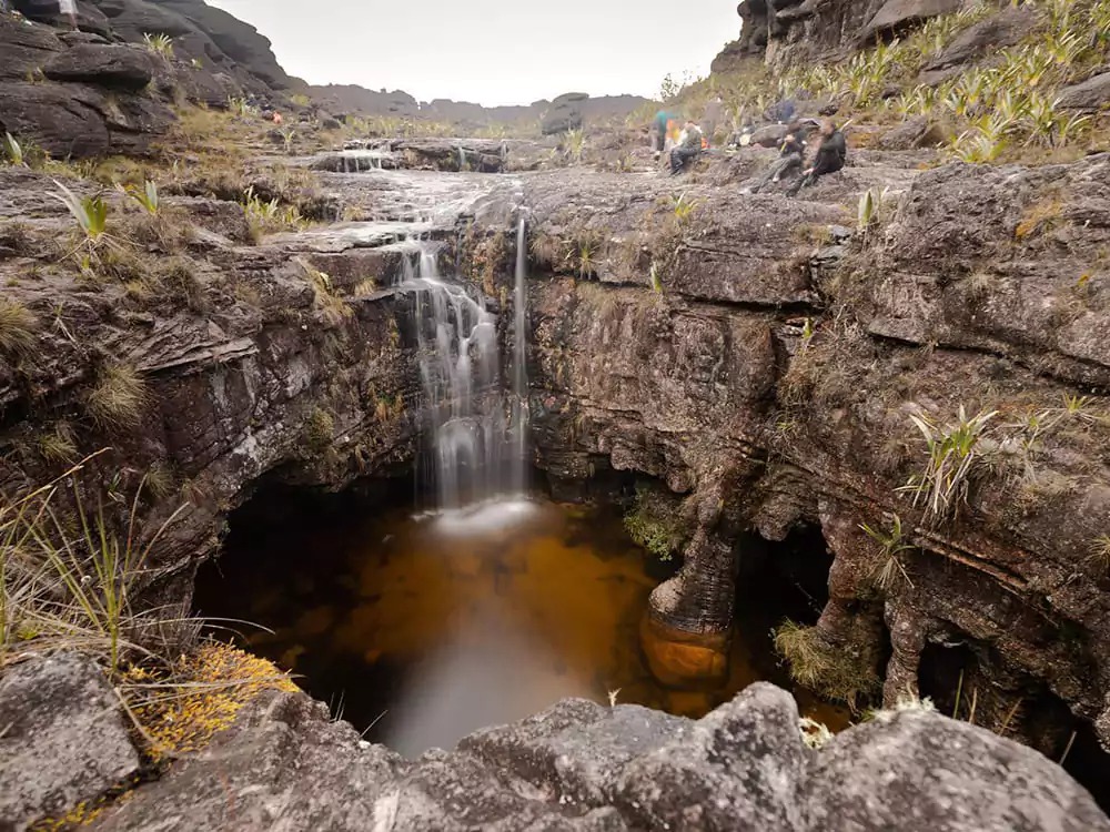
    Sunset Mount Roraima
    @watchluke

    Hiking Mount Roraima with PlanetaEXO

    At PlanetaEXO, we’re committed to providing sustainable travel experiences that benefit both travelers and local communities. 

    We work closely with expert local guides, many from the Indigenous community of Paraitepuy inside Canaima National Park, who are passionate about conservation and sharing the beauty of the mountain.

    How hard is it to trek up Mount Roraima
    Photo: Lucas Gobatti

    By choosing us, you’re not just embarking on an adventure; you’re supporting ecotourism that helps preserve Mount Roraima for future generations.

    👉 Ready to take on the challenge? Start planning your Mount Roraima trek today with PlanetaEXO.

  • 10 Facts About Mount Roraima

    10 Facts About Mount Roraima

    Learn key facts about Mount Roraima, including its formation, height, location, what’s up there, and how to experience it responsibly

    Mount Roraima is one of the most fascinating places in South America. From ancient geology to rare animals and Indigenous culture, there’s more to it than meets the eye.

    Its isolation, ecosystem, and sheer cliffs have inspired curiosity and scientific studies for many years. Whether you’re planning a trip or just want to learn more, PlanetaEXO, an ecotourism platform specializing in Mount Roraima tours, breaks down everything you need to know about this fantastic destination.

    Check out 10 facts about Mount Roraima below!
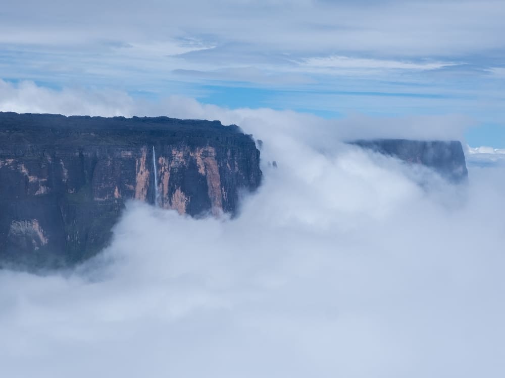
    facts about Mount Roraima
    Photo: Lucas Gobatti

    1. Triple border: Brazil, Venezuela, and Guyana

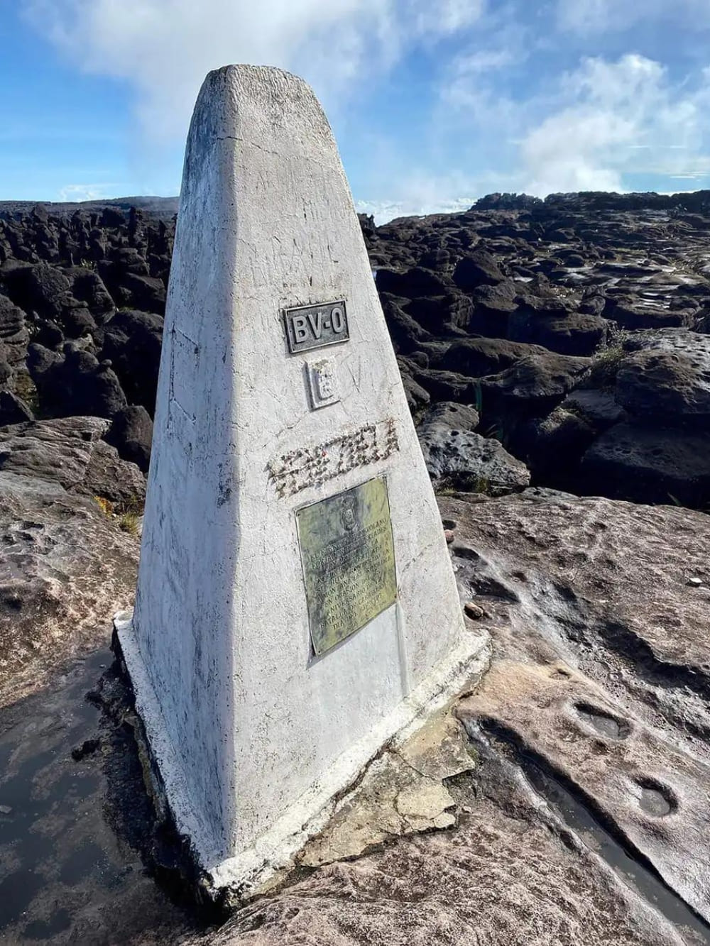
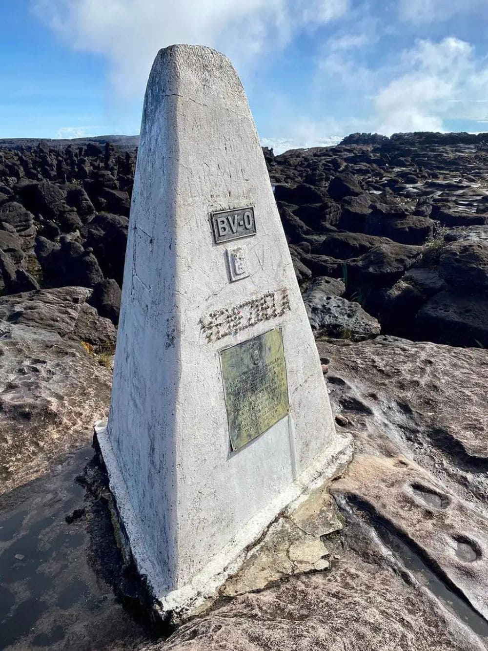
    Mount Roraima straddles the borders of Brazil, Venezuela, and Guyana, though most of its mass is located inside Venezuelan territory. The meeting point of the three countries is marked by a pyramidal concrete monument. You can’t miss it!

    The most common trekking route begins in Venezuela, departing from the village of Paraitepuy, which is accessible via Santa Elena de Uairén. For travelers coming from Brazil, the most recommended starting point due to logistics, the nearest major city is Boa Vista, in the state of Roraima.

    From there, it’s a 3-hour drive to the Venezuelan border and then 20 minutes to reach Santa Elena.

    facts about Mount Roraima
    .

    👉 Read more: How to get to Mount Roraima?

    2. Formed over 2 billion years ago

    Mount Roraima is part of the Guiana Shield, one of the most ancient geological formations on Earth. It dates back over 2 billion years, making its rock layers older than most mountain ranges on the planet.

    The marks of time are visible in its very shape. Geologists explain the top of Roraima’s flatness through erosion. Horizontal layers of sandstone have eroded evenly over time, unlike volcanic or folded mountains that form jagged peaks.

    The plateau consists of resistant quartzitic sandstone, which erodes slowly and uniformly. Beneath it lies a hard igneous basement, which helps preserve the flat structure. This combination prevents the formation of peaks, resulting in the mountain’s striking tabletop shape.

    3. 2,810 meters above sea level

    Ever wondered about Mount Roraima’s height? It reaches an impressive 2,810 meters (9,219 feet) above sea level, with cliffs that rise nearly 400 meters from the base, making it the highest tepui in the Pakaraima mountain range.

    Although it’s not the tallest mountain in South America, the title belongs to the 6,961-meter Aconcágua in Mendoza, Argentina, its shape and prominence make it one of the most striking.

    Mount Roraima’s height
    Photo: Denis Minnetdinov

    👉 Learn more about trekking in Mount Roraima:

    4. Mount Roraima’s Indigenous communities protect its legacy

    Mount Roraima is surrounded by Indigenous communities who live there, including the Pémon, Kapon, and Taurepang.

    The Pémon and Taurepang belong to the Carib (Karib) linguistic and cultural group, while the Kapon are part of the Akawaio-speaking peoples, who are also often classified within the Carib family.

    These groups are the traditional custodians of the land and hold deep spiritual ties to the mountain. They play a vital role in sustainable tourism as well, not only guiding visitors but also providing the logistics that make the trek possible: carrying equipment, setting up tents, preparing meals, and facilitating access to remote areas.

    Their work ensures tourism benefits local economies while preserving both the environment and cultural heritage.

    Indigenous communities Mount Roraima
    .

    5. The Tree of Life, one of Mount Roraima’s mysteries

    One of the most enduring aspects of Mount Roraima is the mystery surrounding its symbolic meaning. In Indigenous mythology, the mountain is believed to be the trunk of the “Tree of Life” (also called the Tree of All Fruits), a sacred figure from which the world’s fruits once originated. Makunaíma, the powerful indigenous hero, serves as its guardian.

    This idea has gained attention in recent years as visitors reflect on the mountain’s otherworldly terrain. The concept of a “living origin” resonates with those seeking spiritual connection in natural spaces. Additionally, some indigenous people also refer to the mountain as the “house of the gods.”

    mystery of the “Tree of Life”
    @overlandtheamericas

    6. Inspiration for Pixar’s Up (and other fictional stories)

    Did you know that Mount Roraima was one of the main inspirations for Pixar’s animated film Up? The movie’s iconic “Paradise Falls” was modeled after the tepuis of the Guiana Shield, especially Roraima, with its vertical cliffs, flat summit, and dramatic waterfalls.

    The destination also served as inspiration for various other literary and audiovisual works. The most famous is the book The Lost World, written in 1912 by Sir Arthur Conan Doyle. Years later, it served as the basis for Jurassic Park.

    In Brazil, the hero Makunaíma is reimagined as an anti-hero in the classic Macunaíma, written in 1928 by Mário de Andrade. More recently, in the 2014 soap opera Império, Mount Roraima plays a major role in the plot.

    Film Up – Paradise Falls
    Photo: Pixar Film, Up – Paradise Falls

    7. Typical flora of tepuis

    A significant portion of Mount Roraima’s flora is found only in the Pantepui, the cluster of tepuis in South America, located primarily between Venezuela and northern Brazil.

    Certain species stand out, such as the pitcher plant (Heliamphora nutans), a carnivorous plant discovered in 1839 by the naturalist brothers Robert and Moritz Schomburgk. Also noteworthy is Brocchinia reducta, one of the few carnivorous bromeliads on the planet.

    Other species are also commonly found on Roraima’s summit, including Bonnetia roraimae, Drosera roraimae, and Utricularia quelchii.

    8. Native wildlife at the summit

    Contrary to what is suggested in the fantastical universe of Conan Doyle’s The Lost World, Mount Roraima’s animals are not big. Its cold, wet, and windy climate, combined with a lack of fertile soil, cannot support the biomass required for large predators or herbivores. In other words, the local fauna is miniature in scale.

    Amphibians constitute the most notable group, with an endemism rate of 77%. The Roraima bush toad (Oreophrynella quelchii), measuring just 2 to 3 centimeters, was one of the first species to be officially cataloged.

    Other species found exclusively on the Pantepui include the Tepui swift (Streptoprocne phelpsi), the Roraima mouse (Podoxymys roraimae), and the greater flowerpiercer (Diglossa major).

    endemic frogs Mount Roraima
    @cafred33

    9. Find rock formations, natural pools, and the iconic Crystal Valley at the top

    The geological value is a well-known fact about Mount Roraima. On the plateau, visitors are captivated by panoramic views and rock formations, including the massive Maverick Rock and La Ventana, the opening that beautifully frames the landscape.

    Heavy rainfall feeds the rivers and the famous “jacuzzis”, various natural pools carved into the quartzite by streams crisscrossing the plateau. The dark waters of the enigmatic Lake Gladys and El Foso, a water-filled pit 20 meters deep, are also unmissable attractions.

    In the Valley of Crystals, millions of quartz crystals cover a shallow depression in the sandstone. Formed an estimated 1.8 billion years ago through sedimentation and quartz crystallization, these crystals are believed by local indigenous peoples to be fragments of stars that fell to earth when Makunaíma cut down the original Tree of Life.

    Mount Roraima pools
    Photo: Lucas Gobatti

    👉 Read more: What’s on top of Mount Roraima?

    10. Reaching the top of Mount Roraima takes 8 to 10 days of trekking

    Here’s a fact about Mount Roraima you should definitely know if you’re interested in visiting: while the trek doesn’t require climbing gear, it is physically demanding. Most tours take between 8 and 10 days round-trip and involve hiking 80–90 km through jungles, rivers, and steep terrain.

    Although seasonal factors and logistical arrangements affect daily visitor numbers, peak periods see an estimated 100 to 200 trekkers distributed along the trail and across various areas of the mountain. The final ascent includes the “Rampa,” a narrow natural path leading to the summit, where the landscape changes dramatically.

    Due to the elevation and constant cloud cover, temperatures at the summit can vary greatly, from 5°C at night to over 25°C during the day. The climate is defined more by Venezuelan seasons than Brazilian ones, with a wetter season from May to September and drier months between December and March. Sudden weather shifts are common, so visitors should be prepared for rain and cold at any time.

    trekking Mount Roraima
    Photo: Lucas Gobatti

    Exploring Mount Roraima with PlanetaEXO

    Now that you know the key facts about Mount Roraima, it’s time to experience this fantastic place firsthand!

    At PlanetaEXO, an ecotourism platform specializing in Mount Roraima tours, you’ll find experiences that offer authenticity and a positive impact on every front. To ensure the vacation of your dreams, our team of experts takes care of everything, from logistical details to tailor-made itineraries. Contact us now!

  • How much does it cost to climb Mount Roraima?

    How much does it cost to climb Mount Roraima?

    Are you interested in hiking to climb Mount Roraima but are wondering how much it costs? Join us as we guide you through all the important aspects to consider before embarking on your Mount Roraima adventure.

    We’ll help you make the most out of your trip while ensuring your safety every step of the way. Let’s dive into the details together, so you can fully enjoy this incredible journey to the oldest place on Earth.

    Mount Roraima hike

    How much does it cost to climb Mount Roraima?


    The cost of climbing Mount Roraima can vary depending on several factors, such as the duration of the trek the chosen route, and the services included in the tour. The PlanetaEXO offers authentic experiences with English-speakers local guides and all tours include roundtrip ground transportation from Boa Vista to the Indigenous Community of Paraitepuy; one-night accommodation in a double room in Santa Elena de Uairén; full meals during the trekking; shared camping equipment: double-shared tent, kitchen equipment, cookware, plates, cups, utensils; logistics staff; trail guide and first aid kit.

    The 8-day hike to Mount Roraima costs R$5.500,00 and starts on Santa Elena de Uairén throughout the Paraitepuy Indigenous Community. On this tour, you will spend 3 nights at the top and have an immersive experience in the natural wonders of Mount Roraima, with a special emphasis on discovering and enjoying the enchanting natural pools and jacuzzis along the way.

    Mount Roraima hike

    Trekkers explore natural pools and rock formations atop Mount Roraima in Venezuela

    Hikers trek across the dramatic summit landscape of Mount Roraima in Venezuela

    The 10-day Makunaima Expedition hike costs R$6.200,00 and offers a captivating journey to the “Lost World” of Makunaima, showcasing the natural wonders of Mount Roraima and providing insights into the indigenous culture of the region. In this adventure, you will spend 5 nights on the top and have a remarkable opportunity to explore the mystical landscapes and embrace the rich heritage of this destination.

    climb Mount Roraima

    A trekker takes in the mystical rock formations on top of Mount Roraima

    How much does it cost to climb Mount Roraima?

    Do you still have any questions or lingering uncertainties regarding Mount Roraima? Explore our comprehensive guide, packed with valuable information and insider tips. 

    Come to climb Mount Roraima!


    Try one of our following Mount Roraima tours!