Tag: Brazil

  • What to Do in Chapada Diamantina, Brazil

    What to Do in Chapada Diamantina, Brazil

    Distances, difficulty, entrance fees, and the base town for each of the 10 Chapada Diamantina attractions are worth planning your days around

    Chapada Diamantina National Park covers 152,000 hectares of Bahia’s central highlands, spread across the municipalities of Lençóis, Palmeiras, Mucugê, Andaraí, and Ibicoara. Created by federal decree on September 17, 1985, it is one of the few places where three Brazilian biomes meet inside a single park (Caatinga, Cerrado, and Atlantic Forest).

    In one week, you can look down a 340-meter waterfall, swim in a flooded cave where a prehistoric sloth was recovered, and sleep in a valley with no cell signal. Access is controlled on the busiest routes: ICMBio counts more than 25,000 visitors a year on the Cachoeira da Fumaça trail alone. Want to know what to do in Chapada Diamantina without burning a day on the wrong trail?

    PlanetaEXO, an ecotourism platform specializing in Chapada Diamantina tours, has selected 10 attractions, with the distance, difficulty, fee, and base town for each. Check it out below!

    Vale do Pati

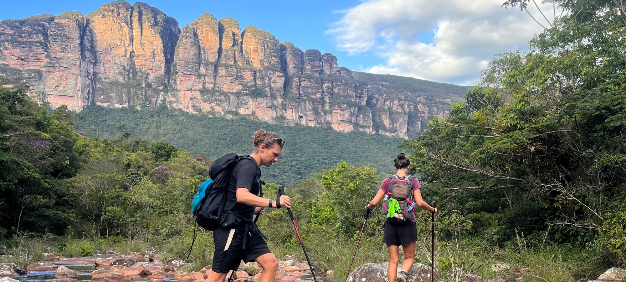
    Vale do Pati sits in the middle of the national park and can only be crossed on foot. A full traverse covers more than 70 kilometers over five days, climbing to nearly 1,400 meters, with daily stages of 15 to 25 kilometers. There is no road in, no cell signal, and no hotel.

    You sleep in the houses of the families who still live in the valley, who cook your meals and rent out a room. Because you can enter and leave through three different points—Vale do Capão, Guiné (in Mucugê), and Andaraí—itineraries run anywhere from 3 to 8 days, which is what makes it the most customizable trek in the park.

    Good to know:

    • Base towns: Vale do Capão, Guiné, or Andaraí.
    • Distance: 70+ km over 5 days, with 3-day and 8-day versions.
    • Difficulty: hard (15 to 25 km a day carrying your own pack).
    • Guide: essential; the route is unmarked and crosses private land.

    👉 Read more: 10 Facts about Vale do Pati, Brazil

    Cachoeira do Buracão

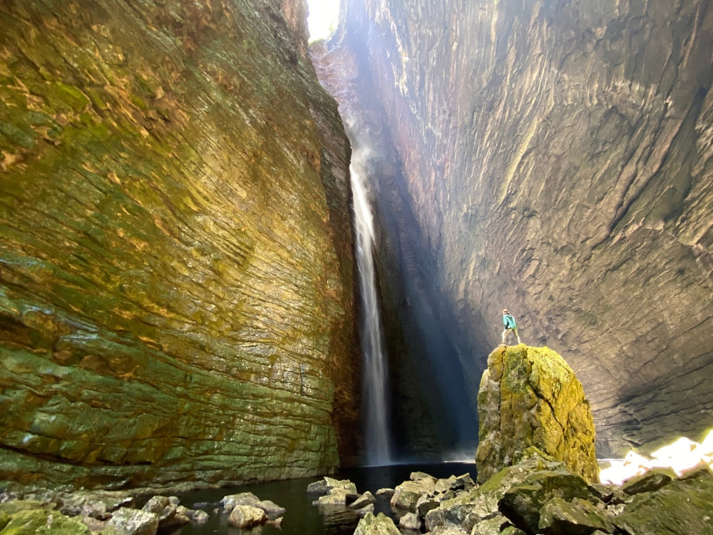
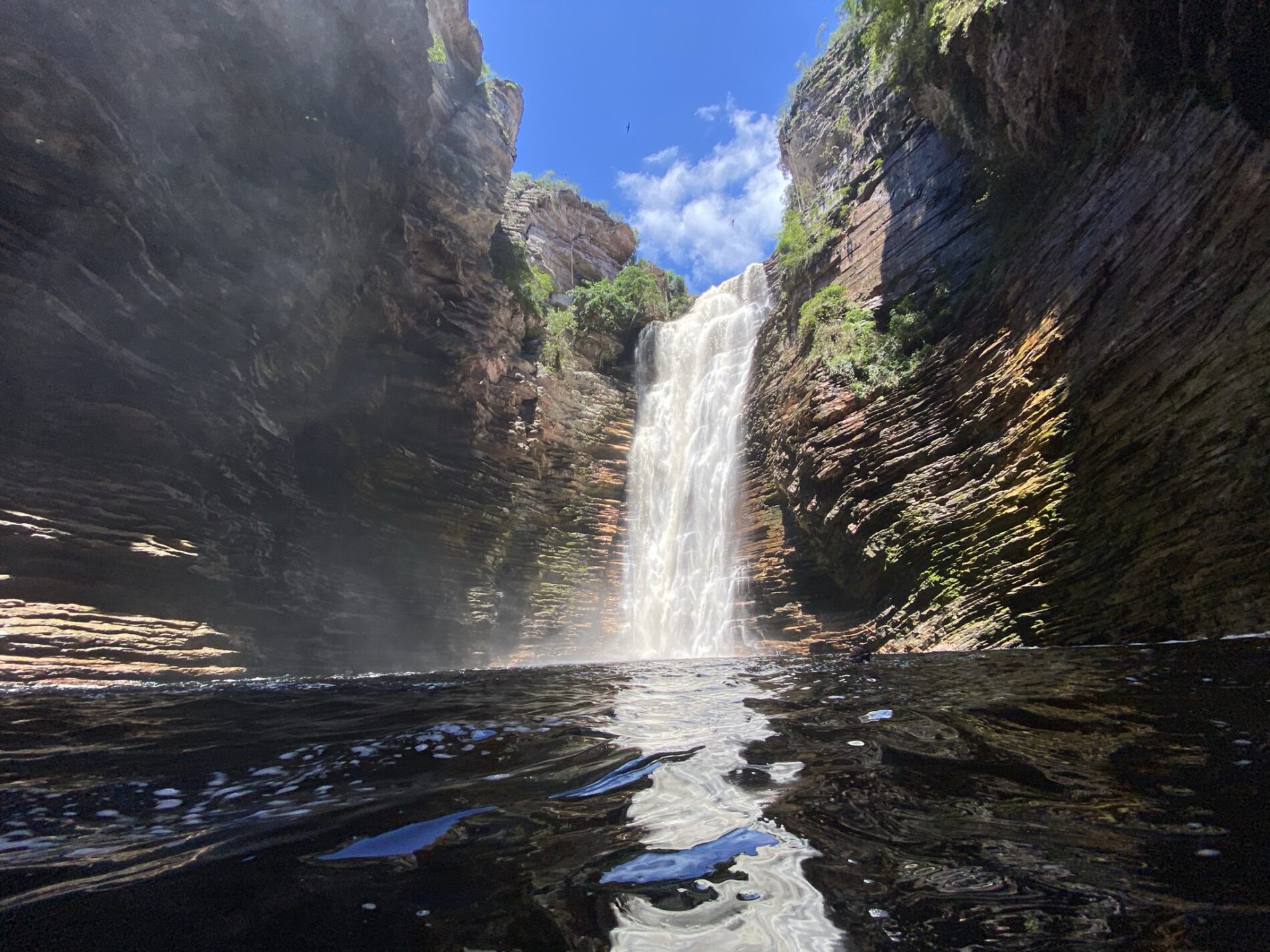
    Cachoeira do Buracão drops 85 meters into a canyon of layered rock near Ibicoara, at the southern end of Chapada Diamantina. The 3-kilometer trail in is short and rated light to moderate, which makes it the best return on effort of any big waterfall here.

    Cachoeira do Buracão falling into a dark pool between the layered canyon walls near Ibicoara, seen from the water

    Located within the Parque Natural Municipal do Espalhado, access to the waterfall requires a municipal registered guide or visitor conductor. Visitors must also pay an entry fee and wear a mandatory life jacket when entering the pool. After heavy rain, the current can make swimming impossible, even though the waterfall itself only gets stronger.

    Good to know:

    • Base town: Ibicoara.
    • Distance: about 3 km each way, on a light-to-moderate trail.
    • Fee and guide: both mandatory, hired in town or at the guides’ association.
    • Combine it with: Cachoeira das Orquídeas and Cachoeira do Recanto Verde on the same day.

    👉 Explore the adventure: 6-Day Ultimate Chapada Diamantina Hike

    Morro do Pai Inácio

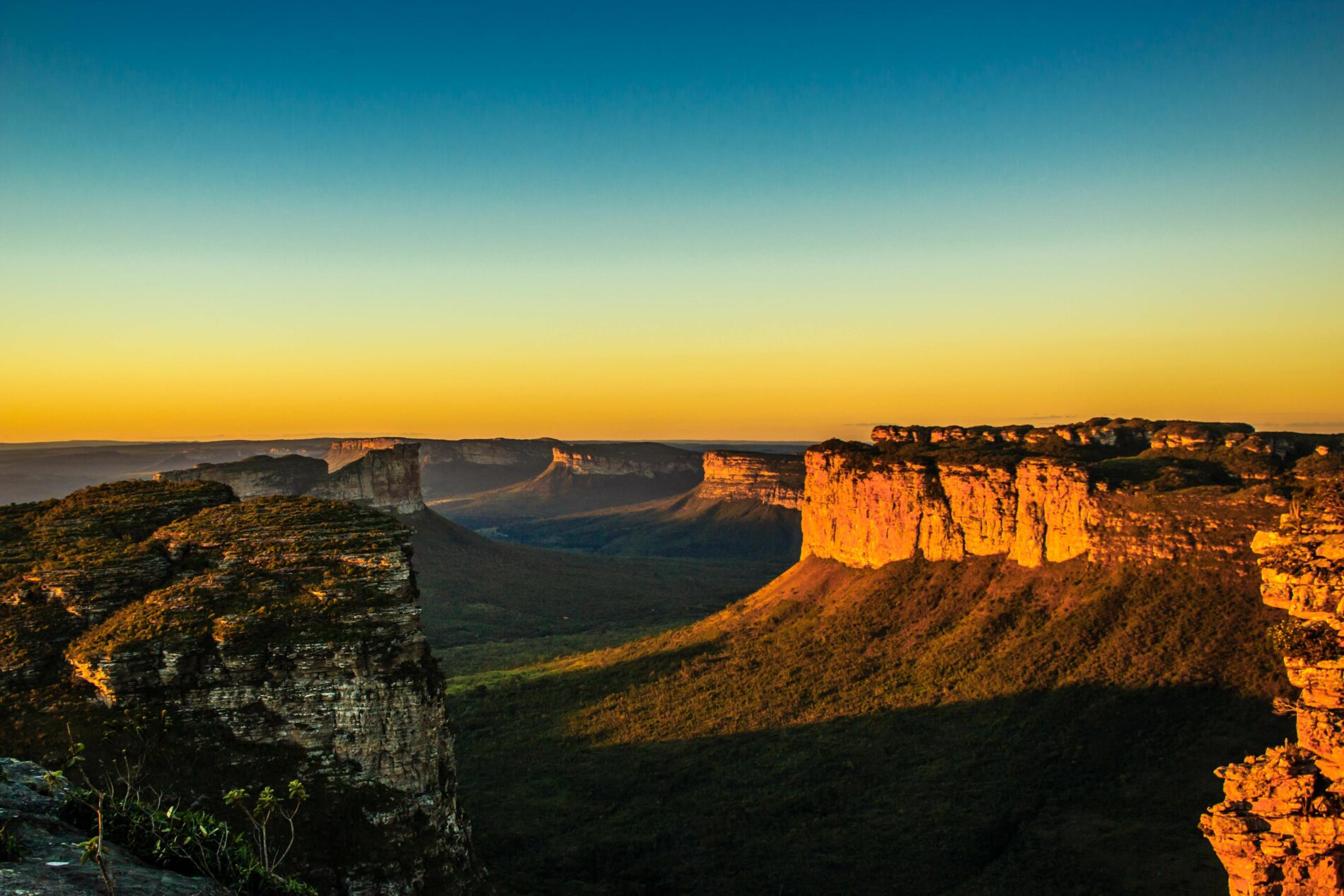
    If you have half a day and are still deciding what to do in Chapada Diamantina, start here. The summit of Morro do Pai Inácio stands at 1,120 meters, roughly 250 meters above the plain, while the climb from the gate takes about 25 minutes on a short, steep path.

    Sunset from Morro do Pai Inácio over the flat-topped hills and the valley cut by the BR-242 in Chapada Diamantina

    From the top, get the Camelo and Três Irmãos hills and the full width of the valley cut by the BR-242 highway. Go close to sunset and pair it with a nearby waterfall such as Poço do Diabo.

    Good to know:

    • Base town: Lençóis or Palmeiras, both under an hour by car.
    • Distance: roughly 500 meters uphill from the parking area.
    • Difficulty: easy (the only stop on this list a non-hiker can do).
    • Fee and hours: small gate fee (R$12 recently, check locally); 9 AM to 5 PM.

    Cachoeira da Fumacinha

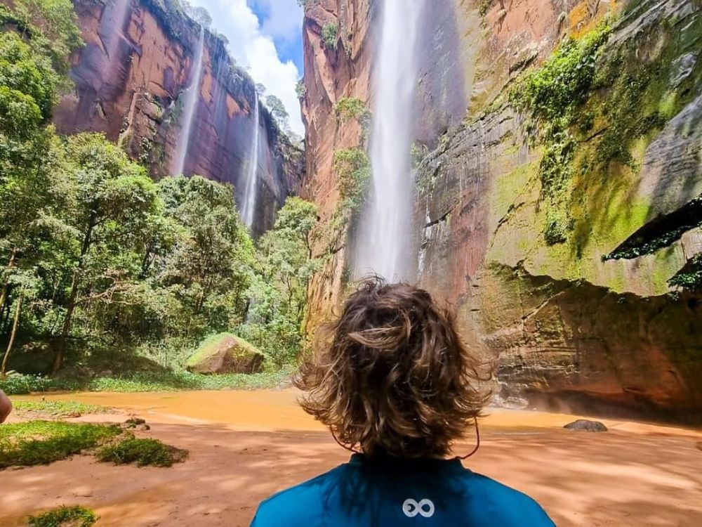
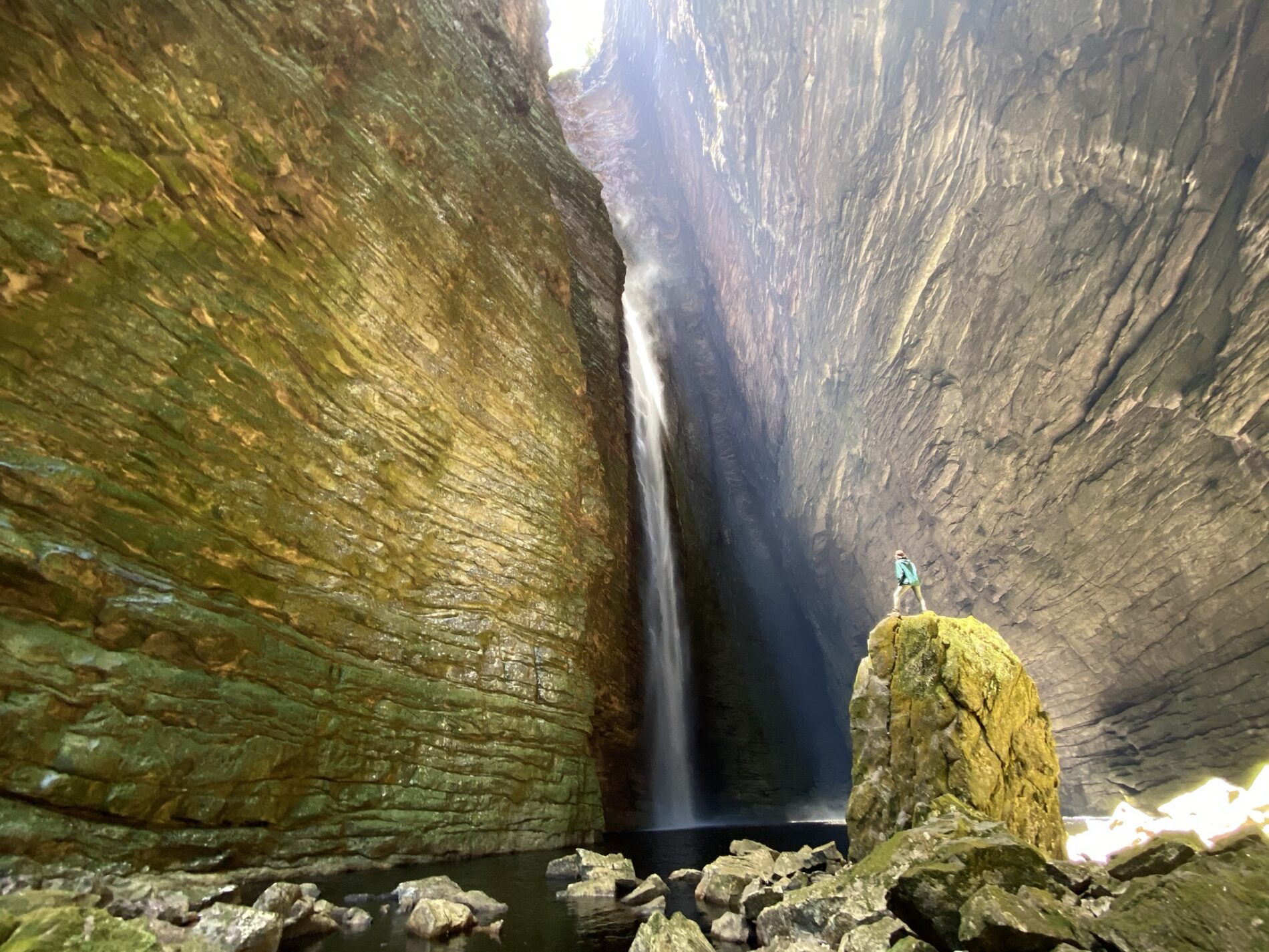
    Fumacinha is the hardest single day on this list. The walls closing in around the falls rise close to 300 meters, and the waterfall itself was measured at 210 meters by the Projeto Cachoeiras Gigantes survey, well above the 100 meters usually quoted.

    A hiker standing on a boulder inside the closed canyon of Cachoeira da Fumacinha, dwarfed by walls close to 300 meters high

    The trail runs 18 kilometers round trip up the riverbed from the Baixão community, which is itself 30 kilometers of dirt road from Ibicoara. The first 3 kilometers are easy; after that you are hopping boulders and using your hands.

    A registered Chapada Diamantina guide is mandatory, as the river turns dangerous in the rainy season.

    Good to know:

    • Base town: Ibicoara, plus 30 km of dirt road to the trailhead.
    • Distance: 18 km round trip (3 to 4 hours each way).
    • Difficulty: hard (riverbed boulders and scrambling after km 3).
    • Watch the forecast: powerful currents during the rainy season, while the flow can diminish significantly in dry months.

    👉 Read more: Chapada Diamantina Waterfalls: Best Trails and Hidden Gems

    Cachoeira da Fumaça (from the top)

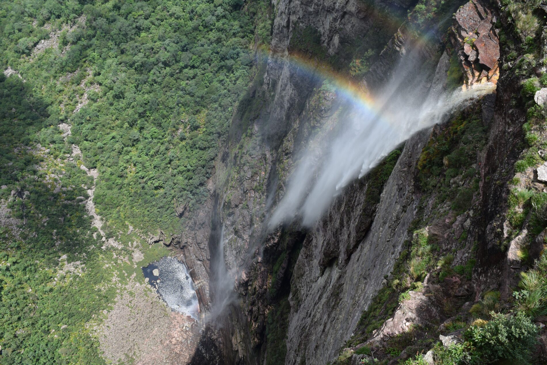
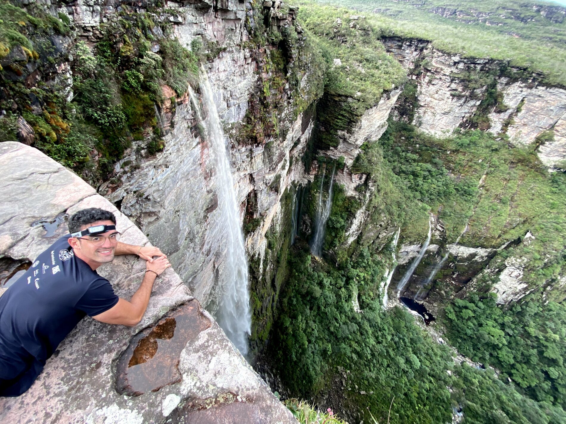
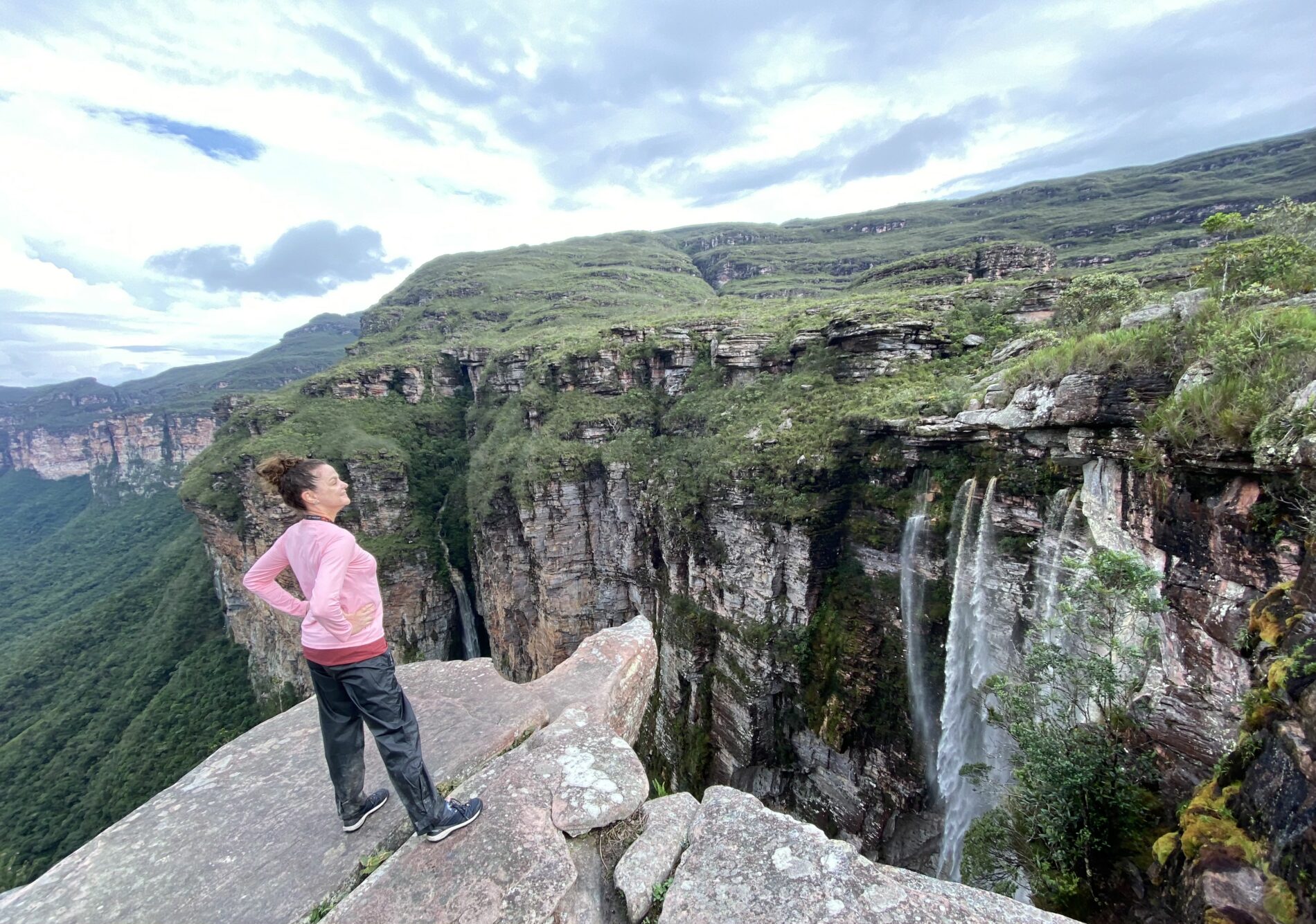
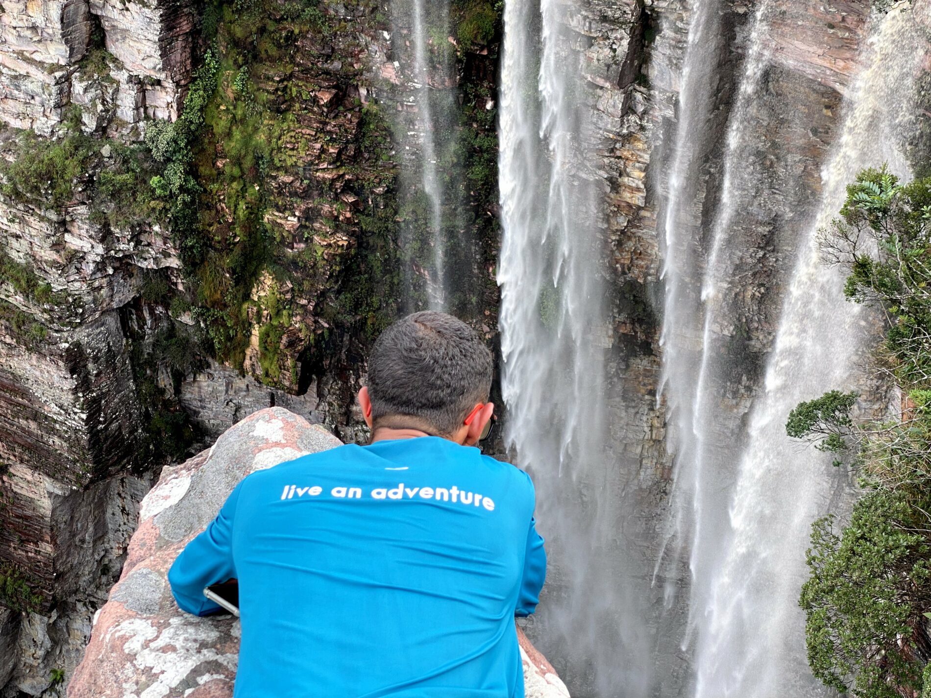
    At 340 meters, Cachoeira da Fumaça is the second-highest waterfall in Brazil, behind Cachoeira da Neblina in Rio de Janeiro. Wind catches the water long before it lands and turns it into drifting spray, which is where the name comes from—fumaça means smoke.

    The 340-meter Cachoeira da Fumaça seen from the top, its water breaking into spray with a rainbow above the valley

    The trail from Vale do Capão is 12 kilometers round trip, with 2 kilometers of steep steps, then 4 kilometers of uneven rock to the lookout. It is the busiest controlled trail in Chapada Diamantina National Park.

    There is no pool at the top, so most groups drive the extra 3 kilometers to Cachoeira do Riachinho to cool off afterward.

    Good to know:

    • Base town: Vale do Capão, in the municipality of Palmeiras.
    • Distance: 12 km round trip (about 5 hours).
    • Difficulty: moderate (the first 2 km are the whole climb).
    • Timing: the fall can disappear completely at the end of the dry season.

    👉 Read more: When is the best time to visit Chapada Diamantina?

    Cachoeira da Fumaça (from the bottom)

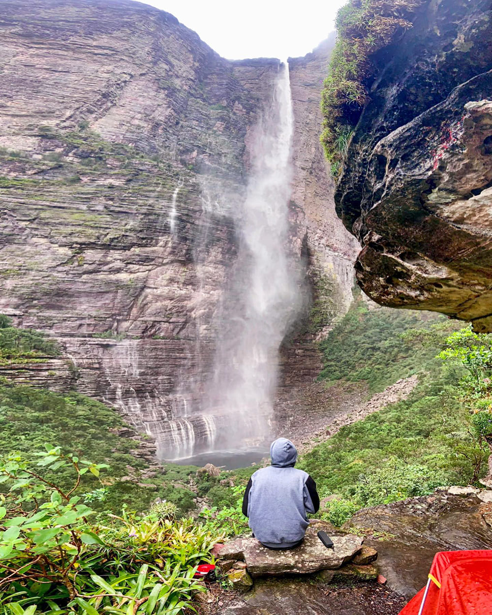
    Same waterfall, opposite angle, completely different trip. Reaching the base means a 3-day traverse between Vale do Capão and Lençóis, in either direction, camping in the wild and carrying your own food, water, and equipment.

    A trekker sitting at camp watching Cachoeira da Fumaça from the bottom on the traverse between Vale do Capão and Lençóis

    Your reward for completing this classic Chapada Diamantina trek is a refreshing swim in the natural pool right at the base of the towering cliff face. Along the way, the trail winds through pristine forest, historic diamond-mining ruins, and past two additional waterfalls: Capivara and Palmital.

    Keep in mind that there are no restroom facilities along the trail, so visitors must pack out all trash and waste.

    Good to know:

    • Base towns: Vale do Capão and Lençóis, one at each end.
    • Duration: 3 days, wild camping, no resupply.
    • Difficulty: hard (full pack, rock sections, river crossings).
    • Bring: tent, water treatment, all your food, and waste bags.

    👉 Explore the adventure: Chapada Diamantina Tour 7 Days

    Poço Encantado and Poço Azul

    These two flooded caves are the easiest stop on any list of what to do in Chapada Diamantina—and the most unique.

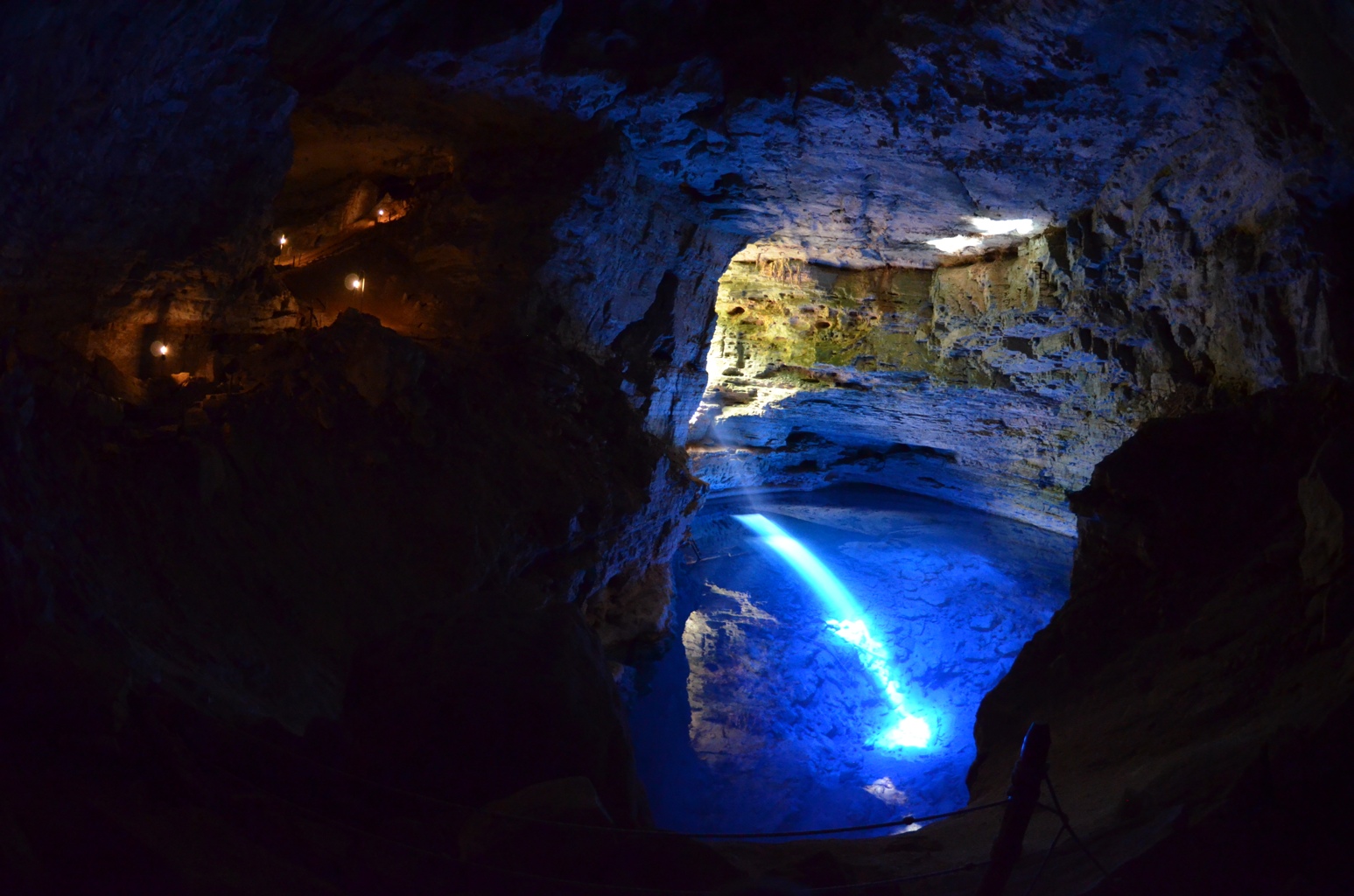
    Poço Encantado in Itaetê measures 110×70 meters and is over 60 meters deep. Its crystal-clear water comes from a non-renewable water table, so swimming is banned. From April 1 to September 10 (peaking in June and July), sunlight passes through a rock opening onto the lake between 10 AM and 1:30 PM.

    A shaft of sunlight hitting the blue water of Poço Encantado inside its cave chamber in Itaetê

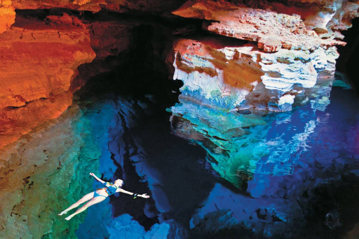
    Poço Azul, in Nova Redenção, has running water, so floating with a life jacket is allowed. It is also a fossil site—divers recovered a near-complete skeleton of Eremotherium laurillardi, a ground sloth up to 6 meters long weighing around 5 tons, extinct for roughly 11,000 years. The first skull surfaced in 1995.

    A visitor floating on her back on the blue water of Poço Azul, the cave walls mirrored in the pool at Nova Redenção

    Good to know:

    • Base towns: Itaetê (Poço Encantado) and Nova Redenção (Poço Azul), one hour apart.
    • Distance: Poço Encantado is 140 km from Lençóis, reached by dirt road.
    • Fees: both sit on private property and charge on-site.
    • Best light: April to September, between 10 AM and 1:30 PM.

    👉 Read more: 10 facts about Chapada Diamantina National Park

    Cachoeira do Mixila

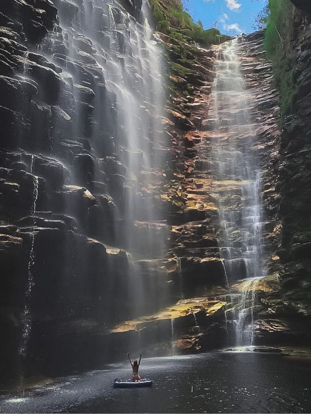
    The 80-meter Mixila waterfall sits deep inside the Capivari river canyon, which narrows to 4 meters wide at its tightest point. Get there by following the riverbed from near Lençóis, hopping boulders, and swimming across two pools with your backpack left behind on the rocks.

    A swimmer on a float raising both arms at the foot of the 80-meter Cachoeira do Mixila in the Capivari canyon
    Photo: @nairaferreiraa

    As a day hike, it is punishing and only for very fit hikers—roughly 25 kilometers round trip, after a 9-kilometer approach by car best driven in a 4×4. Camping one night turns it into a much better trip and lets you add the Capivari and Poção waterfalls on the way.

    Good to know:

    • Base town: Lençóis.
    • Distance: about 25 km round trip.
    • Difficulty: hard (4 to 5 hours on day one, 6 to 7 hours on day two).
    • You will swim: two pools have to be crossed, so pack dry bags.

    Cachoeira do Sossego

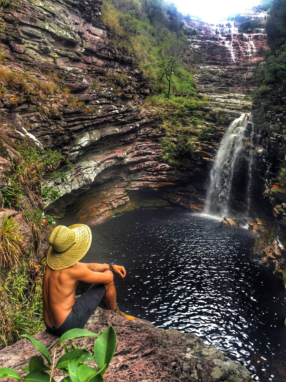
    Sossego drops about 20 meters down a stepped wall inside a canyon, into a pool wide enough to swim across and flanked by flat rock to dry off on. The round trip from Lençóis, Bahia, is 12 kilometers with 463 meters of elevation gain, normally done in a single day.

    A traveler in a straw hat sitting on the rock above the pool of Cachoeira do Sossego, 12 kilometers from Lençóis

    The final section proceeds along the riverbed across large boulders, including a passage beneath an overhanging ledge that should only be attempted during low water levels. Avoid this route following extended rainfall, as the river rises rapidly and makes the rocks exceptionally slick.

    Good to know:

    • Base town: Lençóis.
    • Distance: 12 km round trip (463 m of elevation gain).
    • Difficulty: hard for the distance (the boulder sections are the slow part).
    • Do not go: after several consecutive days of rain.

    👉 Read more: The 5 Best Hikes in Chapada Diamantina: Trails, Waterfalls and Distances

    Lapa Doce cave and Pratinha

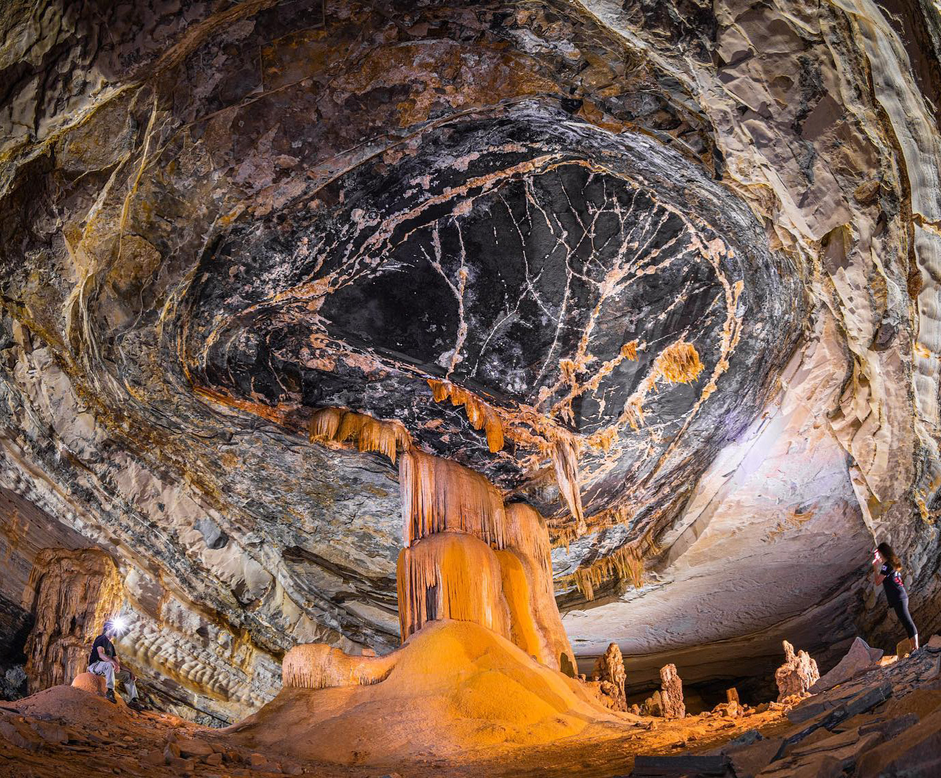
    Lapa Doce, in Iraquara, is part of a cave system 42 kilometers long, of which 850 meters are open to visitors around 1.5 hours underground among stalactites, stalagmites, and limestone curtains. It has more than ten entrances and is the most visited cave in the municipality.

    Visitors lit by headlamps beside a giant column of stalagmites in the Lapa Doce cave chamber in Iraquara

    The visit starts with a steep descent on stairs and stays easy after that, which makes it workable for almost anyone. Most people pair it with Pratinha, minutes away, where a clear river runs straight out of a cave mouth and you can float, snorkel, or ride the zip line. Both charge on-site.

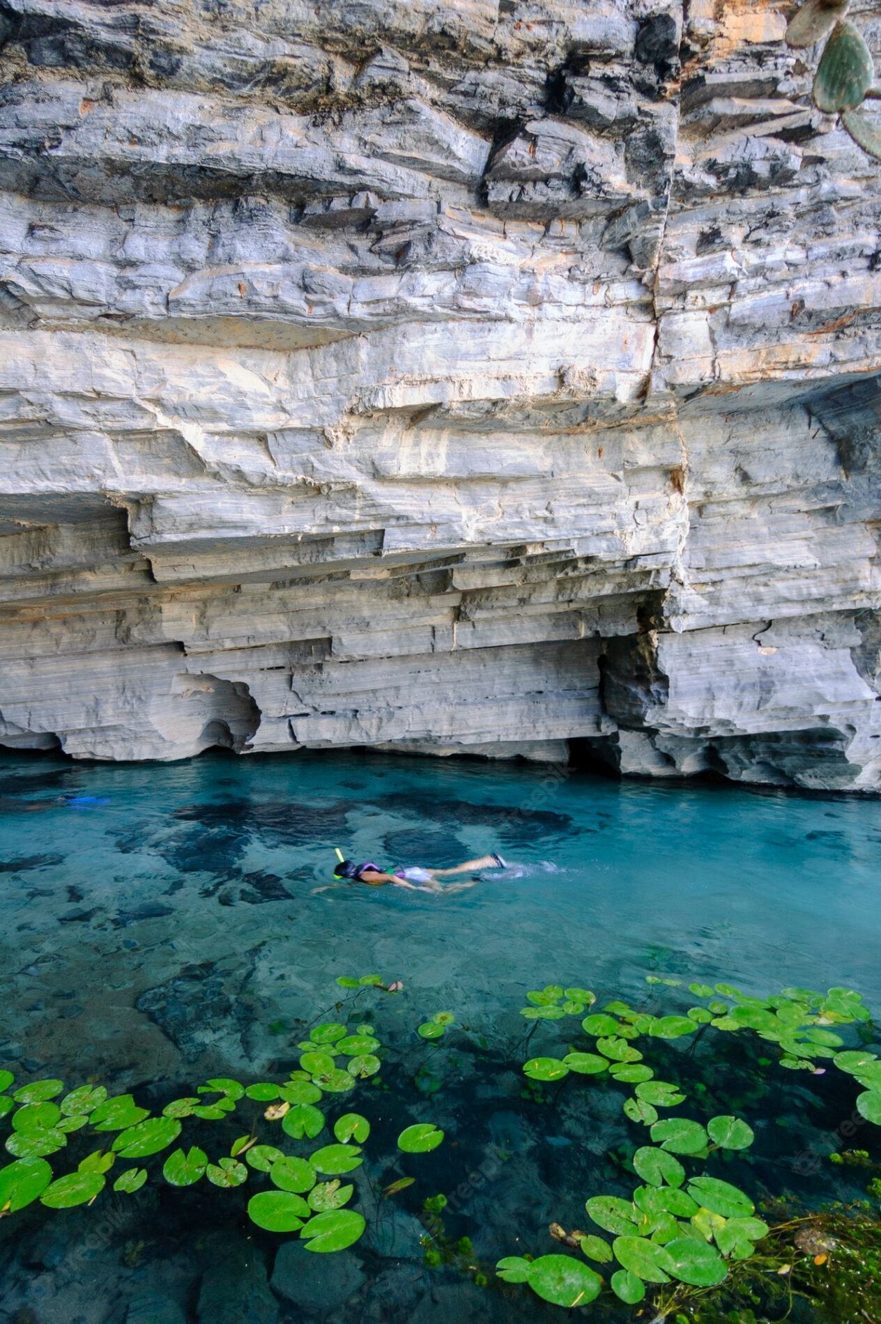
    A snorkeler in the clear turquoise water of Pratinha, under the layered limestone wall and among the water lily pads

    Good to know:

    • Base town: Iraquara, about 1.5 hours from Lençóis by car.
    • Distance: 850 meters underground (roughly 1.5 hours).
    • Difficulty: easy (after the stairs at the entrance).
    • Guide: mandatory inside Lapa Doce; fees paid on-site at both stops.

    Ready to Visit Chapada Diamantina? Plan Your Trip with PlanetaEXO

    Now that you know what to do in Chapada Diamantina, it’s time to pick your favorite attractions and plan your vacation.

    PlanetaEXO is an ecotourism platform specializing in hiking and trekking tours in Brazil. Working with local guides and operators who know the national park like the back of their hand, our team plans your entire trip, from logistics to tailor-made itineraries, so all you have to do is enjoy yourself. Contact us now!

  • Jalapão State Park, Brazil – Travel Guide

    Jalapão State Park, Brazil – Travel Guide

    How to get to Brazil’s Jalapão, when to go, what the fervedouros really are, how many days you need, and what the trip costs

    Jalapão State Park sits in the far east of Tocantins, in the middle of the Cerrado, the largest savanna in South America, which covers 2,036,448 km² (22% of Brazil) and holds more than 12,000 plant species. The park protects dunes, sandstone plateaus, waterfalls, and spring-fed pools.

    What sets Jalapão apart from other Brazilian parks is the water. Underground springs push up through sand at the fervedouros, where you float instead of sinking, and the nearby Rio Novo holds one of only three known populations of the Brazilian merganser, a duck with fewer than 250 individuals left in the world.

    Want to know when to go, how many days you need, and what a trip actually costs? PlanetaEXO, an ecotourism platform specializing in Jalapão tours, has put together this travel guide to help you plan every stage of the trip. Check it out below!

    What you will find in this guide:

    1. About Jalapão State Park
    2. Where is Jalapão?
    3. How to get to Jalapão?
    4. When is the best time to visit Jalapão?
    5. What to do in Jalapão State Park?
    6. How many days do I need in Jalapão?
    7. Do I need a guide to visit Jalapão State Park?
    8. How much does it cost to visit Jalapão?
    9. What to bring to Jalapão
    10. Is it worth visiting Jalapão in Brazil?
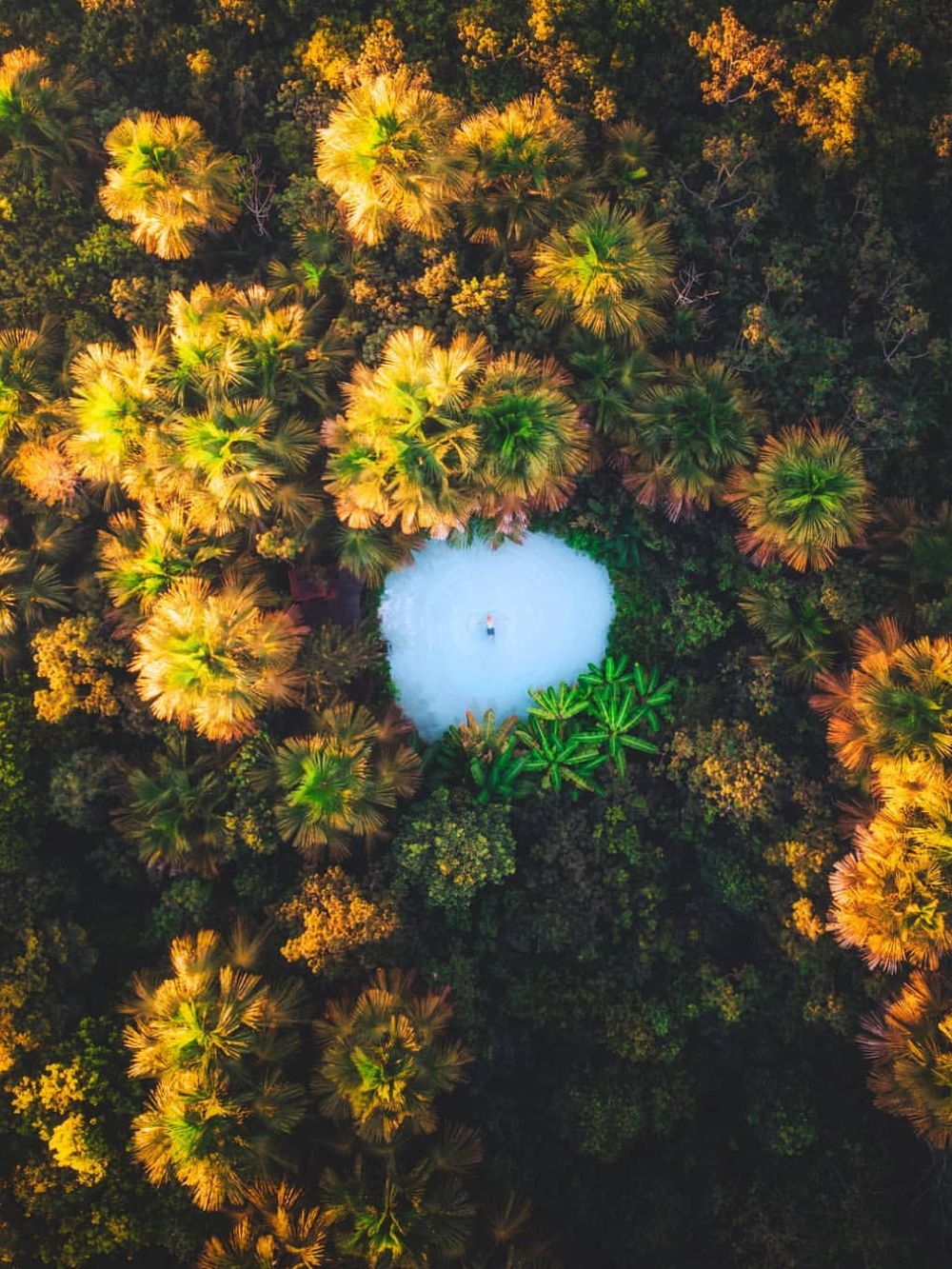
    Aerial view of a turquoise fervedouro spring surrounded by buriti palms in Jalapão State Park, Tocantins
    Photo: Lucas Guerra

    About Jalapão State Park

    Jalapão State Park was created on January 12, 2001, and is managed by Naturatins, the Tocantins environmental agency. It covers 158,970 hectares (1,590 km²) across waterfalls, dune fields, canyons, and sandstone outcrops, along with the fervedouro springs that form natural pools.

    The wider Jalapão region, at about 34,000 km², is close to the size of Switzerland, and the park is only one piece of it. Next door, the Serra Geral do Tocantins Ecological Station protects another 716,306 hectares under the Chico Mendes Institute for Biodiversity Conservation. Together with neighboring reserves in Bahia, Piauí, and Maranhão, they form the largest continuous block of protected Cerrado in Brazil.

    The sandstone underfoot is older than any of it. The rocks belong to the Urucuia Group, laid down in the Cretaceous. Geologists read them as ancient dune fields, as this was a desert, not a sea. That same porous sandstone is what stores and slowly releases the groundwater that feeds the springs, rivers, and waterfalls you came to see.

    The region is also a center for sustainable handicraft production, built around capim-dourado (golden grass) and buriti palm fiber. Harvesting is regulated: under Naturatins Ordinance 362/2007, golden grass can only be collected between September 20 and November 30 and only by registered extractivists, with the flowers scattered on the ground so the plant reseeds itself. State Law 3,594/2019 governs the rest of the production chain.

    Where is Jalapão?

    Jalapão State Park is in eastern Tocantins, about 300 kilometers from Palmas, the state capital. The region spreads across several municipalities, including Ponte Alta do Tocantins, Mateiros, and São Félix do Tocantins. The Serra do Espírito Santo, the flat ridge that dominates the horizon, reaches about 900 meters.

    “Remote” is not a figure of speech here. Mateiros, the parks main gateway, had 2,748 residents spread over 9,589 km² in the 2022 Census, a density of 0.29 people per km², according to IBGE. That isolation is exactly what kept the landscape intact, and it is also why the practical planning in the rest of this guide matters more than it would anywhere else.

    How to get to Jalapão?

    The usual way in is through Palmas, which has the closest airport, Brigadeiro Lysias Rodrigues (PMW). Three airlines fly there (Gol, Azul, and LATAM), with roughly 240 departures a month on direct routes to São Paulo, Brasília, and Belo Horizonte, among others.

    From Palmas, expect at least 4 hours by road to Mateiros or São Félix do Tocantins, the two towns most travelers use as a base. A 4×4 is not optional: although select segments of the TO-030, TO-110, and TO-247 highways have been paved, extensive portions of the route remain unpaved dirt or soft sand, accompanied by very limited road signage.

    It also helps to know that touring Jalapão is a circuit, not a there-and-back trip. The attractions are scattered across the region, so itineraries usually enter on one side and leave on the other.

    Most tours start and end in Palmas. Every Jalapão package from PlanetaEXO includes transfers, so you don’t have to worry about navigating unmarked sand roads, and all you have to do is enjoy the journey.

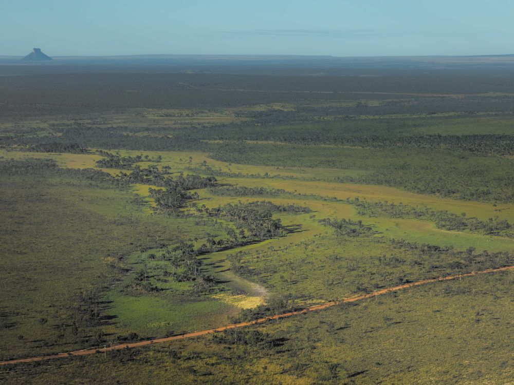
    Red dirt road crossing the Cerrado on the way to Jalapão State Park, with a table-top mesa on the horizon

    When is the best time to visit Jalapão?

    You can visit Jalapão year-round, but the dry season (May to September) is ideal due to minimal rain, clear skies, and reliable roads. May is the sweet spot with lush Cerrado greenery and high humidity just after the rains stop. As September approaches, conditions grow drier and dustier, though sunsets improve.

    The rainy season runs from October to April. Storms can leave dirt roads close to impassable and make wildlife harder to spot, while January is the wettest month, averaging around 255 mm of rain.

    It never gets cold. Mateiros has an annual average of 25.1 °C (77 °F) and about 1,372 mm of rain a year. Temperature swings are small all year, with highs between 30 °C and 34 °C (86 °F and 93 °F) and lows between 15 °C and 20 °C (59 °F and 68 °F).

    The trade-off between seasons is scenery: green landscapes and full waterfalls in the wet months and easier access and sharper light in the dry ones.

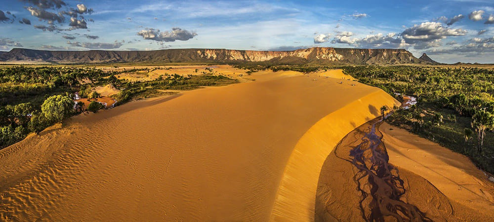
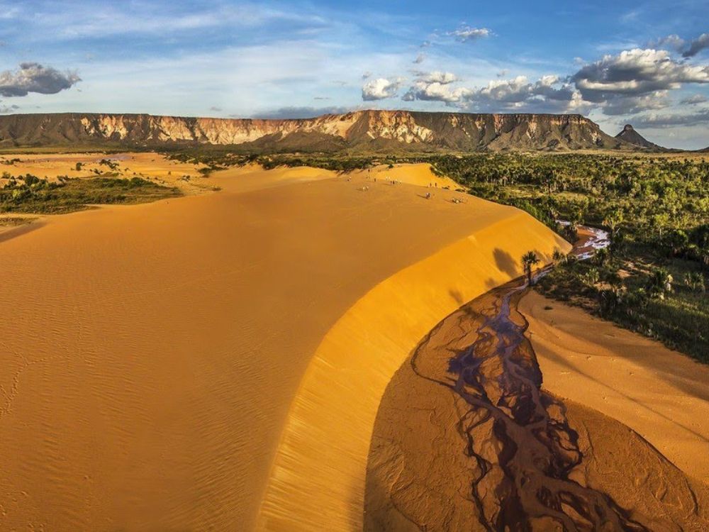
    Golden sand dunes of Jalapão at sunset, with the flat-topped Serra do Espírito Santo rising behind them

    Period Rain What it means for your trip
    May to June Very low Green vegetation, full rivers, comfortable driving. The most balanced window.
    July to September Almost none Driest air, dustiest roads, best sunsets. Peak season, so book early.
    October to December Rising Storms return, landscapes turn green, fewer visitors.
    January to April Highest (≈255 mm in January) Roads can be blocked, some attractions harder to reach.

    Aerial view of Cachoeira da Velha, the wide waterfall on the Rio Novo in Jalapão

    What is the current weather in Jalapão, Tocantins?

    Take a look at how the weather is right now in Jalapão State Park.

    What to do in Jalapão State Park?

    Jalapão offers a wide range of tour itineraries and activities for nature and adventure travelers, from hiking and rafting to floating in spring-fed pools and visiting quilombola communities. Here are the activities worth building an itinerary around.

    Floating in the fervedouros

    The fervedouros of Jalapão are the reason most people travel there. Water rises through a fracture in the sandstone and pushes up through a bed of sand, keeping the grains in permanent suspension, so there is no solid floor to stand on and the upward flow holds you at the surface.

    It has nothing to do with salt or water density, and no comparable phenomenon has been documented anywhere else. Most of these pools are only 1 to 2 meters deep, yet you cannot touch the bottom where the spring emerges.

    The best-known are Fervedouro do Soninho, Ceiça, Buritizinho, and Bela Vista, the last one is the widest in the region and the only one with a restaurant and lodging on site.

    Several fervedouros now work with timed entries and a cap on how many people can be in the water at once, so your guide will usually schedule them early or late in the day.

    Rafting on the Rio Novo

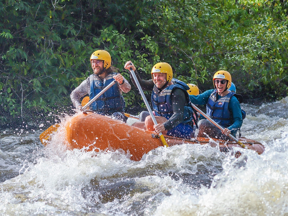
    For a bigger adrenaline hit, rafting on the Rio Novo runs through Class III and IV rapids. The same river holds one of the last populations of the Brazilian merganser (Mergus octosetaceus), listed as Critically Endangered by the IUCN with fewer than 250 individuals worldwide, so quiet stretches double as birdwatching. Trips usually stop at sandy river beaches along the way.

    Four travelers in an orange raft paddling through the whitewater rapids of the Rio Novo in Jalapão

    Waterfalls

    Cachoeira da Formiga drops into a pool of green water clear enough to see the bottom, making it the easiest swim in the park.

    Cachoeira da Velha, on the Rio Novo, is the opposite: a wide, high-volume cascade you watch rather than swim in, and the launch point for most rafting descents.

    Swimmers underwater in the clear turquoise water of Cachoeira da Formiga in Jalapão
    Photo: @viagemnarelacao

    Trails, dunes and sunrises

    Begin your day early watching the sunrise from Serra do Espírito Santo, a sandstone ridge rising to nearly 900 meters. Later, wrap up the day at the Jalapão dunes, the sole dune field in the Brazilian Cerrado, featuring peaks reaching up to 40 meters high.

    The dunes were built from sand eroded off the Serra itself, carried by wind that has been dropping it in the same place for millennia.

    Group of hikers on a red-rock trail through the Cerrado in Jalapão State Park

    Local communities

    The Mumbuca quilombola community, in Mateiros, is the birthplace of the golden-grass craft that now supports dozens of families across the region. Visits usually include the workshops, a home-cooked meal, and the story of how the harvest came to be regulated.

    Around 54 families take part in the annual harvest, which the community celebrates with the Festa da Colheita do Capim Dourado.

    👉 Read more: What to do in Jalapão?

    How many days do I need in Jalapão?

    Four days is the practical minimum. Jalapão State Park is large, its attractions are scattered, and each base, from Ponte Alta to Mateiros and São Félix do Tocantins, opens a different set of them. This window lets you see the headline sights without spending the whole trip in a vehicle.

    Keep the road time in mind. Reaching any of the gateway towns takes at least 4 hours from Palmas, and moving between attractions inside the region eats more hours than the map suggests. If your schedule is tight, that travel time is what gets cut from your sightseeing.

    Five or six days changes the trip. The extra days buy longer hikes, attractions off the main circuit, unhurried mornings at the fervedouros before the day groups arrive, and real time with the local communities.

    Sunset over the Cerrado in Jalapão, with buriti palms silhouetted against an orange sky

    Do I need a guide to visit Jalapão State Park?

    It is not compulsory, but going with a professional guide is strongly recommended. The roads are sand and dirt, suitable only for 4×4 vehicles, and signage is close to nonexistent. With a population density of 0.29 people per km² in Mateiros, you can drive for hours without meeting anyone to ask for directions.

    A guided tour also settles the logistics that are hard to arrange from outside the region: transport from Palmas and back, the timing of each fervedouro, permits and access to community visits, and support if a road washes out. It keeps your impact on the sites low and puts income into the communities that maintain them.

    A guide helping a traveler climb a ladder up a rock face in Jalapão State Park

    How much does it cost to visit Jalapão?

    The cost of a Jalapão tour depends on the length of the itinerary, the size of your group, and which activities you add.

    On PlanetaEXO, prices currently start at US$650 per person for the 4-day trip from Palmas, US$800 for the 5-day adventure, and US$1,150 for the 6-day trekking tour.

    Those rates cover a professional guide, accommodation, breakfast and lunch, all transport during the trip, and entry to the attractions on the itinerary. Prices per person fall as the group grows and rise in July (peak month), so the same itinerary can vary by more than 30% depending on when you travel and with how many people.

    One detail worth planning for: some activities are sold as optional add-ons, including sunrise at the Serra do Espírito Santo and rafting on the Rio Novo. Decide on those before you travel, as they change both the price and the shape of your days.

    👉 Explore the adventures:

    Traveler sitting on a sandstone cliff at sunrise, looking out over the Cerrado plain in Jalapão

    What to bring to Jalapão

    Pack for your specific itinerary, since hiking days, waterfalls, and rafting each call for different gear. This is the list we recommend to every traveler:

    • Long-sleeved shirt with UV protection
    • Hiking pants (lightweight pants or leggings)
    • Hiking boots or comfortable sneakers with good grip
    • Water shoes or a second pair of sneakers that can get wet for rafting
    • Sunscreen and insect repellent
    • Hat or cap
    • Sunglasses
    • Water bottle or canteen
    • Daypack of up to 20 liters for the trails
    • Light jacket for cooler nights from May to September, when lows reach 15 °C
    • Rain jacket between October and April, with the heaviest rain from December to March
    • Light clothing and swimwear

    Travelers with daypacks and sun hats at a Jalapão viewpoint over the Cerrado plain

    Is it worth visiting Jalapão in Brazil?

    Visiting Jalapão State Park is more than worth it! Few places put dune fields, Class IV rapids, clear-water waterfalls, and a spring phenomenon documented nowhere else within a few hours of each other inside the best-preserved block of Cerrado left in Brazil.

    Add the quilombola communities and the golden-grass craft, and you get a trip that is as cultural as it is outdoors.

    Visitor looking up at two tall waterfalls dropping into a red sandstone canyon in Jalapão

    Ready to discover Jalapão State Park?

    Now that you know when to go to Jalapão, how to get there, and how many days it takes, the only thing left is to pick your itinerary.

    PlanetaEXO is an ecotourism platform specializing in Jalapão tours. Working alongside the best local operators and guides in Tocantins, we handle 4×4 logistics, accommodation, and timing so you can concentrate on the breathtaking landscapes. Contact us now!

  • Mount Roraima's flat-topped tepui rising above the green Gran Sabana savanna in Venezuela

    Is it Safe to Travel to Mount Roraima in Venezuela?

    Learn everything you should know for a safe trip to Venezuela and a smooth trek across Mount Roraima

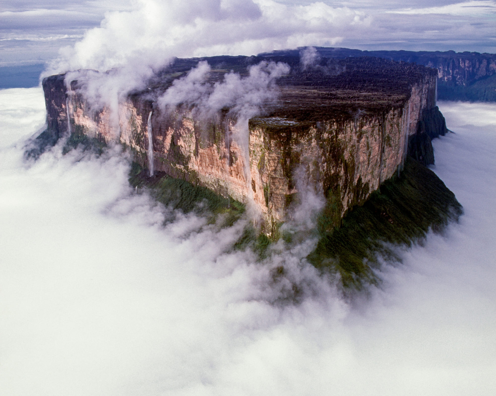
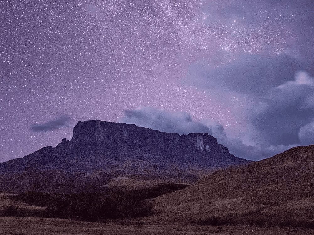
    Mount Roraima is the best known of the tepuis, the flat-topped table mountains that rise from the savannah where Brazil, Venezuela, and Guyana meet. Its sandstone plateau has stood for close to 2 billion years, and its summit reaches 2,810 meters (9,219 feet), making it Brazil’s 8th highest peak. About 85% of it sits inside Venezuela, which is behind most of the questions travelers have before they book.

    So, is Mount Roraima dangerous? Not in the way the rumors suggest. The real dangers are the cold, the high plateau, rugged terrain, remoteness, and the Venezuelan border—not crime or wild animals. As long as you do it the right way, your travel experience has no reason to be a problem.

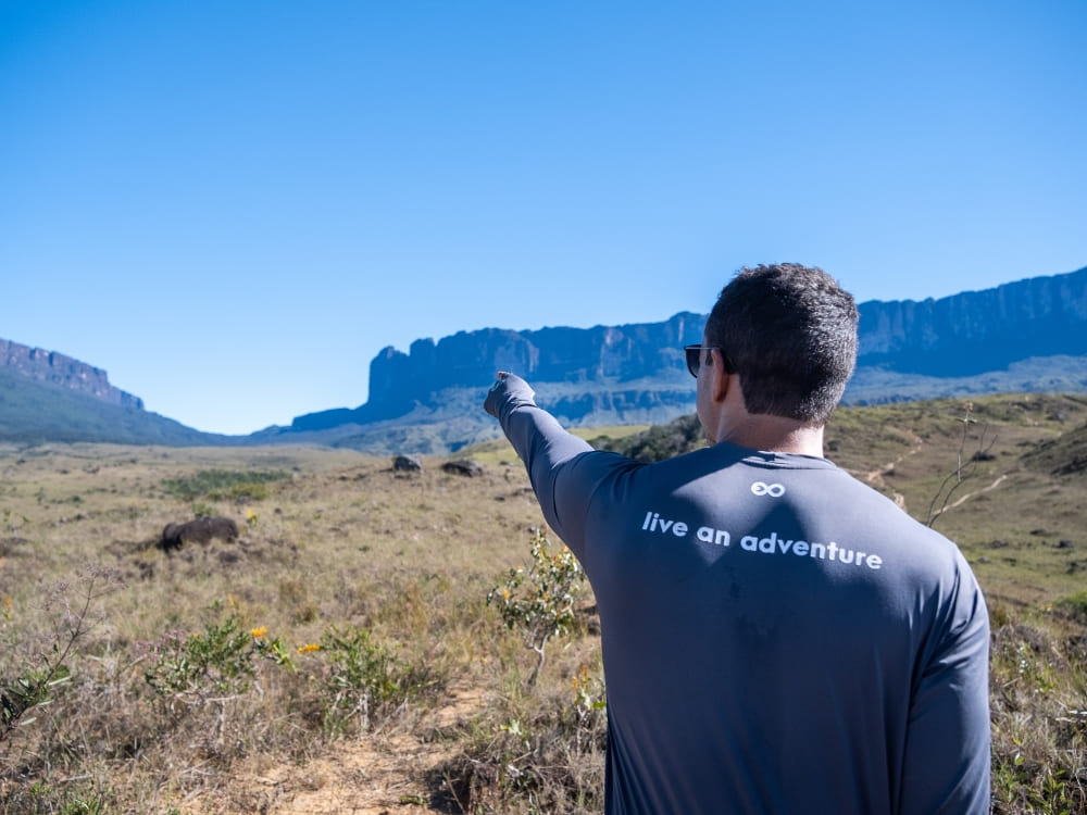
    PlanetaEXO guide pointing toward Mount Roraima across the Gran Sabana on a trip to Venezuela
    Photo: Lucas Gobatti

    PlanetaEXO, an ecotourism platform specializing in Mount Roraima tours, has put together this guide to help ease your worries. Check it out below!

    Approach from Boa Vista, on the Brazilian side

    The plateau can technically be reached through Venezuela, flying into Caracas and traveling overland, but almost nobody does.

    Brazil’s Roraima route is simpler, better serviced, and far less exposed. Boa Vista is a calm regional capital with daily flights and proper infrastructure, and the drive north on the BR-174 is straightforward.

    But is it safe to travel to Venezuela at all? This is the reassuring part. Since the Brazil–Venezuela border reopened in 2022, a dedicated tourist corridor lets groups with the correct permits reach the trailhead without passing through the parts that advisories warn about.

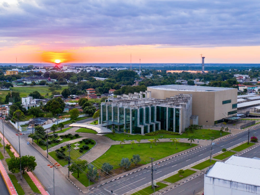
    Aerial view of Boa Vista, the Brazilian gateway city to Mount Roraima, at sunset
    Photo: Andreza Mariot

    👉 Read more: How to get to Mount Roraima?

    Respect the rules on both sides of the border for a smooth Roraima trip

    Since the Mount Roraima trek crosses into Venezuela, you deal with two sets of border rules. A valid passport is required for every nationality, Brazilians included, valid for at least six months beyond your entry date.

    Visa requirements vary: EU, UK, and most Latin American citizens enter Venezuela visa-free for tourism, while others, including U.S. and Canadian citizens, need a visa arranged in advance for Venezuela’s Roraima crossing.

    To have a safe trip to Venezuela, you should be aware of some restrictions. The U.S. Department of State rates the country “Level 3: Reconsider Travel” (its June 2026 update, eased from “Level 4: Do Not Travel”) and keeps a stricter warning on specific regions such as the Colombia border and Amazonas state, not the Gran Sabana corridor used to reach Roraima.

    This is where the tourist corridor matters. Since 2022, a dedicated, permit-controlled corridor connects the Brazilian border to Paraitepuy, so travelers move through a monitored route rather than the open country. Your time in Venezuela is short, guided from start to finish, and spent in the peaceful Gran Sabana, well away from the flagged areas.

    If you’re wondering if it’s safe to go to Venezuela for the Mount Roraima hike, the answer is yes, as long as you properly plan your trip: stay on the tourist corridor and check your own government’s current travel advisory before you book, as the situation can change.

    The Brazil–Venezuela border marker with both national flags, on the crossing used to reach Mount Roraima
    Photo: Paolo Stefano

    👉 Read more: Do I need a Visa to visit Mount Roraima in Venezuela?

    Trek with experienced, qualified guides and a reputable operator

    Choosing a qualified guide and a trusted tour operator is your single most critical safety choice—and for Mount Roraima, it is mandatory.

    National park rules require every group to trek with certified local guides, and independent trekking is not allowed. The guides are Indigenous Pemón from the Paraitepuy community, who handle the route, the camps, and the cooking.

    A reputable operator does more than lead the trail: it arranges the border formalities, the transfers, the meals, and the shared gear so the logistics that trip up solo travelers are taken care of.

    Venezuela’s park authority, Inparques, also caps groups at 8 trekkers in peak periods and 16 in regular season, always with at least two guides. That support structure is precisely what differentiates standard options from top-tier Roraima tours.

    Trekkers with backpacks approaching Mount Roraima on the trek across the Gran Sabana
    Photo: Lucas Gobatti

    👉 Explore the adventure: Mount Roraima Trek: 8-Day Expedition to the Lost World

    Follow your guide and keep the group together

    The dangers of Mount Roraima become much less significant when you follow your guide’s lead. They read the weather, judge the river crossings, set the pace on La Rampa, and decide when the plan needs to change—which changes often on the plateau, as the mist can close in within minutes and rock turns slick the moment it rains.

    Stay with the group, tell your guide early if you feel unwell or are struggling with the cold or the altitude, and don’t wander off the marked route on the plateau, where sinkholes and drop-offs hide in the fog.

    Don’t see good communication as a formality but as a way to keep such a remote trek safe.

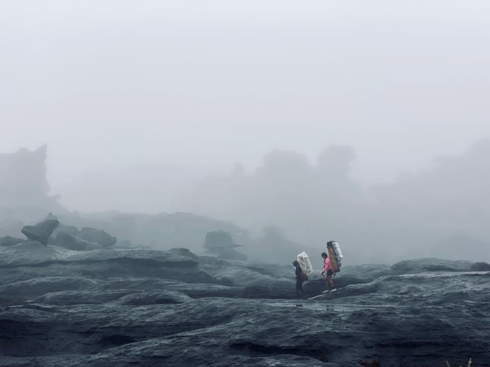
    Hikers crossing Mount Roraima's misty summit plateau among dark rock formations
    Photo: Lucas Gobatti

    Pack the right gear, clothing and medication

    The dangers of Mount Roraima are more about the cold, wet weather than anything else. To make sure you won’t have any health issues during the trek and go back home sick, your packing list is safety equipment.

    Temperatures on the plateau can plummet to around 5°C overnight and hover near 0°C during rainfall. Combined with frequent exposure to heavy mist and rushing waterfalls, keeping warm and dry becomes a crucial defense to avoid hypothermia rather than a mere matter of personal comfort.

    Here are the essentials:

    • Well-worn, waterproof trekking boots (new boots cause blisters) and trekking poles for the steep descent.
    • A high-quality rain jacket, pack cover, and dry bags to keep everything inside your backpack dry.
    • Thermal base layers, a warm jacket, gloves, and one set of dry clothes kept only for sleeping.
    • A sleeping bag rated to 0°C, a headlamp with spare batteries, and a 1-liter bottle with water purification tablets.
    • A personal first-aid kit and any personal medication, plus sunscreen and a wide-brimmed hat for the exposed savannah.

    Keep your international yellow fever vaccination certificate stored right alongside your passport. It’s also essential to carry cash in Brazilian Reais to cover expenses where cards aren’t accepted, as ATMs are extremely hard to find near the border.

    Hiker on Mount Roraima's rocky summit plateau in the mist during the Roraima trek
    Photo: Lucas Gobatti

    👉 Read more: 10 Travel Tips for Mount Roraima to make the most of your trip

    Take out adventure travel insurance

    Some might consider Mount Roraima dangerous in the sense that, in a remote location such as this, serious injuries can mean a slow, weather-dependent evacuation.

    Accidents are avoided when hikers follow the guide’s instructions, use the right equipment, and recognize their limits, but unforeseen events can still occur. That’s why travel insurance that covers remote, high-altitude trekking is mandatory.

    Make sure your policy explicitly covers trekking to around 2,800 m, medical evacuation, and repatriation, because standard vacation insurance often excludes exactly this kind of trip.

    If you’re not sure where to find coverage for everything you need, reliable operators can point you in the direct direction—another reason to book your Mount Roraima trek with specialists!

    Know your limits and do your homework

    The last piece of safety is honest self-assessment. The Mount Roraima trek is graded as challenging, including roughly 86 km on foot, a steep 4.5 km ascent, multiple nights in a tent, and days that run up to 8 hours. You don’t need to be an athlete, but you should be able to walk several kilometers with a loaded pack on consecutive days.

    A couple of months of hiking, cardio, and leg training beforehand make the difference between suffering and enjoying it, so research the mountain, the route, and the season before you commit.

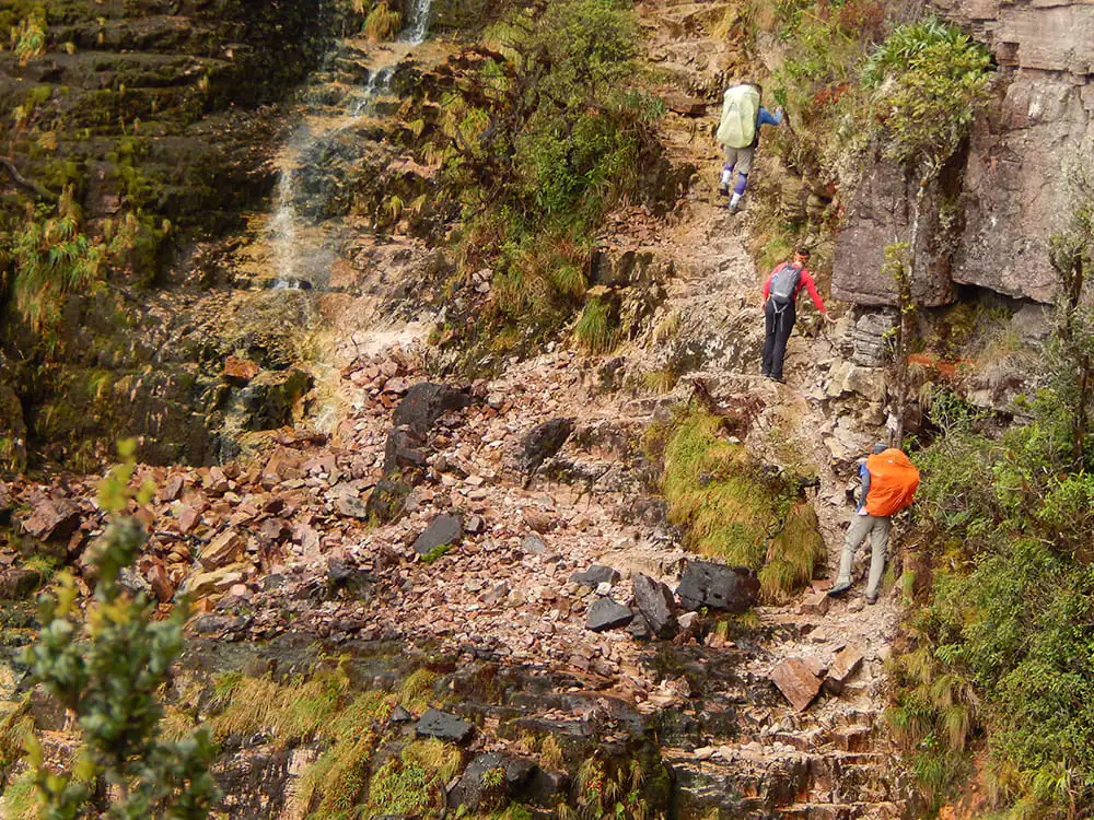
    Trekkers climbing the steep rocky ascent of La Rampa on the Mount Roraima hike
    Photo: Lucas Gobatti

    👉 Read more:

    Safely trekking Mount Roraima with PlanetaEXO

    Mount Roraima is dangerous only if you go unprepared or alone. For a smooth trek, do it the right way: pack your gear, follow border protocols, get travel insurance, and hire local guides. If you just want to enjoy the trail and not worry about anything else, an experienced operator can take care of all that!

    PlanetaEXO is an ecotourism platform that runs Mount Roraima tours with experienced Indigenous Pemón guides and trusted local partners, handling everything from the border crossing to the summit camps. Our team takes care of the logistics, the permits, and the safety of your trip to Venezuela. Contact us now!

  • How to Visit the Pantanal in Brazil: Travel Guide

    How to Visit the Pantanal in Brazil: Travel Guide

    Are you wondering what the best way to visit the Pantanal is? In this travel guide, you’ll find everything you need to plan your trip to Brazil’s wildlife haven.

    Home to the greatest population of jaguars in the world, and the best wildlife watching destination in Brazil, the Pantanal has hundreds of different species of birds and mammals. Its vast expanse and unique ecosystem offer an unparalleled experience for nature enthusiasts, making it a must-visit place for those seeking adventure and connection with nature.

    As a platform specialized in Pantanal tours that works with the best local operators, PlanetaEXO has put together a comprehensible travel guide with essential information for your trip, such as when is the best time to visit, how to get there, what to do and where to stay. Check it out below!

    Table of contents:

    1. About the Pantanal
    2. Where is the Pantanal?
    3. What is the wildlife like in the Pantanal?
    4. How to get to the Pantanal in Brazil?
    5. When is the best time to visit the Pantanal?
    6. What to do in Pantanal? 
    7. Where to stay in the Pantanal, Brazil?
    8. How many days should I stay in the Pantanal?
    9. What is the best Pantanal safari? 
    10. What should I pack for a Pantanal trip in Brazil?
    11. What makes the Pantanal so special?
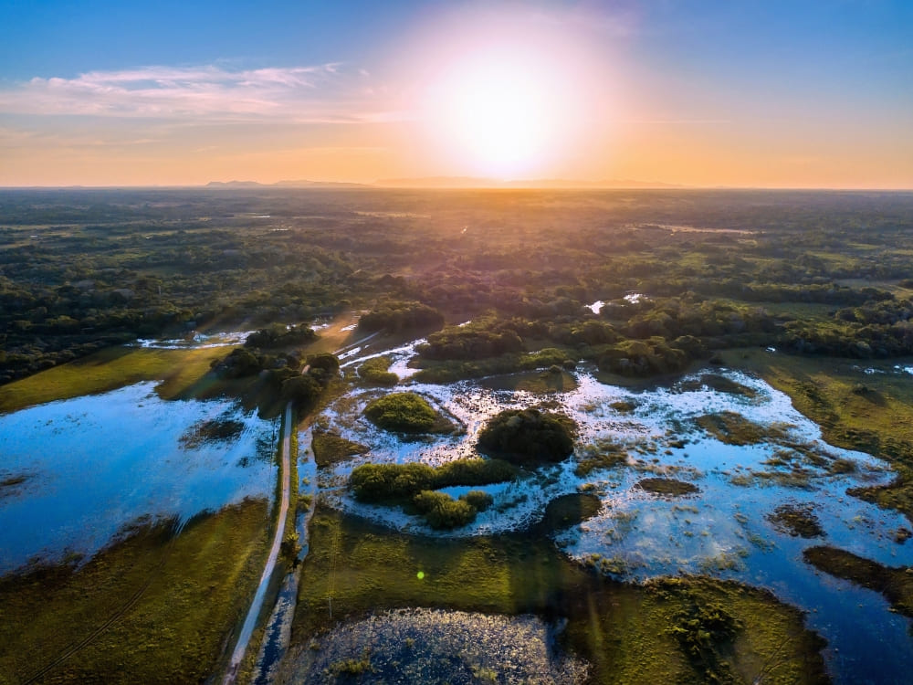
    Panoramic aerial view of flooded plains, winding rivers, and green forests of Pantanal, Brazil under a bright sun.
    .

    About the Pantanal

    The largest wetland on the planet and a UNESCO World Heritage site, the Pantanal harmoniously combines fauna, flora and water. Fed by the Paraguay, Cuiabá, Miranda and Taquari rivers, it’s characterized by seasonal flooding and directly influenced by three major Brazilian biomes: Amazon Rainforest, Cerrado and the Atlantic Forest.

    The Pantanal’s rich biodiversity is complemented by its cultural significance, allowing visitors to immerse themselves in the traditional lifestyle of local communities that have coexisted with this ecosystem for generations.

    Economically, the Pantanal thrives on fishing activities, tourism, and cattle farming, all with a strong commitment to conservation. Over the years, efforts to educate locals and tourists about the socioeconomic benefits of preserving the biome have been successful, fostering a balanced, imperative relationship between wildlife and human activities. 
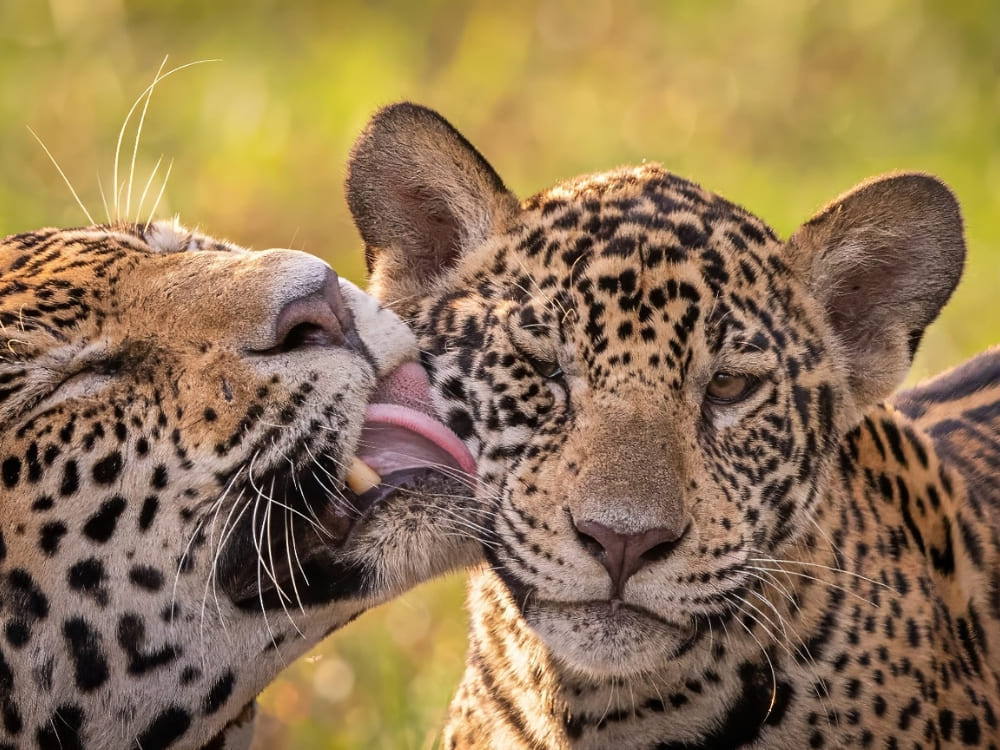
    Close-up of an adult jaguar licking and grooming a cub in the wild, showcasing the rich biodiversity of Pantanal, Brazil.
    @matthias_kern_photography

    👉 Read more: 10 facts about the Pantanal

    Where is the Pantanal?

    The Pantanal is so massive it extends itself across Brazil, Bolivia and Paraguay, but most of its territory is located within Brazilian borders, in the states of Mato Grosso and Mato Grosso do Sul.

    Divided by Northern and Southern Pantanal, the biome spans over 210,000 square kilometers — only a bit smaller than the entire territory of Guyana (214,969 km²)!

    What is the wildlife like in the Pantanal?

    Despite being often overshadowed by the Amazon, the Pantanal hosts the continent’s highest concentration of wildlife. It’s a haven for wildlife observers and photographers, boasting around 325 species of fish, 656 birds, 159 mammals, 53 amphibians and 98 reptiles.

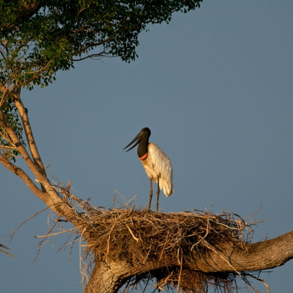
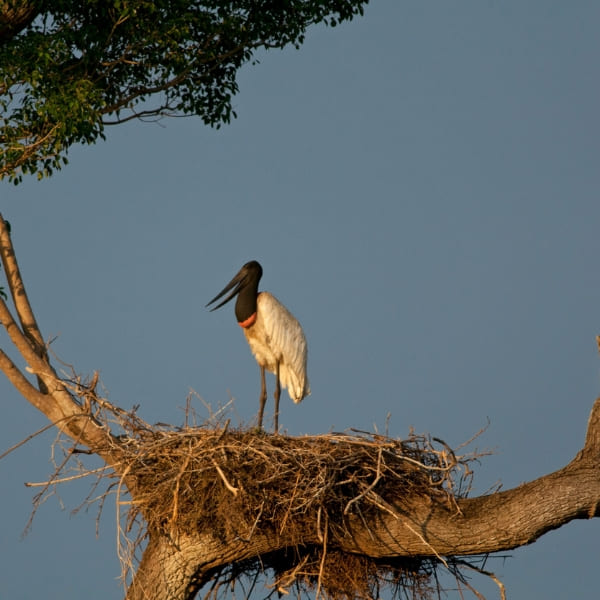
    Jaguars are the stars of Brazilian wetlands, but other native animals are often spotted roaming around, like capybaras, giant otters, jabiru storks, mash deer and the mysterious maned wolf. 
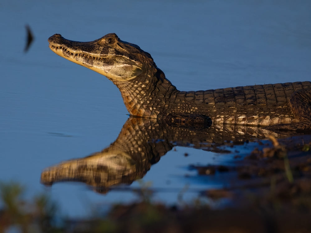
    A caiman resting in calm water with its head reflected on the surface during a boat trip in Pantanal, Brazil.
    Photo: Keith Ladzinski, Caiman

    👉 Read more:

    How to get to the Pantanal in Brazil?

    When planning your trip, it’s important to understand if you’re going to the North or South Pantanal. Naturally, different routes should be considered.

    For adventurers exploring the Northern Pantanal, the gateway is Cuiabá, capital of Mato Grosso, accessible via Marechal Rondon International Airport (CGB) and served by direct flights from Brazilian capitals (São Paulo, Rio de Janeiro, Belo Horizonte, Brasília, etc). If you’re going to Porto Jofre via Poconé, the journey continues along the Transpantaneira Highway.

    👉 Compare our Pantanal tours from Cuiabá

    Campo Grande, capital of Mato Grosso do Sul, is the starting point for traveling to Aquidauana, Miranda, and Corumbá — cities that surround the Southern Pantanal. Campo Grande International Airport (CGR) offers direct flights from São Paulo, Rio, Campinas, Brasília, etc.
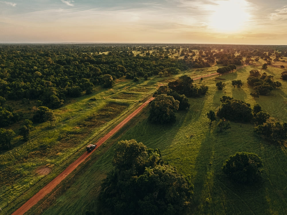
    👉 Compare our Pantanal tours from Campo Grande

    A 4x4 safari vehicle driving along a dirt road through the lush wetlands of Pantanal, Brazil.
    Photo: Felipe Castellari, Caiman

    👉 See more details: How to get to the Pantanal, Brazil

    When is the best time to visit the Pantanal?

    The Pantanal is a year-round destination. Each season has its own unique charm and opportunities for exploration.

    The rainy season (November to December) turns the vegetation into a vibrant green, while the wet season (January to March) is known for the plain floods and river overflows — perfect for boat tours and birdwatching. 

    During the intermediate season (April to June), the water levels start to drop, making it a great time for the fauna. The dry season (July to October) is even better for wildlife watching, as well as horseback riding and hiking.
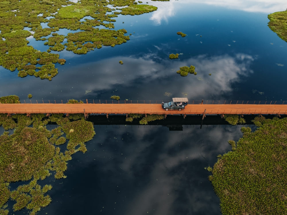
    An aerial view of a safari vehicle crossing a long wooden bridge over the flooded wetlands during a Pantanal safari in Brazil.
    Photo: Felipe Castellari, Caiman

    👉 See more details: When is the best time to visit the Pantanal?

    What to do in the Pantanal? 

    Pantanal experiences are as abundant as the biome itself. See the main activities below!

    Horseback riding

    Horseback riding is a traditional way of exploring, allowing visitors to cross flooded areas and access hard-to-reach places. That’s how you dive deep into the true Pantanal lifestyle!
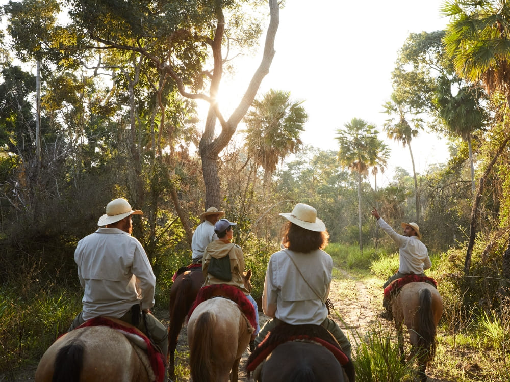
    A group of travelers on horseback led by a guide through a sunlit forest trail in the Pantanal.
    Photo: Layla Motta, Caiman

    Jaguar sighting

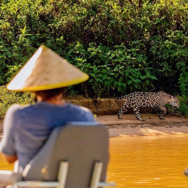
    The Pantanal is the best place in the world to see jaguars in their natural habitat. In the Northern Pantanal, particularly around Porto Jofre, jaguar sightings are frequent along the banks of the Cuiabá River. Most lodges offer boat safaris that provide excellent opportunities to observe and photograph the largest feline of the Americas.

    👉 Compare our Pantanal jaguar tours in the north and south

    Spotting jaguars in South Pantanal is less likely, but definitely not impossible. Casa Caiman, in Miranda, is the only place in the area where these animals can be seen.
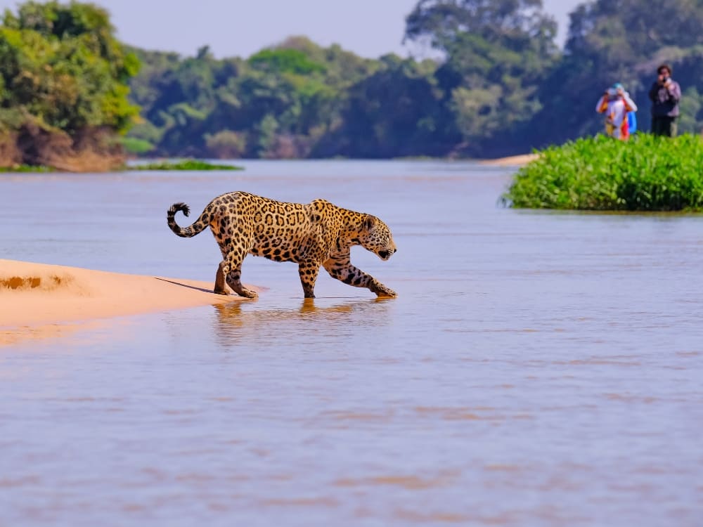
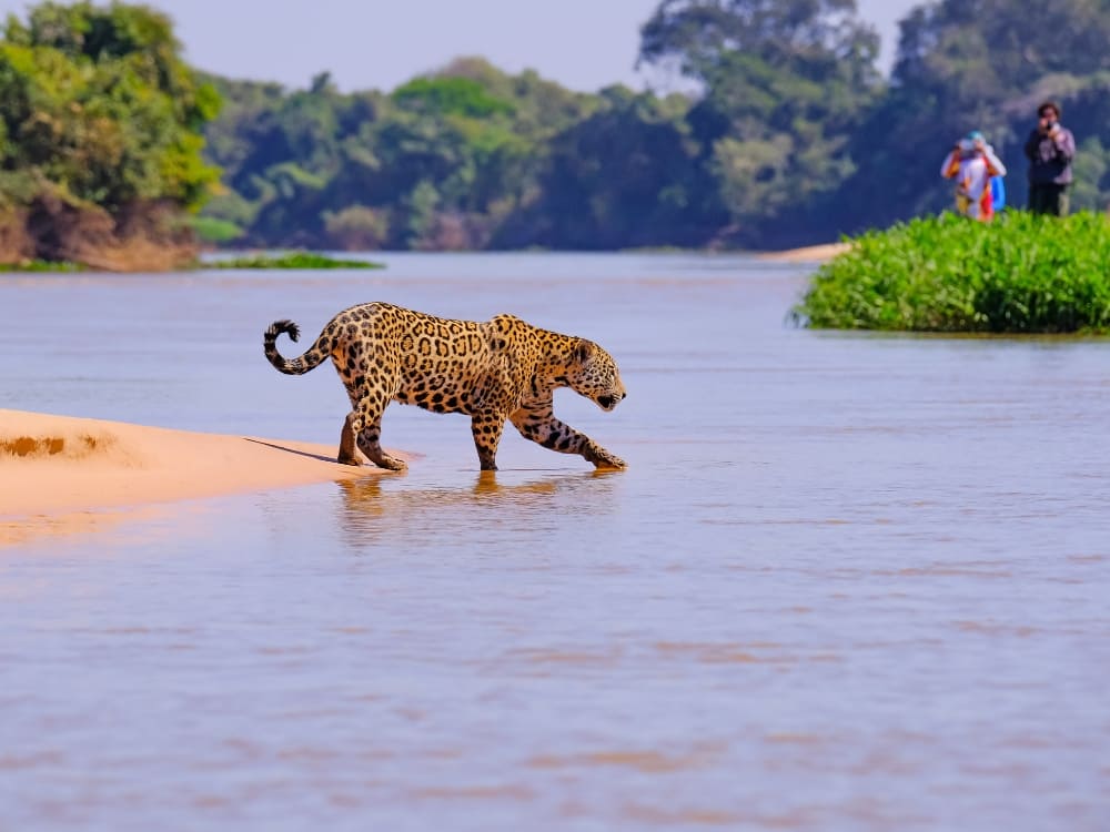
    A wild jaguar walking into the river from a sandbank with observers in the distance in Pantanal, Brazil.
    .

    Photo safaris

    Pantanal photo safaris are conducted in 4×4 vehicles, which allow visitors to explore diverse landscapes and capture stunning images of the wildlife, while also enabling access to remote areas. Naturally, this increases the chances of encountering rare species and getting close-up shots of the biome’s rich biodiversity.

    To guarantee the best shots, photo safaris are led by experienced guides who know the perfect spots to photograph birds, reptiles, and mammals.
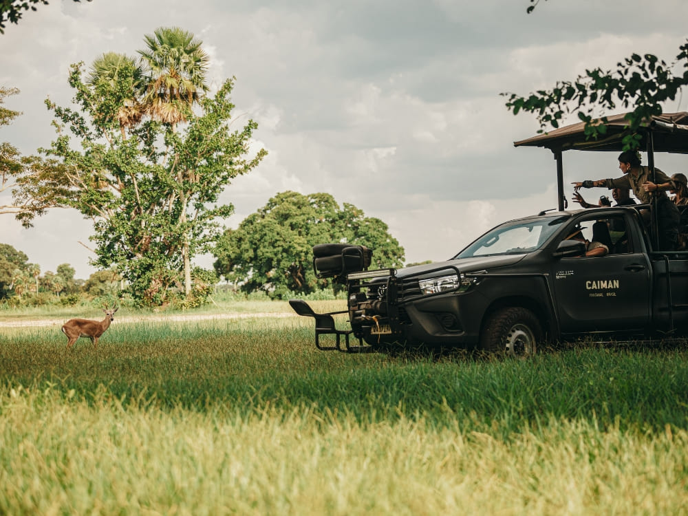
    Travelers in a branded 4x4 safari vehicle observing a marsh deer in a grassy field in Pantanal, Brazil.
    Photo: Felipe Castellari, Caiman

    Boat trips

    Boat trips are incredible options to observe the wildlife from the water. As you navigate the rivers, you can spot a wide variety of Pantanal animals, including capybaras, caimans, giant otters, and numerous bird species. 
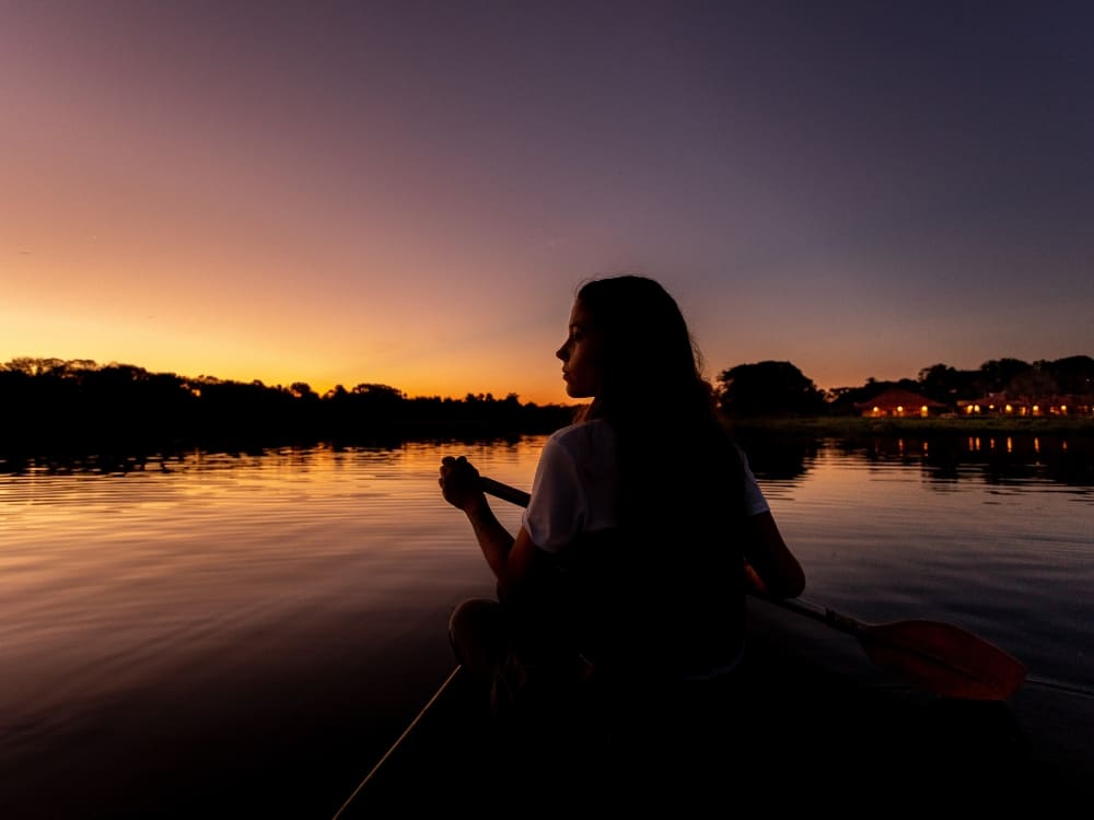
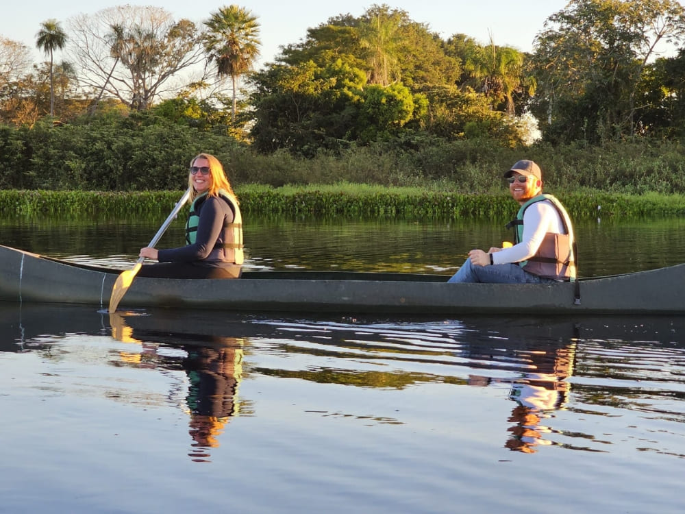
    A woman paddling a canoe on a calm river at sunset, highlighting the peaceful nature of a Pantanal trip.
    Photo: Felipe Castellari, Caiman

    Night spotlighting

    When night falls, tour guides take visitors to the wetlands to watch nocturnal animals, like owls and caimans. Using spotlights and flashlights, experiencing the Pantanal come alive at night is unforgettable, as many species are more active and easier to see under the cover of darkness.

    Close-up of a small owl peering from a tree hollow during a night spotlighting tour in Pantanal, Brazil.
    @allecgomes.jpg

    Ecological walks

    Ecological walks across the Pantanal are guided hikes that allow visitors to discover the area’s flora and fauna on foot. These walks are led by seasoned guides who share insights about the ecosystem, plant species, and animal behaviors.
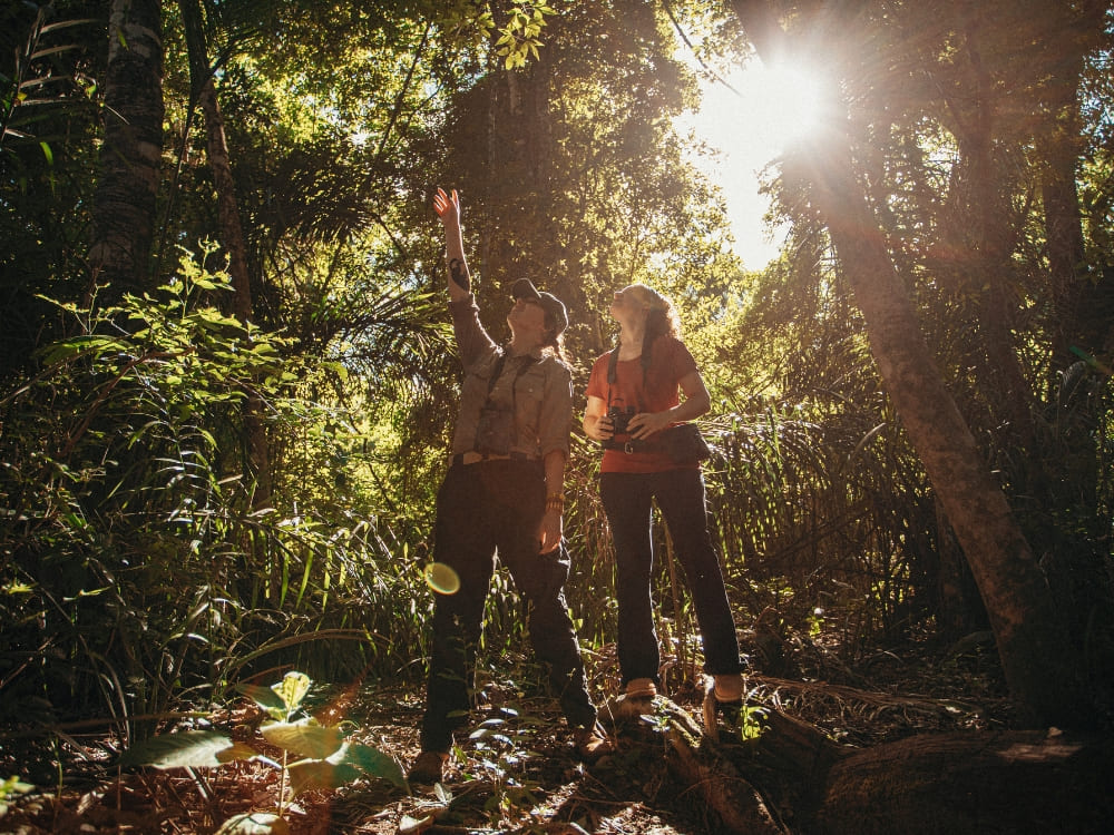
    Two hikers looking up and pointing at the forest canopy during a guided ecological walk in the Pantanal.
    Photo: Felipe Castellari, Caiman

    👉 Check our Pantanal tours and enjoy these incredible experiences!

    Where to stay in the Pantanal, Brazil?

    In general, the accommodations in the Pantanal are typically found on traditional farms that have been transformed into conservation areas due to ecotourism efforts. This provides an authentic taste of the Pantaneiro lifestyle while you enjoy a wonderful stay experience with delicious meals, comfortable rooms and premium services.

    If you’re heading to Northern Pantanal, book your stay in Porto Jofre, Poconé, Barão de Melgaço or Cáceres. You’ll find simple, yet cozy accommodations with a charming rustic style that reflects directly into local day-to-day life.

    Miranda, Aquidauana and Corumbá, in Southern Pantanal, have a great variety of accommodations, from modest to luxury. Regardless of the category, they all combine hospitality, comfortable facilities and sustainability.
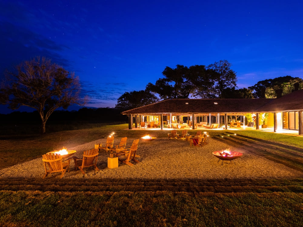
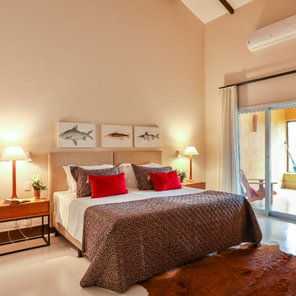
    The exterior lounge of Casa Caiman at night, featuring fire pits and wooden chairs under a deep blue starry sky.
    Photo: Felipe Castellari, Caiman

    👉 Read more: Where to stay in the Pantanal?

    How many days should I stay in the Pantanal?

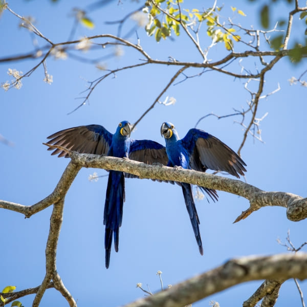
    You need at least 4 days to truly enjoy the richness of the Pantanal with safaris at sunrise and sunset, explore different habitats, and increase your chances of seeing species like jaguars, giant otters, hyacinth macaws, capybaras, etc.

    By staying 5 days or more, you’ll have the opportunity to visit more remote regions, join specialized activities (jaguar tracking, birdwatching expeditions, photography-focused tours), and engage more closely with local conservation projects.

    Don’t forget: reaching one of the biome’s gateway towns requires a considerable amount of time on the road due to the distances involved, so be prepared to set aside at least 3 hours. The drive itself is a mini-adventure that offers great opportunities for wildlife spotting. Enjoy this journey as a part of your Pantanal trip!
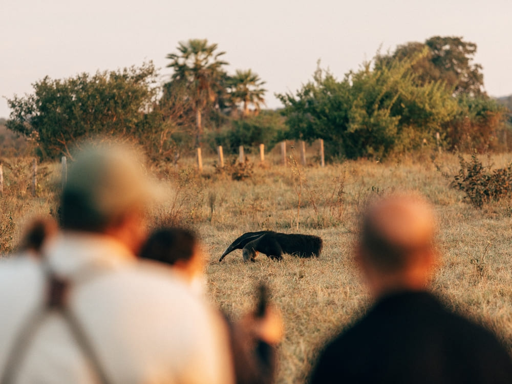
    Travelers observing a giant anteater foraging in an open field during a Pantanal trip at dusk.
    Photo: Felipe Castellari, Caiman

    👉 See more details: How many days should you spend in the Pantanal?

    What is the best Pantanal safari? 

    When choosing your Pantanal safari, several factors come into play: type of wildlife, comfort level, preferred activities and budget.

    The Northern Pantanal, especially around Porto Jofre, is perfect for wildlife watching. Boat safaris often sail across Cuiabá River in search for jaguars and other native species. Check it out: Pantanal Jaguar Safari in Porto Jofre, Cuiabá.

    Alternatively, the Southern Pantanal also offers remarkable safari experiences. If you have a larger budget, the best option is the ecological refuge for jaguars, notable for its conservation and education efforts that help sustain local wildlife and promote eco-friendly tourism.

    This is also the only place in the South that guarantees a 98% chance of jaguar sightings while also providing luxury accommodations. Check it out: Pantanal Luxury Safari.

    For those on a limited budget, there are other options for safaris in the Southern Pantanal, including Pantanal tours from Campo Grande. Adventures like this provide an incredible wildlife viewing experience with horseback riding, boat tours, jeep safaris, and ecological walks. Accommodations are simple, yet incredibly cozy.
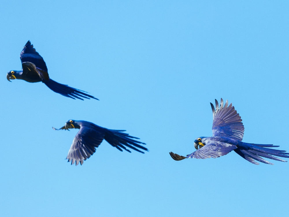
    Three vibrant hyacinth macaws with deep blue feathers flying across a clear sky during a Pantanal safari in Brazil.
    Photo: Felipe Castellari, Caiman

    👉 Read more: Which is the best Pantanal Safari Tour in Brazil?

    What should I pack for a Pantanal trip in Brazil?

    When preparing for a trip to the Pantanal, packing the right gear is essential to ensure comfort and safety. Here’s a list of must-bring items to make the most of your experience:

    • Light clothes, including at least one UV long-sleeved shirt and shorts/pants (earth or light colors)
    • Lightweight jacket
    • Windbreaker or rain jacket
    • Swimming suit
    • 2 pairs of shoes (sneakers/walking shoes and hiking boots)
    • Sandals (or water shoes)
    • Socks
    • Hats
    • Sunglasses
    • Waterproof sunscreen (SPF30+)
    • Insect repellent
    • Bath towel and washcloth
    • Camera, batteries/battery charger for cameras (underwater camera is also highly recommended)
    • Headlamp or flashlight + extra batteries
    • Dry-bag for cameras and personal gear
    • Daypack for hiking and short outings
    • Binoculars
    • Non-perishable snacks
    • Non-breakable reusable water bottle
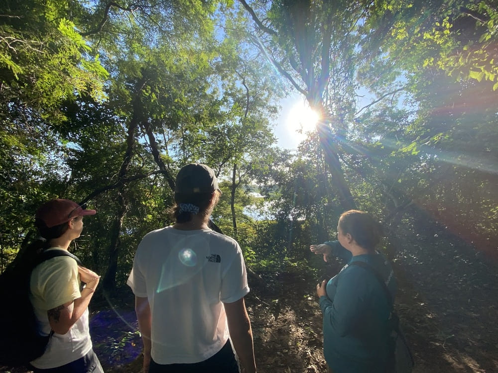
    Three travelers guided through a dense forest path with sunlight filtering through the trees in the Pantanal
    .

    What makes the Pantanal so special?

    Traveling to one of the world’s most fascinating ecosystems not only allows for an escape from the urban pace, but it also provides an authentic immersion in untouched nature.

    The Pantanal is a one of a kind destination, offering the opportunity to witness rich biodiversity while encouraging local tourism, supporting communities, and helping conservation efforts.

    Local customs also add an enriching cultural layer to the journey. Through ecotourism activities, visitors dive deep into the unique blend of tradition and nature to live experiences found nowhere else on Earth.
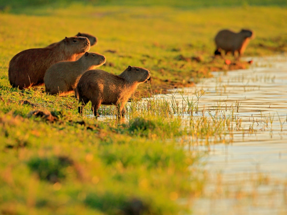
    A group of capybaras standing in the grass by a riverbank in the early morning light of Pantanal, Brazil.
    .

    Book your trip for the Pantanal in Brazil with PlanetaEXO

    We hope you’ve enjoyed our Pantanal travel guide! Now that you know everything about this incredible place, it’s time to start vacation planning.

    PlanetaEXO specializes in Pantanal tours and connects you with the best ecotourism operators while assisting with tailor-made itineraries, transfer options and much more. Book now!
  • How to visit Mount Roraima – Travel Guide

    How to visit Mount Roraima – Travel Guide

    Learn everything you should know to travel to Mount Roraima, including how to get there, the best time to visit, main attractions, and more!

    Standing tall at an impressive altitude of 2,810 meters (9,219 feet), Mount Roraima is the 8th highest peak in Brazil and one of the tallest on the planet.

    Known for its wild beauty, ancient geological formations, and spirituality, it attracts thousands of tourists from all over the world. According to Brazil’s Ministry of Tourism, the state of Roraima welcomed over 16,000 foreign travelers in 2024—a good chunk had the mountain as their destination.

    Curious to learn more? PlanetaEXO, an ecotourism platform specializing in Mount Roraima tours, has put together a comprehensible travel guide with all the essential information for a fantastic trip. Check it out below!

    Table of contents

    1. About Mount Roraima
    2. Is Mount Roraima the Oldest Place on Earth?
    3. Where is Mount Roraima Located?
    4. How to Get to Mount Roraima?
    5. When is the Best Time to Visit Mount Roraima?
    6. Main Attractions: What’s on Top of Mount Roraima
    7. Can You Visit Mount Roraima?
    8. Is it Safe to Visit Mount Roraima?
    9. What to Pack for a Mount Roraima Hike?
    10. How Hard is it to Trek Up Mount Roraima?
    11. How Many Days Should You Stay in Mount Roraima?
    12. Mount Roraima Tours
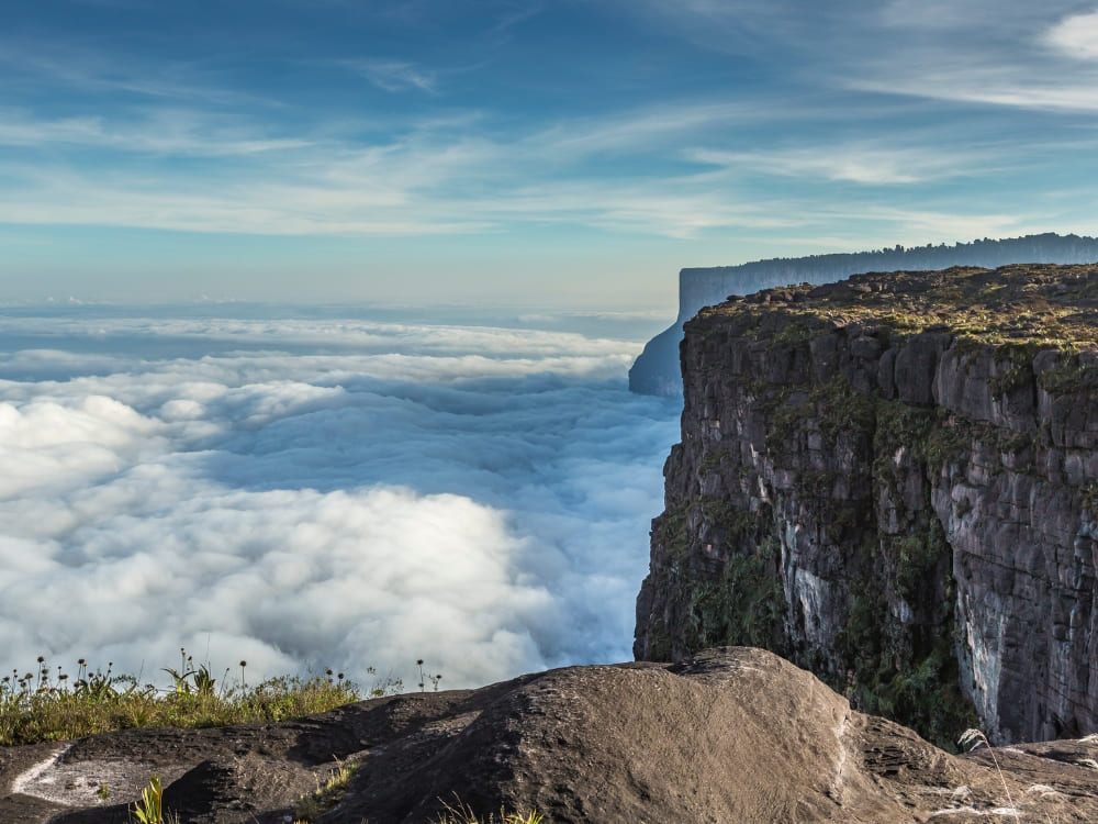
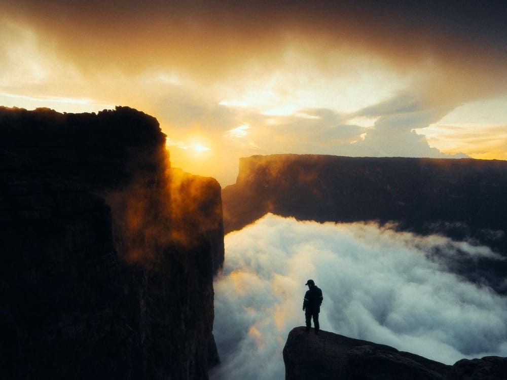
    Sunset over the cliff edge of Mount Roraima's summit, above a sea of clouds
    @watchluke

    About Mount Roraima

    Mount Roraima is a tepui, a table-shaped geological formation typical of the northern region of South America. Offering breathtaking views of plateaus, cliffs, and unique natural landscapes, it was first climbed in 1884 by British explorer Sir Everard im Thurn.

    The discovery of a remote and mysterious place inspired one of the most famous literary works of all time. The Lost World, written in 1912 by Sir Arthur Conan Doyle, was entirely inspired by Roraima. In the story, a group of scholars sets off from London to explore an isolated plateau where dinosaurs and other prehistoric creatures survived extinction. The book, in turn, inspired Jurassic Park.

    Outside of fictional books and films, the mythology of Mount Roraima is well-known. The main one is the legend of Makunaíma, an indigenous hero who was born from a lake fertilized by the sun and the moon. Clever, strong, and just, he is the protector of the Tree of All Fruits, a magical tree that provides all foods. The origin of the story is attributed to the Macuxi indigenous group.

    This legend served as inspiration for the eponymous work by Brazilian author Mário de Andrade—he also based his work on the accounts of the German explorer Theodor Koch-Grünberg. In the 1928 book, Macunaíma is an antihero who goes to São Paulo to retrieve a valuable artifact.

    For the indigenous people of the region (Macuxi, Pemón, Taurepang, Arekuna, and Kamarakoto, etc.), Mount Roraima is a sacred place. It is believed that the so-called Land of Makunaíma has a powerful connection between man and nature, balancing respect, ancestry, and mystical aspects.

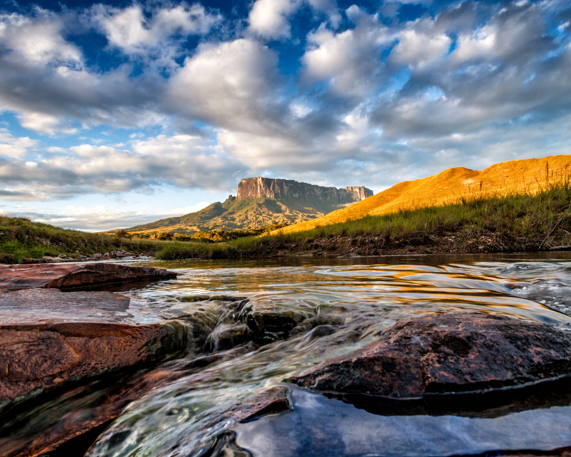
    The Kukenán tepui next to Mount Roraima reflected in a river at golden hour
    .


    Is Mount Roraima the Oldest Place on Earth?

    The geological composition of Mount Roraima is predominantly formed by Precambrian rocks dating back approximately 2 billion years, providing a window into the planet’s distant past.

    Over millions of years, the mountain has resisted relentless erosion, shaping its unique landscape and revealing its flat plateau that extends for about 31 km².

    In addition, tectonic activity has also sculpted Roraima—a crucial factor for its title as the oldest place on Earth, as it is part of the ancient Pakaraima mountain range, formed over billions of years by the movement of the tectonic plates.

    Where is Mount Roraima Located?

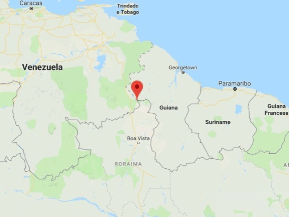
    Mount Roraima is located on the triple border of Venezuela, Brazil, and Guyana, in South America. The largest share is situated within Venezuelan borders (85%), while the Brazilian and Guyanan sides represent 5% and 10%, respectively.

    In Brazil, the area is overseen by the state of Roraima, more specifically in the city of Uiramutã. See the map of Mount Roraima below:

    How to Get to Mount Roraima?

    The most convenient access to Mount Roraima is via Boa Vista, the capital of the state of Roraima, Brazil. Boa Vista Airport (BVB) receives daily flights from Brasília, Manaus, and São Paulo.

    From there, travelers head north on the BR-174 highway, crossing into Venezuela and arriving in Santa Elena de Uairén, in Gran Sabana, Bolívar, the main hub for expeditions (20 km away from Brazil). This town provides accommodations and a pause before the trek begins.

    While Santa Elena has a small airport, flights are rare and less reliable, making the road journey from Boa Vista the preferred option. From the city, the route continues toward the Community of Paraitepuy, the official gateway to the trails.

    The drive across the Gran Sabana reveals breathtaking landscapes, where travelers often catch their first glimpse of the tepui.

    A 4x4 jeep transfer crossing the Gran Sabana with Mount Roraima in the distance
    Photo: Lucas Gobatti

    👉 Read more: How to get to Mount Roraima?

    When is the Best Time to Visit Mount Roraima?

    The weather on Mount Roraima is highly unpredictable and follows the tropical climate of Venezuela. Rain, fog, and sudden temperature changes can happen at any time, so being prepared for all conditions is essential throughout the year.

    From October to March (dry season), the trek is generally easier, with less rain and clearer trails. Views from the top of Mount Roraima are more frequent, and temperatures range from 20–25°C (68–77°F) at the base to 10–15°C (50–59°F) at the summit during the day, dropping to 5°C (41°F) or even 0°C (32°F) at night.

    From April to September (rainy season), the trails become muddier and more challenging, but waterfalls are fuller, and some appear only during this period.

    Year-round, trekkers should expect cold nights, frequent winds, afternoon showers, and mist at the summit—elements that make every expedition unique.


    A hiker on a misty cliff at the summit of Mount Roraima, in black and white
    Photo: Lucas Gobatti

    Main Attractions: What’s on Top of Mount Roraima

    Crystal Valley

    Crystal Valley is a shallow depression on the Roraima plateau covered in millions of quartz crystals scattered across the dark sandstone like broken glass. The crystals were formed roughly 1.8 billion years ago, when the tepui was still part of an ancient seabed, making them among the oldest exposed minerals on Earth.

    Removing crystals is strictly forbidden by Venezuelan park authorities, and local Pemón guides treat the valley as sacred ground. The Pemón believe the crystals are fragments of stars that fell when Makunaima, the creator god, cut down the original tree of life.


    Lake Gladys

    Gladys is a small, dark pool on top of the plateau, named by British botanist Everard Im Thurn after the heroine of Arthur Conan Doyle’s The Lost World. The water sits in a natural sandstone basin and reflects the surrounding rock formations like a black mirror.

    The lake is one of the few permanent water sources on the summit, fed by the constant mist and over 4,000 mm of annual rainfall that hits the area. Endemic species like the tiny black Oreophrynella frog, found nowhere else on the planet, live in the moss around its edges.

    A dark natural pool on the summit plateau of Mount Roraima
    Photo: Luiz Gustavo Rebello

    👉 Read more: 10 Facts About Mount Roraima

    El Foso

    A circular natural well carved into the sandstone, roughly 20 meters deep, filled with rainwater so dark it looks like ink. El Foso’s walls drop almost vertically, polished smooth by millennia of erosion, and the surface stays still even on windy days because the pit sits below the level of the plateau wind.

    For the Pemón, El Foso is one of the “eyes of the mountain”—points where the spirits of Mount Roraima watch the world below. Trekkers who reach it usually swim a few strokes in water that hovers around 8–12°C year-round, even when the air above is warmer.

    A swimmer in the golden natural pool inside a cave at Mount Roraima

    Maverick Rock

    The most photographed rock formation on the summit, Maverick is a massive isolated boulder shaped by wind and rain into a form that resembles a face in profile. It stands near the edge of the plateau, with a sheer 400-meter drop behind it.

    The rock is part of the Mato-Tepui sandstone formation, the same geological layer that makes up the entire Pacaraima chain. The Pemón legend tells that the silhouettes carved by wind on the plateau are the frozen faces of warriors who challenged Makunaima and were turned to stone.

    Weathered rock formations across the summit landscape of Mount Roraima

    La Ventana

    La Ventana is a natural opening in the rock at the very edge of the plateau, framing a view of the savanna 1,000 meters below. On clear mornings you can see Kukenán-tepui to the west and, on rare days, all the way to the borders of Guyana.

    The window faces east, which makes it the most popular spot for sunrise on the trek. Mist rises from the savanna at dawn and pours through the opening, a phenomenon the Pemón call “the breath of the mountain.”

    A viewpoint on Mount Roraima looking out above the clouds
    @katharina_bongaertz

    👉 Read more: What’s on top of Mount Roraima?

    Jaccuzis

    The jacuzzis are a series of natural pools carved into the quartzite by streams running across the plateau—round, shallow basins of clear, freezing water surrounded by black rock. The largest are about 2 meters in diameter and 1 meter deep, fed by springs that emerge directly from the sandstone.

    Water temperature stays between 6 and 10°C all year, and the mineral content gives it a slight pink tone from the iron in the surrounding rock. Most groups stop here for a quick dip on the way to Triple Point (the spot where Venezuela, Brazil, and Guyana meet).

    A trekker swimming in a natural jacuzzi pool on Mount Roraima
    Photo: Lucas Gobatti

    Coati Camp

    Coati is a natural rock shelter (essentially a wide, shallow cave formed by overhanging sandstone) where trekkers sleep on the second or third night of the route, already on top of the plateau. A small stream of drinkable water runs nearby—a very welcome feature for campers.

    The roof of rock blocks most of the constant mist and rain that hits the summit, making it one of the few dry spots on Roraima and the reason every expedition uses it as a base.

    Tents set up in a rock shelter base camp on Mount Roraima
    Photo: Lucas Gobatti

    Can You Visit Mount Roraima?

    Yes, you absolutely can visit Mount Roraima, but it’s important to be aware that the location is remote, camping is the main form of accommodation, and some foreign travelers might need visas to enter Brazil and/or Venezuela.

    Canadian and United States citizens, for example, need a visa for both countries, while Chinese visas are only required in Venezuela. Upon arriving in Santa Elena de Uairén, Brazilians only need an ID.

    Find out if you need a visa on Sherpa and check the conditions of Brazil’s Ministry of Foreign Affairs and the official channels of the Venezuelan embassy in your country.

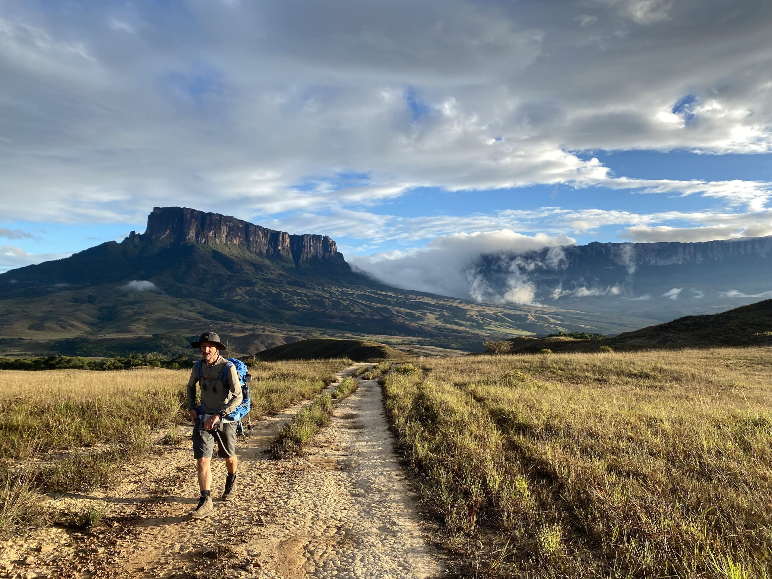
    A hiking trail across the Gran Sabana toward Kukenán tepui near Mount Roraima

    👉 Read more: Do I need a Visa to visit Mount Roraima in Venezuela?

    Is it Safe to Visit Mount Roraima?

    Yes, visiting Mount Roraima is considered safe, especially when starting the journey through Brazil. Boa Vista is a reliable gateway with daily flights from major cities, and the crossing into Venezuela via Santa Elena de Uairén is a well-established route frequently used by tourists.

    With organized tours, border procedures are straightforward, and the town itself has adapted to receive trekkers, offering accommodations, restaurants, and support for expeditions. Traveling with local operators ensures logistics run smoothly and gives you peace of mind from the moment you land in Brazil.

    The trek itself is also safe when done with experienced local guides who know the terrain. Hiking to the top of Mount Roraima requires physical preparation, but the trails are well-marked, and campsites are organized.

    With proper guidance and realistic expectations, visitors can enjoy this adventure securely and focus on the incredible landscapes along the way.

    What to Pack for a Mount Roraima Hike?

    Packing smart is key to a successful Mount Roraima expedition since you’ll be trekking for several days. Equip yourself with durable hiking boots, breathable yet protective clothing, and weather-resistant gear to tackle the mountain’s diverse climates.

    Essentials include a robust backpack, a comfortable sleeping bag rated for 0°C (32°F), reliable trekking poles, and an efficient headlamp. Prioritize hydration with reusable water bottles, and ensure safety with a portable water purifier.

    Round off your gear with energy-boosting snacks, protective sunscreen, sunglasses, and a hat to shield you from the elements.

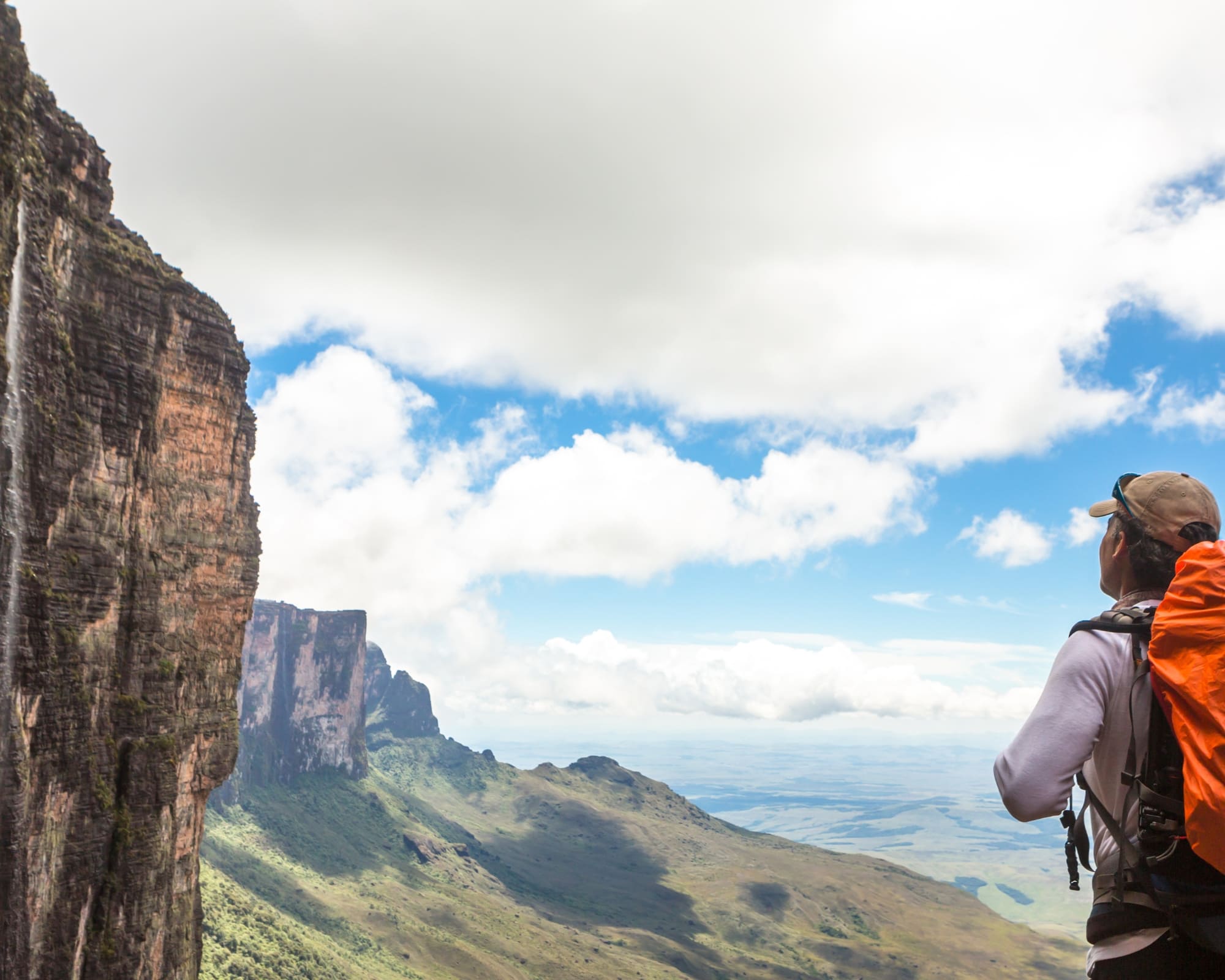
    A hiker at a viewpoint over the tepui cliffs of Mount Roraima

    👉 Read more: 10 Travel Tips for Mount Roraima to Make the Most of Your Trip

    How Hard is it to Trek Up Mount Roraima?

    Trekking Mount Roraima is a challenging hike that demands endurance and preparation. Some sections, like steep ascents and slippery rocky passages, require extra caution and physical strength.

    The trek covers up to 100 km in several days, with long walks, river crossings, and rugged trails. Nights at high altitude bring cold temperatures and less-than-ideal camping conditions.

    Still, with good fitness, proper gear, and the support of experienced local guides, the adventure is absolutely achievable and deeply rewarding!

    A trekker climbing the rocky steps on the ascent of Mount Roraima
    Photo: Lucas Gobatti

    How Many Days Should You Stay in Mount Roraima?

    The hike to Mount Roraima lasts at least 6 days. The first thing to have in mind is that the climb to the summit involves 3 days of trekking through dense jungle and challenging trails, followed by 2 days of descending.

    Mount Roraima Tours

    PlanetaEXO offers amazing Mount Roraima trekking tours that include accommodation in Venezuela, shared camping gear, meals, and incredible guided tours through some of the tepuis’ most iconic sites.

    TOUR HIGHLIGHTS DURATION STARTING PRICE*
    Mount Roraima Trek 7 days of hiking; visits to the main attractions of Mount Roraima (Lake Gladys, Crystal Valley, Maverick, La Ventana, Jacuzzis, etc.); Coati Camp; immersion in local culture. 8 days US$ 1,390
    Mount Roraima Hike 8 days of hiking; visits to the main attractions of Mount Roraima (Lake Gladys, Crystal Valley, Maverick, La Ventana, Jacuzzis, etc.); Coati Camp; immersion in indigenous culture. 10 days US$ 1,570

    *Per person, based on double occupancy in group departures. Prices may vary depending on the season and availability. Exchange rate as of May 25, 2026; subject to change.

    A hiker pointing toward the Kukenán tepui view from Mount Roraima
    Photo: Lucas Gobatti

    👉 Read more: Is Mount Roraima Dangerous? Everything You Should Know For a Safe Trip to Venezuela

    Traveling to Mount Roraima with PlanetaEXO

    Discover the wonders of one of Earth’s most fascinating destinations with PlanetaEXO, an ecotourism platform specializing in Mount Roraima tours.

    From bookings to tailor-made itineraries, our team works with the best local operators to ensure safe, responsible, and unforgettable vacations. Contact us now!
  • What is the best Pantanal safari in Brazil?

    What is the best Pantanal safari in Brazil?

    Looking forward to exploring Brazil’s natural wonders? Discover the best tours for your Pantanal trip!

    The best Pantanal safaris are the ones that allow for total immersion in this fascinating biome, with plenty of activities focused on exploring its impressively rich biodiversity.

    Spanning an area of over 210,000 km², the Pantanal is the greatest place in Brazil for wildlife watching. Some of the country’s most celebrated animals call this territory their home, such as caimans, capybaras, macaws, and the greatest felines in the Americas: the jaguars.

    👉 Browse our Brazil wildlife tours

    PlanetaEXO specializes in Pantanal tours and handpicks the best local operators to make sure your trip includes diverse itineraries, great stay options, eco-friendly practices and unforgettable moments. Check it out!

    A wild jaguar walking on a river sandbar observed by tourists on a boat during a Jaguar safari in the Pantanal Brazil.
    .

    Pantanal safaris in the North and the South

    Before you start planning your trip, it’s important to know that the Pantanal is so extensively rich it’s divided into two sides: the North, in the state of Mato Grosso (accessible via Cuiabá), and the South, in Mato Grosso do Sul (via Campo Grande). Naturally, experiences in each region are different and should be considered before booking your trip.

    The Northern Pantanal is ideal for jaguar spotting and boat safaris. The abundance of wildlife makes this area ideal for photographers and nature enthusiasts who can’t wait to see some of the most fascinating species of Latin America.

    👉 See our Pantanal jaguar tours

    Meanwhile, Southern Pantanal is known for total culture immersion and traditional ranch experiences that mix cattle farming with ecotourism activities, such as horseback riding and canoeing. Seeing jaguars is a lot harder in the South — although not impossible — wildlife watching is still a must!

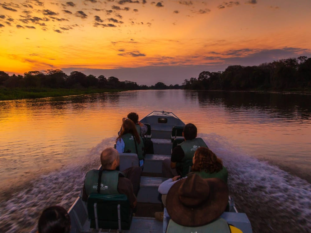
    Travelers on a motorboat navigate a calm river during a vibrant orange sunset in the Pantanal
    .

    👉 Learn more about the Pantanal:

    Jaguar Pantanal safaris

    As the best place in the world to see jaguars, the North Pantanal is the main destination — although not the only one — for travelers whose main goal is spotting this magnificent feline. 

    Additionally, jaguar safaris tend to be a bit more expensive than other expeditions due to specific techniques required to make sure travelers can thoroughly enjoy the experience without stressing out the animals.

    Pantanal Jaguar Safari in Porto Jofre

    One of the main Pantanal safari tours from Cuiabá, this experience takes place in Porto Jofre, in the municipality of Poconé, by the end of the Transpantaneira Highway. It offers incredible activities for nature lovers who are dying to see jaguars roaming around their natural habitat.

    Sailing across the calm waters of the Cuiabá River, you’ll be able to see jaguars peacefully napping on top of trees, strolling on the riverbanks, swimming or even hunting for prey. Local guides will be with you during the boat safari to lead you to strategic spots to watch the wildlife and share their knowledge about the Pantanal.

    This tour includes cozy accommodation, delicious meals, round-trip transfers between Cuiabá and Porto Jofre, English-speaking guides, and daily boat safaris to see jaguars and other Pantanal animals, like giant anteaters, caimans, and hundreds of different species of birds.

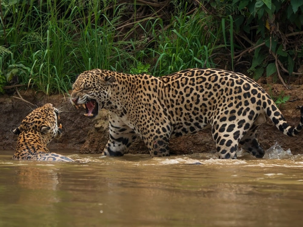
    Two jaguars fighting in a river, a rare and intense wildlife sighting on a Jaguar safari.
    @larissa.pantanal

    👉 Book now: Pantanal Jaguar Safari in Porto Jofre

    Pantanal Jaguar Photography

    Ideal for professional and amateur photographers, this Pantanal photography tour from Cuiabá takes you on a trip to the heart of the biome to capture and immortalize its breathtaking beauty.

    You’ll be accompanied by local guides with extensive background in wildlife photography to help you with the best techniques to take gorgeous pictures of jaguars, macaws, brocket deer, jabiru storks, and much more.

    Regarding accommodation, there are two available options: Flotel, a floating hotel at the entrance of the Meeting of Waters State Park, and Berco Lodge, a classic Pantanal lodge.

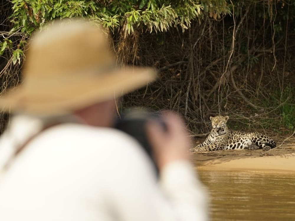
    A wildlife photographer capturing a jaguar on a riverbank during a specialized Pantanal safari.
    @larissa.pantanal

    👉 Book now: Pantanal Jaguar Photography

    Luxury Jaguar Safari in the Southern Pantanal

    Surely one of the most outstanding Pantanal tours from Campo Grande out there, this experience is the perfect mix between nature immersion and a high-end stay experience.

    Although this tour takes place in the South, 100% of visitors who have booked it in the past years have spotted jaguars. This is all thanks to Casa Caiman and Onçafari, a conservation project whose goal is to make animals used to the presence of humans, which consequently raises awareness on environmental issues and helps to develop the area’s ecotourism.

    Aside from the unparalleled experience of spotting jaguars, activities also include canoe trips, ecological hikes, and nocturnal expeditions for more wildlife watching. 

    By staying in Caiman, one of the highest-rated lodges in the Pantanal, your vacation is taken to the next level. Guests enjoy air-conditioned rooms with private bathrooms and balconies, sophisticated decor, sauna, gym, fire pit, swimming pool, sun decks, restaurant and a bar. It’s everything you need in luxury accommodation!

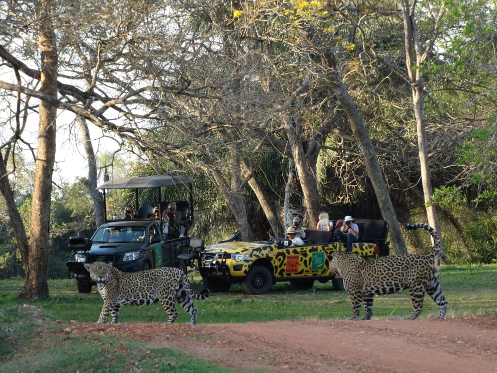
    Safari vehicles parked on a dirt road observing jaguars crossing the path during a sustainable wildlife tour.
    Photo: Edu Fragoso

    👉 Book now: Luxury Jaguar Safari

    Pantanal Wildlife Safari

    Wildlife safari are also a fantastic way to explore the native fauna. Since most of them take place in the South, the chances of spotting jaguars are slim, but you’ll still see amazing Pantanal animals. For the same reason, these experiences are more affordable, making them a great option for travelers on a tighter budget.

    Led by expert guides, these Pantanal trips are perfect for those who wish to dive deep into one of the most captivating ecosystems in the world.

    Pantanal Wildlife Trip from Campo Grande

    Photo safaris, night excursions, and boat rides in Aquidauana River are incredible activities to spot the Pantanal wildlife, while horseback riding, hiking, and piranha fishing allow you to get a deeper glimpse into the local life. You’ll feel like a true Pantaneiro!

    English-speaking guides will be with you throughout the entire trip to pick the best locations to observe tapirs, giant anteaters and the imposing jabiru stork.

    At the lodge, fill your belly with amazing food made with fresh ingredients, and have fun at the entertainment areas — including a beach volleyball court! — and just revel in this exceptional stay experience!

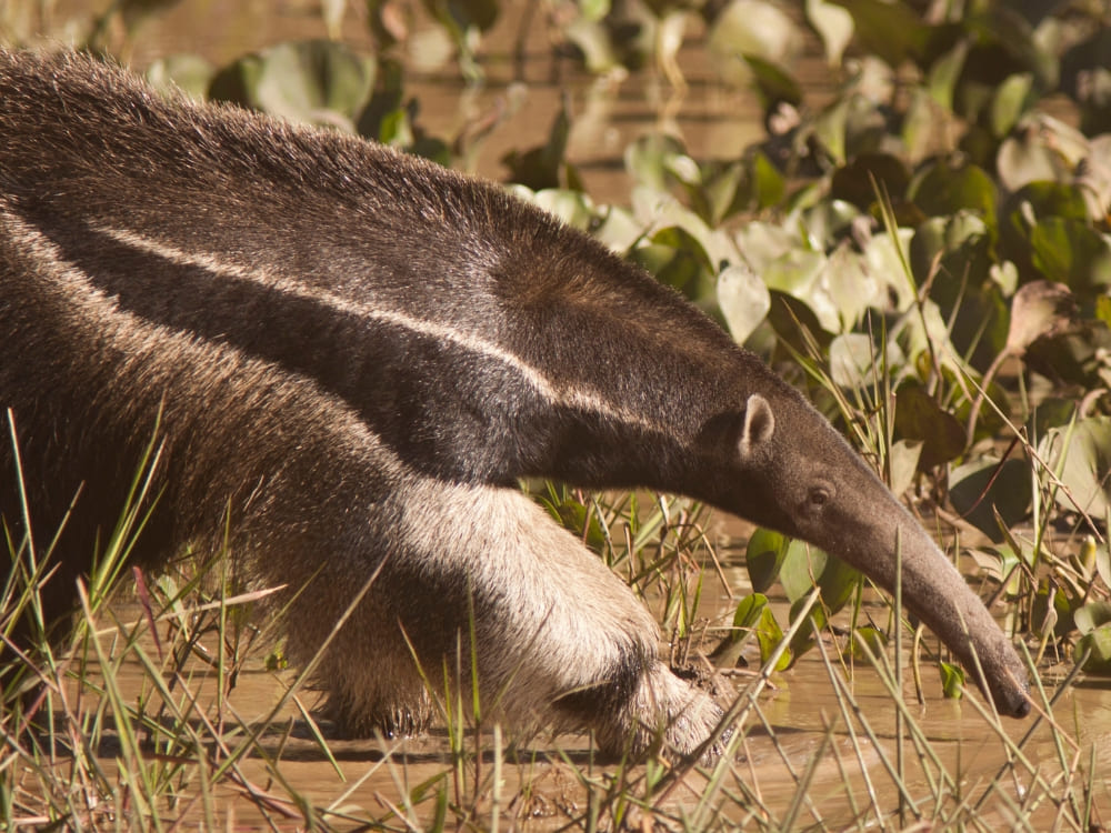
    A giant anteater with its distinctive long snout and black-and-white striped fur walks through shallow water and green aquatic plants in the Pantanal wetlands.
    Photo: Samuel Melim

    👉 Book now: Pantanal Wildlife Trip from Campo Grande

    Wild South Pantanal: Remote Wetland Adventure

    Nhecolândia is one of the Pantanal’s most iconic microregions, famous for its open fields, forest patches and seasonal lagoons near Negro River. This untouched land is perfect for travelers who thirst for adventure and seek for experiences deep into nature.

    While wildlife safaris are generally cost-effective, this one stands out for its exclusivity, high-end services and authentic activities in a remote area. Explore the wetlands to spot (and photograph) some of the most beautiful species in Brazil: giant armadillos, macaws, capybaras, toucans, and many more. 

    Aside from photo safaris, the itinerary also includes canoeing, fishing and horseback riding. When crossing the flooded plains on horseback, you’ll understand what Pantaneiro life is really about. Don’t forget your cowboy hat!

    By nightfall, relax in beautiful ecolodges equipped with comfy beds, air-conditioning, private bathrooms, charming decor and premium amenities. In the common areas, enjoy your stay in the lounge, library, garden or the orchard. Both accommodation options (Baía das Pedras and Barranco Alto) allow for gorgeous views of the Pantanal that will surely make your jaw drop.

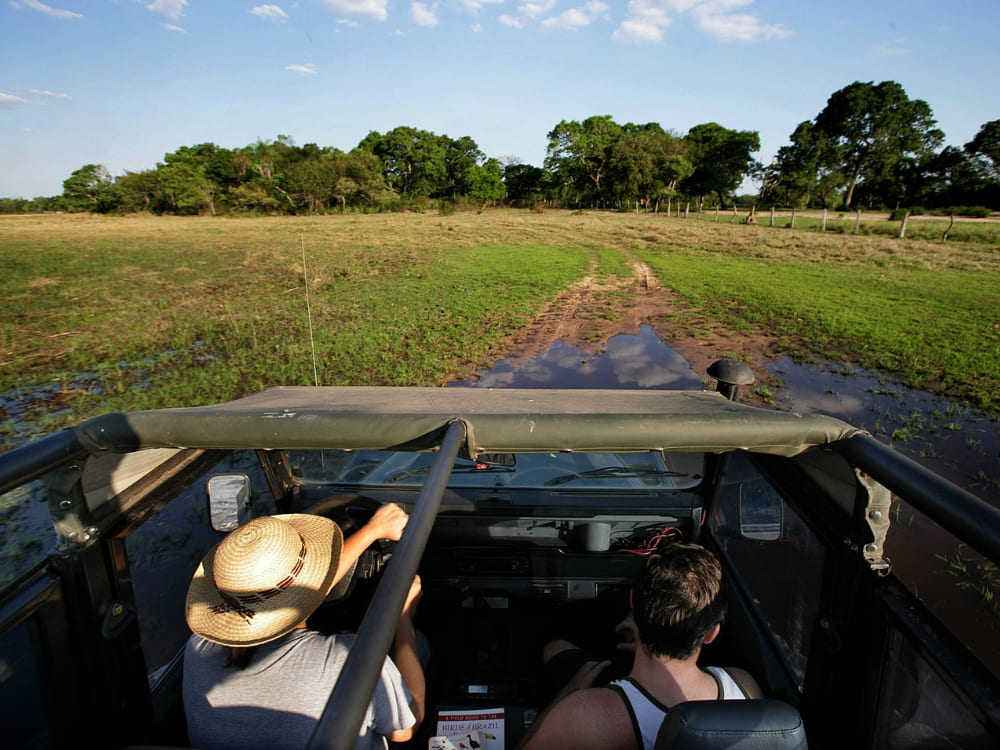
    View from inside a jeep traversing wet terrain, typical of an authentic Pantanal safari adventure.
    .

    👉 Book now: Wild South Pantanal: Remote Wetland Adventure

    Pantanal & Bonito Trip in Brazil

    Mato Grosso do Sul is blessed with the diverse natural beauty of Brazilian biomes, including the Pantanal, the Cerrado and the Atlantic Forest

    In this 5-day Brazil Pantanal safari, explore the largest wetlands on Earth with boat rides, horseback riding and wildlife tours on 4×4 vehicles to see ocelots, caimans, giant otters and deer in their native home.

    By the third day, you’ll hit the road towards Bonito (2-hour drive) where you’ll experience some of Brazil’s most beautiful scenarios, such as São Miguel Cave, Anhumas Valley Ecological Park, Barra do Sucuri and Formoso River. Hiking, swimming in natural pools and river floating are just a few of the amazing activities included in this trip.

    Choose your accommodation for both destinations based on your preferences and needs. All hotel options offer excellent services, delicious meals — full board in the Pantanal and half board in Bonito —, and facilities appropriate for couples, families or solo travelers.

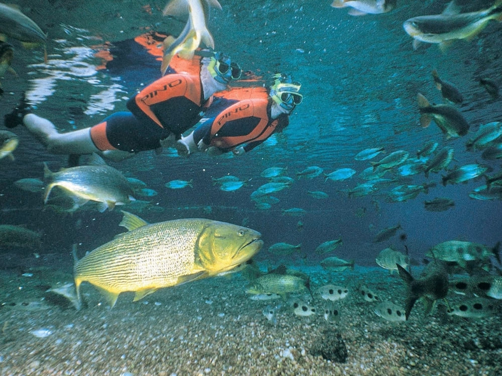
    Tourists snorkeling in a clear river with Dorado fish, a unique underwater Pantanal experience.
    .

    👉 Book now: 5-Day Pantanal Bonito Trip in Brazil

    Pantanal Wildlife Trip from Cuiabá

    If you are planning to travel to the Northern Pantanal, an excellent option is this Pantanal experience from Cuiabá. In Poconé, join nocturnal excursions, boat rides, horseback riding and hiking.

    Spotting jaguars can be difficult here — although not impossible —, but you’ll still have a thrilling experience in photo safaris to watch jabiru storks, marsh deer and capybaras. Make sure to capture the beauty of the flora, too: water lilies, wild orchids, bromeliads and ipês (Brazil’s national flower).

    Take advantage of the premium services of your accommodation and let your tiredness and problems melt away. Dive into the pool, get a tan on the sun deck, and appreciate the breathtaking natural view.

    A silhouette of a capybara in tall grass during a golden sunset, with two small birds perched on its head and back
    .

    👉 Book now: Pantanal Wildlife Trip from Cuiabá

    How much does a Pantanal safari cost?

    The average cost of a Pantanal safari is US$ 2,020 per person. Prices vary according to accommodation category, season, trip duration, etc

    See the main information below and choose your favorite!

    SAFARI HIGHLIGHTS STARTING PRICE*
    Pantanal Jaguar Safari in Porto Jofre (Cuiabá) Jaguar sightings, wildlife watching, boat rides, night spotting. US$ 2,645
    Pantanal Jaguar Photography Visit strategic areas to capture gorgeous shots of jaguars and other animals. Perfect for professional and amateur photographers. US$ 3,700
    Luxury Jaguar Safari High-end ecolodge with great chances of spotting jaguars in South Pantanal (the only one outside the North). US$ 3,200
    Pantanal Wildlife Trip (Campo Grande) Night and photo safari, piranha fishing, boat rides, horseback riding. US$ 1,150
    Pantanal Wildlife Trip (Cuiabá) Night and photo safaris, trekking, horseback riding, boat rides in Aquidauana River. US$ 1,355
    Wild South Pantanal: Remote Wetland Adventure Wildlife spotting, guided walks, canoeing and horseback riding in one of the Pantanal’s wildest areas. US$ 2,275
    Pantanal Bonito Trip Safaris and boat trips in South Pantanal followed by snorkeling and swimming in Bonito’s rivers and natural pools. US$ 1,395

    *Per person, based on double occupancy in group departures. Prices may vary depending on season and availability.

    Two travelers paddling a canoe through calm waters, an immersive way to explore the wetlands during a Pantanal tour.
    .

    Pantanal safari reviews

    It’s clear that the Pantanal in Brazil is one of the most spectacular ecotourism destinations on the planet, but what do travelers say? With the finest tour operators in the business, PlanetaEXO has taken hundreds of tourists to this paradise over the years.

    See what our customers think about some of our Pantanal safaris

    Book your Pantanal trip with PlanetaEXO

    PlanetaEXO is an ecotourism platform specialized in Pantanal tours. We’re committed to turning your dream vacation into a reality by assisting with bookings, tailor-made itineraries and everything else you might need.

    We also connect you with the best Pantanal tour operators to create authentic travel that will forever be engraved in your brain — and your heart. Contact us now!
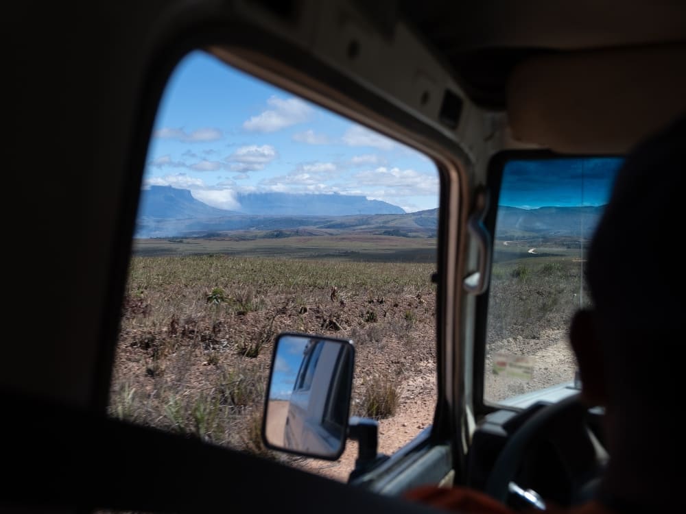
  • 10 Facts about Vale do Pati, Brazil

    10 Facts about Vale do Pati, Brazil

    Looking for an experience in Brazil’s Vale do Pati, the trekking hub of Chapada Diamantina? Learn all about it before booking your trip!

    Amidst Chapada Diamantina National Park, in the state of Bahia, Vale do Pati is a dream destination for trekkers all over the world. Hiking trails, waterfalls, rock formations, and beautiful landscapes make this the perfect place for travelers seeking adventure and full immersion in nature.

    Want to learn more about this fantastic place? PlanetaEXO, an ecotourism platform specializing in Chapada Diamantina tours, has put together 10 facts about Vale do Pati. Check them out below!
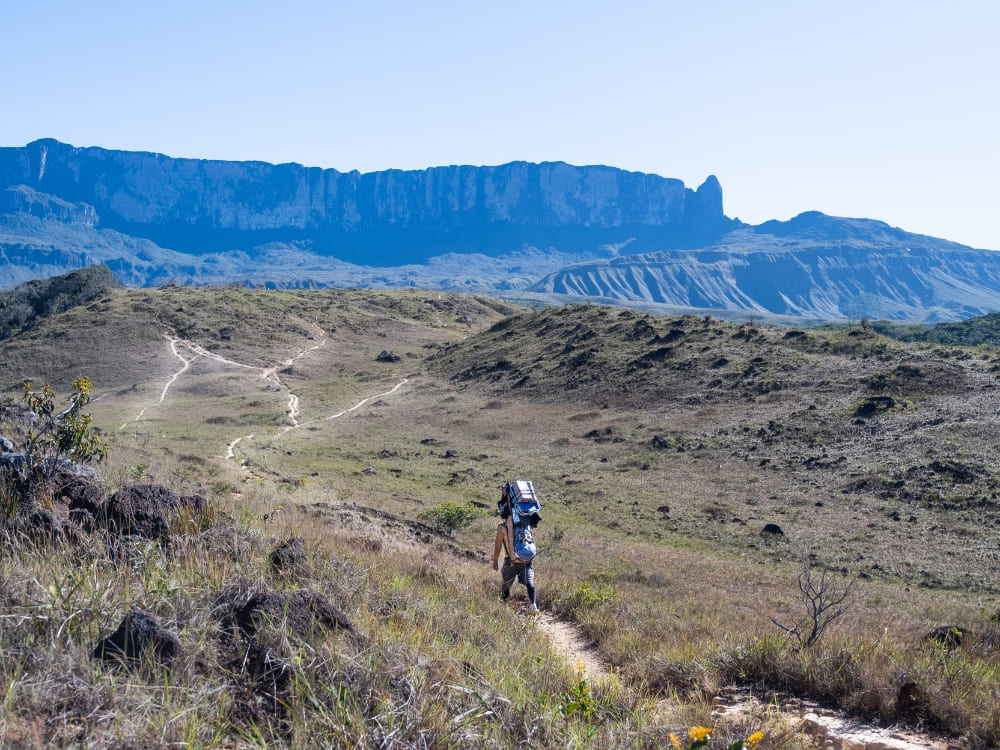
    1. Thousands of Football Fields Can Fit Inside Vale do Pati

    Chapada Diamantina National Park ranges over 152,142 hectares—bigger than Hong Kong, Singapore, and Malta—while Vale do Pati’s total area is 12,300 hectares.

    Let’s put it in easier terms: Vale do Pati is as big as 17,227 football (soccer) fields!

    Two hikers sit on a rocky cliff admiring the vast, green expanse of Vale do Pati in Chapada Diamantina National Park.
    .

    👉 Read more: How to Get to Chapada Diamantina National Park?

    2 – The Downfall of the Coffee Cycle and The Rise of Ecotourism

    The soil in Vale do Pati is known for excellent coffee harvests. In the heyday of the coffee cycle—one of Brazil’s most important economic eras—during the 19th century, over 400 families lived in the area. There was a school, a church, and a city hall.

    Scarce workforce and soil exhaustion caused by mass production prompted the downfall of the coffee cycle in 1930. Consequently, Vale do Pati was abandoned until the late 1970s. In 1985, the region was incorporated into the national park, but this time, only ten families called Pati their home. 

    To this day, locals make a living from ecotourism activities, offering their own homes as a safe place for backpackers to rest.

    3. Authentic Stay Experience in Vale do Pati, Brazil

    One of the most relevant facts about Vale do Pati is that this is a remote location, which means there are no hotels, lodges, buildings, or stores. If you’re planning your vacation to this part of Chapada Diamantina, keep in mind that you’ll stay in the locals’ houses—the very same ones we’ve mentioned before.

    The accommodations are modest but still cozy and very clean. The authentic stay experience also includes home-cooked meals. If you’re interested in eating typical Brazilian food made by people who know everything about it, this is your chance!

    By staying in the natives’ homes, you’ll get the full experience of what it’s like to live in nature. This is the perfect opportunity to fully immerse yourself in Bahia’s culture, learn all about your hosts’ day-to-day life, and support the local communities to make a living in a sustainable, dignified way.

    Modest local houses equipped with solar panels sit in a lush green valley beneath a colorful sunset sky in Vale do Pati.
    .

    👉 Read more: Where to stay in Chapada Diamantina?

    4. Best Trekking Destination in Brazil

    Brazil’s Paty Valley is a popular ecotourism destination due to its great trekking conditions. In 2010, the Ministry of Tourism nominated it the best hike in the country and one of the top circuits on the planet.

    Hiking here is a given to reach pretty much all the iconic attractions of the national park. The good news is that there are options for expert hikers or people with no experience in this type of excursion. The trick is asking your tour guides for recommendations that fit your skills and desired itinerary!

    5. Waterfalls in Vale do Pati

    The waterfalls in Vale do Pati are breathtaking and are considered essential parts of the trekking circuits. If you don’t bathe in a waterfall after a long hike, you’re not enjoying your vacation right!

    Cachoeirão: Its nearly 300-meter fall boasts several smaller waterfalls during the rainy season. To get the full experience, hike on the top side to catch the amazing view of the falls surrounded by mountains and vegetation. Then, explore closer to the well at the bottom.

    Cachoeira dos Funis: Fairly small, the 30-meter fall that pools into a natural well at the base is the perfect place to cool off and relax.

    A hiker stands on a boulder looking up at the towering Cachoeirão waterfall cascading down steep, rocky cliffs.
    .

    👉 Read more: Chapada Diamantina Waterfalls: Best Trails and Hidden Gems

    6. Atlantic Forest

    Vale do Pati is one of the few places in Chapada Diamantina where there still are remnants of the Atlantic Forest, while most of the park is covered by the Caatinga and Cerrado flora, which proves the richness of the region’s biodiversity. 

    The Atlantic Forest features unified treetops that create plenty of shade and humidity, dense vegetation, and a great diversity of mammals, birds, insects, reptiles, amphibians, and fish.

    7. Stunning Lookouts

    Vale do Pati is beautiful everywhere, but there are two specific lookouts that provide stunning panoramic views of Chapada Diamantina: Morro do Castelo and Mirante do Pati.

    At 1600 meters high, Morro do Castelo is the highest point of the national park. To get there, visitors have to face a steep climb and hike around a cave (Gruta da Lapinha).

    A hiker stands on a rocky edge framed by tree branches, looking out over the green valley toward the flat-topped Morro do Castelo.
    .

    To arrive at Mirante do Pati (1400 meters high), the hike kicks off from Guiné, a small town with great access to Chapada. After passing through rocky paths, open fields, and the banks of the Rio Preto, you’ll reach the lookout.

    The journey isn’t easy, but the beautiful views of pristine nature are the reward you need to stay motivated!

    8. A Paradise for Nature Junkies

    Although Chapada Diamantina offers hundreds of breathtaking landscapes, Vale do Pati is, undoubtedly, a true scene stealer. The amazing views, waterfalls, caves, and hiking trails make it one of the most beautiful and unique places in Brazil.

    Vale do Pati gathers everything a backpacker looks for in adventure, including isolation from the outside world, complete disconnection from digital devices, and a new perspective on what Mother Nature is capable of.

    👉 Read more: When Is The Best Time To Visit Chapada Diamantina?

    9. Sustainable Way of Life

    National parks aim for the conservation of natural resources. In other words, things work a little differently on their premises.

    In Vale do Pati, most electric/electronic devices are powered by solar energy, including cellphones, batteries, and lamps. Refrigerators run on gas and showers are cold—which, considering the warm temperatures of Chapada Diamantina, is totally fine.

    Most supplies (food, household goods, solar panels, etc.) arrive in Vale do Pati on horseback, carried by donkeys or even by the locals themselves. No cars making noise or polluting the air!

    10. Zero Internet Connection

    The last fact about Vale do Pati is that there is no internet connection along the trails and in the more isolated areas of the national park. While some residents may offer Wi-Fi, unstable connections are not uncommon.

    A backpacker sits on a jagged rock ledge enjoying a panoramic view of the steep cliffs and pristine green valleys of Vale do Pati.
    .

    Chapada Diamantina is all about nature and human connections. You’ll have everything you need while you’re there—beautiful views, gorgeous waterfalls and underground lakes, several kilometers of hiking trails, cozy accommodations, and interactions with amazing people. 

    You won’t even miss scrolling on your phone!

    Traveling to Vale do Pati, Brazil, with PlanetaEXO

    Now that you know all the important facts about Vale do Pati, it’s time to visit this fascinating destination!

    PlanetaEXO, an ecotourism platform specializing in Chapada Diamantina tours, is here to help you book the vacation of your dreams, from tailor-made itineraries to transfer options and accommodations. Contact us now!
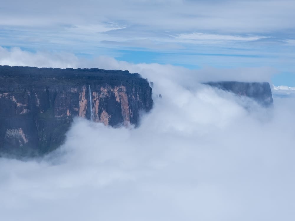
  • How to Get to Mount Roraima?

    How to Get to Mount Roraima?

    Learn about logistics, the best routes, main access points, and what you need to plan before starting your Mount Roraima trekking adventure

    One of the most incredible tepuis in South America, Mount Roraima is located on the triple border of Venezuela, Brazil, and Guyana. At 2,810 meters (9,219 feet) above sea level, it’s one of the highest places on Earth.

    Its untouched natural beauty, thrilling hiking trails, and cultural and spiritual aspects attract countless adventurers every year, so knowing how to get to Mount Roraima is a crucial part of any travel planning.

    To help with the arrangements of your next trip, PlanetaEXO, an ecotourism platform specializing in Mount Roraima tours, has put together a detailed guide with all the information you need. Check it out below!
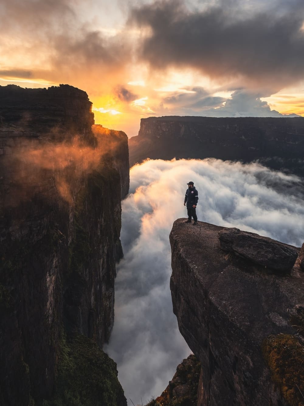
    How to get to Mount Roraima
    Photo: Lucas Gobatti

    How to Get to Mount Roraima?

    You can start your adventure to Mount Roraima from a few different locations, but the most popular and convenient gateway is Boa Vista, capital of the state of Roraima, in northern Brazil.

    Boa Vista’s close location to the Venezuelan border, specifically to the city of Santa Elena de Uiarén (Grand Sabana, Bolívar), makes it a natural hub for expeditions heading to the plateau.

    Boa Vista Roraima
    Photo: Andrezza Mariot

    From Boa Vista to Santa Elena de Uairén

    Boa Vista Airport (BVB) is categorized as internation, but in practice, it mainly receives domestic flights from Brazilian cities such as Brasília, Manaus, and São Paulo. Therefore, foreign travelers need to land in one of these locations before flying to Roraima.

    From Boa Vista, the most common route is to travel by car or transfer along the BR-174 highway. From there, it takes around 3 hours on the road to reach the border with Venezuela, followed by an extra 20 minutes to arrive in Santa Elena de Uairén.

    With a few ways to make the trip, this cross-border journey is a well-trodden path, particularly for Brazilian travelers joining organized expeditions.

    Private Transfer

    The most comfortable option, usually arranged by tour operators. A driver picks you up at your hotel or airport in Boa Vista and takes you directly to Santa Elena de Uiarén. This ensures flexibility with departure times and stops along the way.

    Operated by trustworthy local partners, shuttle services are included in all of PlanetaEXO’s tours.

    Shared Van

    More affordable, travelers join a small group for the ride. Vans depart regularly from Boa Vista and are commonly used by those joining expeditions. They may take slightly longer depending on stops and border procedures.

    Public Bus

    The cheapest but least convenient option. Buses connect Boa Vista to Santa Elena de Uiarén, but schedules are irregular, and the journey can be slower due to frequent stops. Not recommended for travelers with limited time or those who prefer more reliable logistics.

    How to get to Mount Roraima
    Photo: Lucas Gobatti

    The Beginning of the Journey

    Santa Elena de Uairén is a pivotal starting point for travelers, providing modest accommodations, restaurants, and last-minute supplies before the trek.

    From there, the adventure continues with a scenic drive to Paraitepuy, an indigenous community that serves as the gateway to the trails that lead to Mount Roraima. The drive itself offers stunning views of the Gran Sabana landscapes, passing the Tek and Kukenan rivers.

    Always counting on the expertise of local indigenous guides, trekkers usually stop at rustic campsites along the way. This is where the real journey to the top of Mount Roraima begins.

    Trek Mount Roraima
    Photo: Lucas Gobatti

    What’s the Best Access to Get to Mount Roraima: Brazil or Venezuela?

    When you plan a trip to Mount Roraima, one of the most common questions is whether to access it through Brazil or Venezuela. Both are possible, but they offer very different logistics.

    Entering via Brazil

    For most travelers, Brazil is the easiest and safest option. Boa Vista, in Roraima, is connected to major Brazilian cities with daily flights, making it relatively straightforward to plan an itinerary.

    The infrastructure on the Brazilian side is generally reliable, with services and support in Portuguese or English. Another advantage is that some nationalities (including Europeans and many Latin Americans) do not need a visa for short stays, making this a simpler route in terms of bureaucracy.

    After crossing into Venezuela, you’ll reach Santa Elena de Uairén, where most expeditions organize logistics before heading to Paraitepuy and, finally, to Mount Roraima.

    Traveling this way allows you to rely on Brazilian airports and services for your arrival and departure while only entering Venezuela for the actual trek.

    Top of Mount Roraima
    Photo: Lucas Gobatti

    Entering via Venezuela

    Santa Elena de Uairén does have a regional airport (SNV), but it handles little more than charter and air-taxi traffic. Scheduled service has always been thin and intermittent, a twice-weekly Conviasa link from Caracas via Puerto Ordaz and Canaima came and went, so you cannot plan a trip around it.

    Driving in from within Venezuela is a long haul: Caracas to Santa Elena covers about 1,250 km through Ciudad Guayana, which realistically means two days on the road.

    That is why, unless you are already in Venezuela, Boa Vista in Brazil remains the reliable way in to start your Mount Roraima trek.

    Sunset Mount Roraima
    @diaz

    👉 Read more: 10 Facts About Mount Roraima

    Visas and Travel Requirements

    Whether you choose to enter through Brazil or Venezuela, it is crucial to check visa requirements in advance.

    For those holding passports from the US, Canada, or Australia, Brazil mandates an e-Visa. This process is conducted entirely online without requiring a consulate visit, and airlines will verify your approved code prior to check-in. Citizens of Mercosur countries, Europe, Japan, and South Korea enter visa-free.

    Venezuela is where travelers tend to get caught out, because the rule depends on how they arrive. European travelers are exempt from the tourist visa only when they fly in. Crossing at the land border, which is exactly what the Boa Vista route involves, calls for a tourist visa arranged in advance. US citizens need one either way.

    However you enter, expect to show a passport valid for at least six months, onward travel, and proof of where you’re staying.

    Keep in mind: policies can change. During your travel planning, check if you need a visa on Brazil’s Ministry of Foreign Affairs website and/or the nearest Brazilian and Venezuelan embassies. You can also do a quick search on Sherpa, but remember to always verify the current conditions on the official channels of each country.

    How to get to Mount Roraima
    .

    👉 Read more: Do I need a Visa to visit Mount Roraima in Venezuela?

    Trekking in Mount Roraima with PlanetaEXO

    When you plan your trip to Mount Roraima, or any other destinations for hiking in Brazil, you need professionals who are familiar with the location and who can make the trek as smooth and fulfilling as possible.

    PlanetaEXO, an ecotourism platform specializing in Mount Roraima tours, works with expert local partners who are deeply connected with the indigenous community of the region, not only ensuring safety and the best logistics but also a culturally rich experience. Contact us now!
  • How hard is it to trek up Mount Roraima?

    How hard is it to trek up Mount Roraima?

    Hiking Mount Roraima involves diverse terrain and unpredictable weather, but with the right preparation, you can reach the top. Discover the challenges of climbing this iconic peak and how to make it achievable for all!
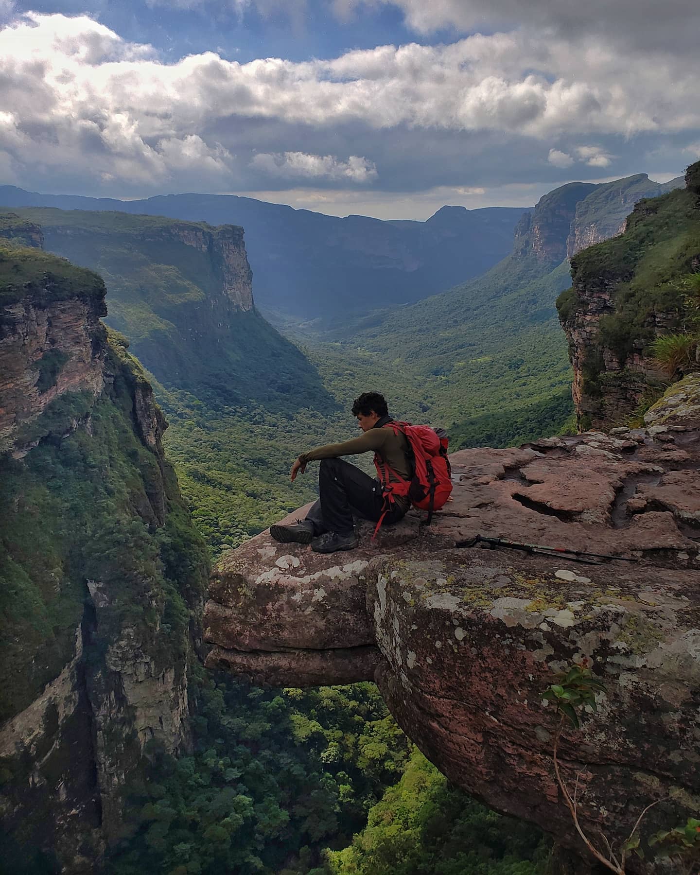
    You might be asking yourself: How hard is it to trek up Mount Roraima? While it’s a moderate challenge that requires physical preparation, it’s definitely achievable for anyone with the right mindset and training. It’s not just for professional climbers: many hikers, regardless of experience, can reach the top of Mount Roraima with proper planning and the right support.

    The trek is suitable for all ages, with children under 14 needing to be accompanied by an adult, making it a challenge for everyone, from young adventurers to seasoned trekkers!

    The path includes navigating rocky routes and steep climbs, which makes it physically demanding, especially in certain sections. But with the right equipment and preparation, it’s a journey that offers incredible rewards, both in terms of natural beauty and personal fulfilment.

    How hard is it to trek up Mount Roraima

    At PlanetaEXO, a specialized South American adventure company, we partner with trusted local partners to help you reach the top of Mount Roraima. Our team ensures you’re fully prepared for the challenges of climbing this iconic peak, from managing the terrain to navigating the unpredictable weather

    Learn more about all the important things you need to know before trekking up Mount Roraima:

    Understanding the Difficulty of Climbing Mount Roraima

    While the idea of “climbing” Mount Roraima may sound daunting, it’s important to understand that it’s not a vertical climb. The trek is challenging, but it’s more about hiking Mount Roraima through various terrains and river crossings. So, how hard is it to climb Mount Roraima? The answer depends on several factors, including the terrain, your physical fitness, and the level of support you choose.

    👉 Don’t forget to check the visa requirements before planning your trek.

    Is it a Trek or a Climb?

    Mount Roraima is a trekking adventure, not a rock climb. It’s a long hike, but most people in good physical condition can successfully reach the top of Mount Roraima with adequate preparation. The key is to pace yourself and take the time to adjust to the terrain and weather conditions along the way.


    How hard is it to trek up Mount Roraima
    Photo: Lucas Gobatti

    Factors That Influence Your Experience

    Before considering the factors below, note that the trek begins in Canaima National Park, at the Indigenous community of Paraitepuy, where visitors register, receive basic instructions, and meet the local guides and porters who will accompany the journey.

    Several factors can affect the difficulty of your trek. Here are the main considerations that will influence your experience:

    1. Duration of the Trek

    The trek to the summit typically spans 8 to 10 days. The total trekking distance is between 90 and 100 kilometers (56 to 62 miles), including the ascent, time spent at the summit, and the return journey. The number of nights at the top of the mountain also varies according to the duration of each trek.

    With the 10-day PlanetaEXO option, for example, you spend 5 nights on the plateau of Mount Roraima. A longer itinerary allows you to pace yourself and adjust to the physical demands, making the experience less strenuous. However, if you’re seeking a more intense challenge, some choose to complete the 8-day itinerary in 6 days.

    Duration of the Mount Roraima Trek
    Photo: Lucas Gobatti

    This compressed version covers the same distance but in a shorter period, making it a more physically demanding experience. While it allows you to reach the top of Mount Roraima in less time, it requires a higher level of fitness and endurance due to the quicker pace.

    👉 Check out 10 Tips for Mount Roraima before your trek

    2. Logistical Support

    Choosing a company like PlanetaEXO makes the trek easier. Our trusted local partners, carefully selected by us, take care of the logistics on the trail, from carrying camping gear to preparing meals. 

    If you decide to manage these tasks yourself, the trek will become more challenging. With the right partners handling logistics, you can focus on enjoying the hike.

    To stay dry, consider using a rain cover for your backpack and dry bags to protect your essentials from moisture. Extra socks (preferably synthetic or wool) and a quick-dry microfiber towel will also help keep you comfortable during and after long days of hiking

    Important reminder: Even with quality gear, heavy rain and humidity can flood tents and muddy campsites, affecting rest. Keep essentials dry and be ready for less-than-ideal nights.

    Camping Mount Roraima
    Photo: Lucas Gobatti

    👉 Let PlanetaEXO connect you with the best local partners: explore our best Mount Roraima tours and start your adventure.

    3. Porter Service

    Even though travel companies handle the logistics of food and camping gear, you’ll still need to carry your personal items. To lighten your load, you can hire a porter from the local community to help reduce the physical demands of the trek.

    This service also contributes to the local economy by supporting experienced porters who are deeply rooted in the community. By hiring them, you’re financially supporting skilled professionals who understand the region, its environment, and its culture, helping sustain their livelihoods.

    Porter Service Mount Roraima
    Photo: Lucas Gobatti

    4.Your Physical Fitness

    Your fitness level plays a significant role in how hard the trek will feel. The terrain varies from easy to moderate, with steeper sections as you approach the summit. 

    If you’re in good health and have done some basic hiking, you’ll be able to handle the trek, but it’s still important to train beforehand to prepare for the demands of a multi-day trek. 

    How hard is it to trek up Mount Roraima
    Photo: Lucas Gobatti

    Remember that it is a long walk, so you need to be in good physical condition and be prepared for strong sun exposure at high altitude, which can intensify its effects.

    5. Terrain and Steep Ascents

    The terrain can be challenging, with uneven surfaces and slippery sections, especially as you approach the summit. These steep ascents can be physically demanding, but with the right preparation, the reward of reaching the top of Mount Roraima becomes an unforgettable achievement.

    Some key elevation points include:

    • Basecamp: Around 1,500 meters (4,920 feet), where the trek levels out before the final push. Reaching it includes early challenges like the “Prova do Novato”, a steep climb that hints at what’s ahead, and crossing the Tek and Kukenan rivers over slippery rocks with guide assistance.
    • Ascent to the Summit: Steep sections begin around 2,200 meters (7,218 feet), getting progressively more challenging as you approach the 2,810-meter (9,219 feet) summit. This stage includes notable landmarks such as La Rampa, a narrow natural ramp carved into the cliffside where hikers often use all four points of contact due to its steep incline, and the Poço das Lágrimas, a slippery rocky passage often wet from rain and waterfalls, both requiring extra caution and steady footing.
    • Rocky Terrain: From 2,500 meters (8,200 feet) onwards, after La Rampa, the trail turns rugged with large boulders and uneven ground, leading to the 2,810-meter plateau and El Maverick, the summit’s highest point and a popular climb for sweeping views.

    Some sections require careful navigation over rocky terrain, which can be exhausting but manageable for most hikers with prior experience.

    People trekking Mount Roraima

    What to Expect on the Trail: Key Points of the Trek

    At this point, you already know that Mount Roraima is a tepui, a flat-topped mountain on the Guiana Shield that rises to 2,810 meters at the Brazil–Venezuela–Guyana border. Its sheer 1,000-meter cliffs isolate the plateau from the forest and savanna below, creating a distinct and fragile ecosystem. 

    Constant rainfall and nutrient-poor soils have shaped highly specialized flora, including carnivorous plants, and fostered a remarkable level of endemic species.

    This perspective highlights that reaching the summit is not only about overcoming physical challenges but also about experiencing an ever-changing landscape filled with natural wonders. Here’s what awaits you along the way:

    • Day 1-2: Start your trek by crossing rivers and gradually ascending. These days are relatively moderate, giving you time to adapt to the pace of the expedition.
    • Day 3–4: The trail grows steeper as you approach the mountain’s base. Here, rocky paths and sharper ascents make the climb more demanding.
    • Day 5–6: Arriving at the summit, you’ll explore an otherworldly plateau dotted with unique vegetation and enjoy sweeping views across three countries.
    Reach the top of Mount Roraima
    @overlandtheamericas

    👉 Want to know what’s waiting at the summit? Read the full article: What’s on top of Mount Roraima?

    Weather and Best Time to Visit Mount Roraima

    The weather on Mount Roraima is highly unpredictable, so being prepared for a variety of conditions is essential. The mountain follows the tropical climate of Venezuela, which means you may encounter rain, fog, and significant temperature fluctuations throughout the trek.

    At the summit, camping is in natural rock shelters (“hotels”) that offer partial protection from wind and rain but have uneven ground. Expect intense sun during the day and near-freezing temperatures at night. The views and sense of accomplishment make it all worthwhile!

    What to Expect:

    • Rain: Rain is common, especially in the afternoon and evening. The wet season, from May to November, brings heavier and more frequent rainfall, which can make the trail slippery and harder to navigate. Be sure to pack waterproof gear, such as a jacket and rain cover for your backpack, to stay dry.
    • Fog and Wind: The summit is often shrouded in fog, and strong winds are frequent, especially as you reach higher elevations. The fog can limit visibility, and the wind can make hiking and camping more challenging.
    • Temperature: Despite being in a tropical region, the altitude causes significant drops in temperature, especially at night. During the day, temperatures can range from 20°C to 25°C (68°F to 77°F), but at night, they can plummet to as low as 5°C to 10°C (41°F to 50°F). Even in the summer months, you’ll experience chilly conditions at night.
    Weather and Best Time to Visit Mount Roraima
    Photo: Lucas Gobatti

    Best Time to Visit

    The best time to trek Mount Roraima is during the dry season, from December to March, when rainfall is less frequent, and the weather is more stable. This period offers the most comfortable trekking conditions, with less rain and cooler nights. However, even in the dry season, weather conditions can still be unpredictable, so be prepared for all possibilities.

     👉 Check out our complete travel guide for all the details on Mount Roraima’s climate, logistics, and more!

    Sunset Mount Roraima
    @watchluke

    Hiking Mount Roraima with PlanetaEXO

    At PlanetaEXO, we’re committed to providing sustainable travel experiences that benefit both travelers and local communities. 

    We work closely with expert local guides, many from the Indigenous community of Paraitepuy inside Canaima National Park, who are passionate about conservation and sharing the beauty of the mountain.

    How hard is it to trek up Mount Roraima
    Photo: Lucas Gobatti

    By choosing us, you’re not just embarking on an adventure; you’re supporting ecotourism that helps preserve Mount Roraima for future generations.

    👉 Ready to take on the challenge? Start planning your Mount Roraima trek today with PlanetaEXO.

  • Guide Lucas Neves: A PlanetaEXO success story of sustainable travel in Chapada Diamantina

    Guide Lucas Neves: A PlanetaEXO success story of sustainable travel in Chapada Diamantina

    The Chapada Diamantina is one of the most coveted destinations in Brazil for nature lovers. With its majestic mountains, stunning waterfalls and rich biodiversity, the region is an adventurer’s paradise.

    However, exploring these natural wonders responsibly requires an experienced and conscientious guide. That’s where Lucas Neves comes in, an adventure tourism guide and PlanetaEXO partner who has dedicated his career to promoting sustainable tourism in the region.

    Who is Lucas Neves?
    At 28, Lucas is a native of Vale do Capão, in the Chapada Diamantina. He found in the profession of adventure tourism guide the opportunity to combine his passion for nature with the freedom of being self-employed. Lucas also works as a brigadier in the Vale do Capão Volunteer Brigade, fighting forest fires, rescuing injured people in remote areas and saving wild animals in urban areas. As Lucas puts it, “As well as being an opportunity to work with what I love (mountains, trails, adventure), in the local reality it’s a profession that allows me to be self-employed, having more freedom, which is something I value a lot.”

    Sustainable Tourism as a Mission
    For Lucas Neves, sustainable tourism is not just a slogan, but a life mission. “Through practices with minimal impact on the environment and passing on knowledge to visitors, this awareness multiplies,” says Lucas. He believes that sustainability begins with education and awareness. Before each hike, Lucas makes a point of introducing visitors to the unique environment of the Chapada Diamantina, explaining the practices that minimise human impact. During the hikes, he demonstrates these practices in action, showing the positive impact they have on the local environment, not only in the short term, but also in the medium and long term.Hikers crossing a rugged mountain trail among the peaks of Chapada Diamantina

    Lucas Neves at the Vale do Pati viewpoint, Chapada Diamatina

    Sustainable Practices in Action
    Lucas adopts a number of initiatives to promote sustainable tourism. He is involved in environmental education programmes in the local community, teaching younger generations about the importance of conservation. In addition, he makes a point of hiring the services of native locals and encourages tourists to buy local handicrafts and culinary products. These actions not only help the local economy but also encourage a form of tourism that respects and values the local culture and environment.

    The Traveller’s Experience
    For Lucas, the aim is to be the link between the client and nature. He customises each itinerary based on the traveller’s profile, taking into account factors such as physical fitness and climate. The focus is always on safety, but also on exceeding visitors’ expectations, allowing them to integrate and give themselves as much as possible to the purpose of the itinerary.

    Fantastic guide! We had a fantastic time with your guidance, Lucas. You really love nature and your work, and it shows!

    Ole, from Germany

    Traveller admiring the vast valley from a Vale do Pati lookout in Chapada Diamantina

    Lucas Neves and Ole

    The role of PlanetaEXO
    The partnership with PlanetaEXO amplifies these efforts. “The partnership with PlanetaEXO through the high frequency of work in partnership and the fair remuneration above what the market usually pays allows me to afford training to improve as a professional,” says Lucas. The company is committed to working with local guides and other stakeholders to contribute to the sustainable economic development of Chapada Diamantina communities. Learning English with the support and encouragement of PlanetaEXO has opened doors for Lucas, allowing him to interact with clients from other countries and enrich his world view.

    According to Lucas Ribeiro, founder of PlanetaEXO, Lucas Neves serves as an inspiring role model and comments: 

    From the very first days of PlanetaEXO, we realised in Lucas Neves not only a talented guide, but a professional whose values resonated deeply with our company's mission: the sustainable development of tourism and the strengthening of local communities. He became a source of inspiration for those entering or considering a career in sustainable tourism. Two years after the start of this fruitful collaboration, I can say with confidence that our mission has been fulfilled – and we're still only at the beginning. The partnership with Lucas Neves is a living testimony to the positive impact we can achieve when values, passion and professionalism align. We are excited about what the future holds and are confident that this partnership will continue to bear much fruit for the communities of Chapada Diamantina and the world of sustainable tourism as a whole.“

    Challenges and rewards
    Being a guide in an area as biodiverse and sensitive as the Chapada Diamantina is no easy task. Lucas points out that one of the biggest challenges is catering for audiences with extremely different profiles, while always keeping his mind focused and positive. However, he keeps up to date and informed through constant communication with other guides and members of the local community.

    Footprints of Change
    Lucas Neves is not just a guide; he is an ambassador for sustainable tourism and an advocate for the local community. His partnership with PlanetaEXO exemplifies how responsible tourism can be a force for good, benefiting both visitors and host communities. In a world that desperately needs more sustainability and environmental awareness, figures like Lucas are true beacons of hope.